


 Country:

 City:


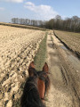
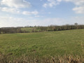
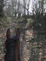
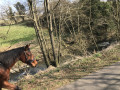
Park in the car park at the old railway station in Ferrière-la-Petite.
(S/E) Leave the car park on the right and, immediately on the left, take the old railway line. You’ll be walking along a sunken path that gives the undulating landscape a hint of the Ardennes. You’ll follow the Solre, a winding river much loved by trout anglers.
(1) When you reach Obrechies station, leave the railway line to the left and, at the Fork in the road, turn left onto Rue du Moulin (towards the village centre). At the Fork in the road, turn right towards La Place. Head towards the church and, just before you reach it, turn left into Rue du Cimetière. Carry on straight ahead until you reach the road (Rue de Ferrière-la-Petite).
(2) Turn right.
(3) Cross the junction and carry on straight ahead. At the Fork in the road, turn right onto the small dirt track towards the Trou de l’Enfer, and cross the ford (a slightly tricky section). Let your horses drink there. If you have any difficulty, don’t hesitate to dismount.
(4) As you leave the track, turn left onto the Chemin de Gard towards Camp Magnon. When you reach the Bois des Onze Bonniers, carry straight on and ignore a path on your left.
(5) Turn left as you leave the track. Ride past a blockhouse on your left.
(6) Admire the magnificent buildings of the Mesnil farm on your left and carry on.
(7) Turn right at the bend and walk along the Bois du Mesnil on your right via a pleasant, shaded path.
(8) At the Cinq Chemins crossroads, take the second dirt track on your left, which is closed to motor vehicles (watch out for the barrier at the exit).
(9) Cross the RD963 carefully at a place called Le Bout d’en Haut and carry on straight ahead. At the edge of the woods, veer left and carry on straight ahead. Pass between Château de Boutigny on your left and a large farm on your right.
(10) After the farm, turn left, then left again at the end of the track onto Rue du Cimetière.
(11) Take the first right, then follow the road to the left, ignoring a path branching off to the right. At the next junction, carry on straight ahead, cross the Route de Jeumont (D963) with care and continue straight on.
(12) At the fork in the road, leave the dirt track on your left and carry on straight ahead (you should have the blockhouse on your left).
(13) When you reach the D936, turn left for about 50 metres, then turn right.
(14) At the four-way junction, turn left. At the wayside shrine, turn right. You’ll enter Colleret via Rue Jean Jaurès. Carry straight on until you reach the church.
(15) Turn left into Rue Jeanne d’Arc, then right into Rue Georges Guynemer, which you will leave by turning left.
(16) Cross the D936 with care and follow Rue Lebrun Malderez opposite. Carry on straight ahead.
(17) Before the Cateau Fountain, turn left then right onto country lane 202, known as ‘des Haies’. Continue straight on.
(18) At Ri d’Haye, leave the dirt track to the right and carry on straight ahead along Rue Max Dormoy.
(19) When you reach Rue d’Obrechies, turn right onto Rue Max Dormoy. Then turn right before the church and right again onto Rue de la Mairie. Ignore a street on the left.
(20) Carry on straight ahead and then follow Rue du Lieutenant Boucly to return to the starting point (S/E).

 AONB


