Country:
 City:


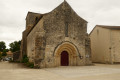
Park in the car park by the wash house, situated behind the Romanesque church dedicated to Saint Martin.
(S/E) Follow Rue de la Fontaine to return to the departmental road that runs through the village and walk about fifty metres to the left.
(1) Take the road on the right towards Chez Veau for about 200 metres.
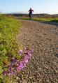
(2) Turn left onto Chemin des Vignes. Continue straight on towards Les Troquerauds, passing through vineyards and shaded areas.
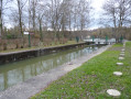
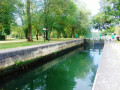
(3) Cross the pretty bridge over the Nouère, and do take a moment to stop and admire this spot of greenery and water, as well as the little wash house. When you reach the D53, take a moment to admire the magnificent traditional Charente gate opposite. Follow this road carefully for about 200 metres to the right.
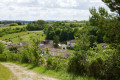
(4) Take thefirst path on the left, a former railway line. When you reach the road, turn immediately right onto the parallel path. Passing through vineyards and farmland, you’ll follow the boundary with the commune of Douzat. Enjoy the magnificent views of the village and the church of Saint-Genis-d’Hiersac.
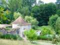
(5) At the crossroads, follow the road to the right and leave it straight away to take the path on the left behind the hedge. After the bend, continue towards the woodland opposite. Emerge onto the white track and head to the right. Ignore the first track on the left (not shown on the IGN map), and climb up to the next junction where, on your right, you’ll find the remains of the Neuillac windmill dating from 1870. It is said never to have been operational and was destroyed during a storm in 1904.
(6) Follow the white track to the left. Further on, keep to the left, ignoring the track on the right which leads down to Neuillac. Continue to the next crossroads, turn right and head down to the D53.
(7) Cross the road and take the Voie Verte (a former railway line) on the right, following it to the car park. Turn left and head back up.
(8) Keep to the right as you continue uphill towards the hamlet of Chez Veau and turn right at the next junction.
(9) Cross the D115, walk past the houses on Rue des Sablons and come out onto the local road. Cross it and take the path opposite which leads down to the D96.
(10) Cross it and head towards the spillway. Head down to the right to return to the village, following the lovely shaded path below the D96 (S/E).

 Tourist office
 Easy

 Visorando Member