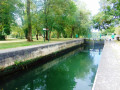
The Charente and Vineyards Route starting from Marsac

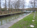
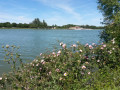
From the bayou-like atmosphere of the banks of the Charente, where ducks and moorhens will be your travelling companions, you’ll move on to a landscape whose colours change with the seasons – a landscape that is both undulating and wide open, where crops and vineyards grow side by side.

Details

n°21549939
Creation:
Last update:
–
Last review:
  • Walking
    Activity: Walking
  • ↔
    Distance: 6.22 mi
  • ◔
    Average duration: 3h 05 
  • ▲
    Difficulty: Moderate

  • ⚐
    Back to start: Yes
  • ↗
    Ascent: + 285 ft
  • ↘
    Descent: - 272 ft

  • ▲
    Highest point: 384 ft
  • ▼
    Lowest point: 125 ft
  • ⚐ Country: France
  • ⚐ City: Marsac (16570)
  • ⚑
    Start/End: N 45.74121° / E 0.07825°
  • ❏
    IGN map(s): Ref. 1731SB
  • Hour-by-hour weather

Photos

Description of the walk

Park in the church car park (see information board).

(S/E) Head east towards the Charente via the Route des Ponts.

(1) Take the path on the left just before the bridge. Cross the footbridge over the Doux and follow the river branch for about 1.5 km.

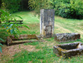
(2) Turn left onto the Chemin de la Prairie. Carry on straight ahead to the village of Lagroux. At the crossroads, take the Rue de Chez Joumier: opposite, note the beautiful Charente-style gateway on the left. Ignore the Route de la Pougnerie on the left, continue along the Rue du Vignaud on the right and you’ll come out onto the RD96, which you follow to the left. Take a moment to rest on the bench in the shade in the small square before tackling the hillsides.

(3) Once you’ve left the village, take the Chemin du Souchaud on the left. Ignore the path branching off to the right, then the one on the left, and carry on climbing straight up the hillside. Right at the top, the Charente valley comes into view: on one side, the ‘winged giants’ of northern Charente, and on the other, the belfry of Angoulême.

(4) Leave the white track and take the wooded path on the left. Turn right at the edge of the woods. Go uphill and then back down towards the D287.

(5) Cross the road and carry on straight ahead. Beautiful rolling countryside continues to accompany you. Carry on to the left along the Route de Basse and pass under a power line.

(6) Turn left onto the white track that runs alongside the high-speed rail line, then descends gently towards the village of Lasdoux.

(7) Leave the Route de la Pougnerie on your left and carry on straight ahead. Pass under the power line again and join a road.

(8) Turn right and carry on straight ahead at the junction.

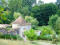
(9) Follow Rue du Lavoir to the right to reach the village washhouse. The Ladon stream is channelled alongside the road. Turn left in front of the washhouse and come out onto Rue de Ladoux. Turn left then right, go up Chemin du Quanty towards the farmhouse, which you go round on the right and then on the left to descend towards Chemin du Ladon.

(10) Continue to the right until you reach the RD96 (Route des Sables), which leads to the village centre. Turn left in front of the cemetery to return to the church square (S/E).

Waypoints

  1. S/E : mi 0 - alt. 141 ft - Car park at the - Église Saint-Gervais et Saint-Protais (Marsac)
  2. 1 : mi 0.18 - alt. 131 ft - Junction before the bridge over the - Charente (fleuve)
  3. 2 : mi 1.14 - alt. 128 ft - Junction
  4. 3 : mi 1.99 - alt. 151 ft - Lagroux exit
  5. 4 : mi 2.76 - alt. 266 ft - Junction on a wooded path
  6. 5 : mi 3.34 - alt. 243 ft - Crossing the D287
  7. 6 : mi 4.22 - alt. 351 ft - Junction before the high-speed rail line
  8. 7 : mi 4.64 - alt. 354 ft - Junction
  9. 8 : mi 5.4 - alt. 157 ft - T-junction
  10. 9 : mi 5.55 - alt. 157 ft - Rue du Lavoir
  11. 10 : mi 6 - alt. 154 ft - T-junction
  12. S/E : mi 6.22 - alt. 141 ft - Car park at the - Église Saint-Gervais et Saint-Protais (Marsac)

Notes

This route along the river is impassable during the winter months.

Contact: Pays d’Angoulême Tourist Office 05 45 95 16 84.

Reviews and comments

3.8 / 5
Based on 2 reviews

Reliability of the description
4 / 5
Ease of following the route
3.5 / 5
Route interest
4 / 5
matmarlulu
matmarlulu

Overall rating : 4 / 5

Date of your route : Apr 10, 2026
Reliability of the description : ★★★★☆ Good
Ease of following the route : ★★★★☆ Good
Route interest : ★★★★☆ Good
Very busy route : No

At the moment, the final stretch along the banks of the Charente is impassable due to numerous fallen trees – a shame, as it’s the most beautiful part of the route.

Machine-translated

jeanclaudelafon
jeanclaudelafon

Overall rating : 3.7 / 5

Date of your route : Sep 29, 2025
Reliability of the description : ★★★★☆ Good
Ease of following the route : ★★★☆☆ Average
Route interest : ★★★★☆ Good
Very busy route : No

very pleasant but grassy paths, with morning dew; Charentais riverbank with pleasant trails and then vineyard landscape, as the name of the route suggests. A deer graced us with its beautiful appearance. We had a pleasant morning with our group of hikers

Machine-translated

Other walks in the area

For more walks, use our search engine .

The GPS track and description are the property of this route's author. Please do not copy them without permission.