The Tonne Fountain in Vindelle

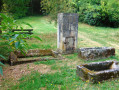
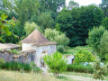
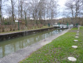
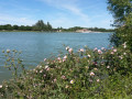
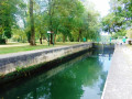
The banks of the Charente will greet you at the start and end of this route, which is quite hilly and open. Along the way, the beautiful Tonne fountain invites you to take a pleasant, refreshing break.

Details

22634241
Creation:
Last update:
Last review:
  • Walking
    Activity: Walking
  • ↔
    Distance: 5.45 mi
  • ◔
    Average duration: 2h 55 
  • ▲
    Difficulty: Easy

  • ⚐
    Back to start: Yes
  • ↗
    Ascent: + 499 ft
  • ↘
    Descent: - 476 ft

  • ▲
    Highest point: 377 ft
  • ▼
    Lowest point: 125 ft
  • ⚐ Country: France
  • ⚐ City: Vindelle (16430)
  • ⚑
    Start/End: N 45.73128° / E 0.09533°
  • ❏
    IGN map(s): Ref. 1731SB
  • Hour-by-hour weather

Photos

Description of the walk

Car park and picnic area in the village of Puant on the banks of the Charente.

Green signposts

(S/E) From the car park, head left towards the village of Puant. Follow the road carefully towards Les Gélinards. Head up towards the village via Rue du Vieux Puits on the right. At the junction, continue right onto Rue des Gélinards.

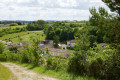
(1) On leaving the village, turn right onto the track. Carry on straight ahead alongside the fields, head downhill and follow the edge of the woodland on the left. At the end, head back up alongside the hedge. At the top of the hedge, turn right towards the signpost, then head up alongside the vineyard to reach the road opposite an electricity pylon – offering a vast, almost 360° panorama. Follow the road to the left, then leave it immediately to take the one on the right and follow it to the next pylon – the crest opens out onto Vindelle and the hillsides of Balzac.

(2) Take the path on the right, which runs straight for 500 m, before turning left at a right angle to descend to the road. Head back up to the right, pass the model aeroplane field and turn left before the top of the hill. Continue straight on until you reach the road.

(3) At the crossroads, follow the Route des Sept Journaux to the left; leave this by turning right just behind the electricity pylon. Head up towards the hamlet of Le Cluzeau. Once you reach the road, take the Chemin des Érables on the right just above it and cross the hamlet. At the top, take the path on the right – initially tarmac – known as the ‘Chemin des Grandes Fenêtres’; signs point towards the Tonne fountain. Just before taking the dirt track, there’s a stunning view down over the valley.

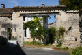
(4) At the junction, turn right onto the Chemin des Carreaux. Opposite the lovely farmhouse, go down the Rue des Écureuils, turn left and then immediately right to find, directly in front of you, one of the oldest houses, thought to date from 1774. Turn left and note, on the right, a bread oven chimney attached to a house dating from 1859.

(5) Take the path on the right as indicated by the sign. You will arrive at the Tonne fountain. Continue along the path which climbs towards the orientation table. A beautiful hundred-year-old lime tree stands on your left.

(6) Turn left. At the crossroads, take the road to the left for 250 metres before turning right onto the dirt track that descends alongside the grounds of the Domaine de Chantemerle. Continue to the junction with a small road where there is a beautiful ancient oak tree

(7) Cross over and follow the sign opposite indicating the path; take this immediately to the right, between the stream and the cultivated field. At the other end, walk past the houses in the village of Puant to return to the starting point (S/E).


Waypoints

  1. S/E : mi 0 - alt. 128 ft - Car park and picnic area - Charente (fleuve)
  2. 1 : mi 0.41 - alt. 194 ft - Junction on the path
  3. 2 : mi 1.15 - alt. 243 ft - Electricity pylon
  4. 3 : mi 2.07 - alt. 161 ft - Crossroads
  5. 4 : mi 3.09 - alt. 358 ft - Chemin des Carreaux
  6. 5 : mi 3.29 - alt. 348 ft - Start of the path
  7. 6 : mi 3.89 - alt. 367 ft - Orientation board
  8. 7 : mi 4.9 - alt. 174 ft - Road junction – Signpost
  9. S/E : mi 5.45 - alt. 128 ft - Car park and picnic area

Notes

Contact: Pays d’Angoulême Tourist Office: 05 45 95 16 84

Worth a visit

(S/E) The village of Puant owes its name to the foul odours once emitted by the processing of hemp, which was left to ‘rot’.

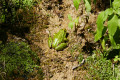
(5) You’ll arrive at a wonderful spot for a well-deserved refreshing break; be quiet so you can spot a beautiful green frog or a salamander. A little further up, discover the spring emerging into the open air after a long underground journey, flowing out of a channel carved into the rock. The high concentration of carbonates causes the porous rock to solidify, extending into the upper basin of the fountain.
(E) As you leave the Route du Moulin and cross the bridge, you can climb up to the viewpoint overlooking the village from Puant Hill, then head back down for a refreshing stop by the banks of the Charente.

Reviews and comments

4.1 / 5
Based on 4 reviews

Reliability of the description
4 / 5
Ease of following the route
3.8 / 5
Route interest
4.5 / 5
Florikawalk
Florikawalk

Overall rating : 4.3 / 5

Date of your route : Apr 28, 2026
Reliability of the description : ★★★★☆ Good
Ease of following the route : ★★★★☆ Good
Route interest : ★★★★★ Very good
Very busy route : No

A particularly pleasant and varied route.
As for the route description, I can’t comment as I haven’t looked at it (I only checked the route map). A big thank you to the hiker who mapped it out. But it’s true that there is a glitch at one point.
However, the picnic area doesn’t exist. You can’t park there and there’s just a table, worn away by damp, in the middle of (very tall) grass.

Machine-translated

ETIENNE DE ROMILLY
ETIENNE DE ROMILLY

Overall rating : 3.3 / 5

Date of your route : Mar 03, 2025
Reliability of the description : ★★★☆☆ Average
Ease of following the route : ★★★☆☆ Average
Route interest : ★★★★☆ Good
Very busy route : No

The weather was brilliant – the perfect opportunity to take some photos and relax!
However, the signposting on your site leaves a lot to be desired… Twice, I had to ask locals for directions to the Tonnes fountain and towards Puant on the way back.
But I’m still delighted!

Machine-translated

Office de tourisme Angoulême

Hello,
Thank you for your comment, and I hope you have a lovely outing with your club.
Chantal

Machine-translated

LAIRAIN
LAIRAIN

Overall rating : 5 / 5

Date of your route : Apr 26, 2023
Reliability of the description : ★★★★★ Very good
Ease of following the route : ★★★★★ Very good
Route interest : ★★★★★ Very good
Very busy route : Yes

A lovely route with beautiful scenery and plenty to see
I’d highly recommend this hike through the woods
I’m going to take my club there at the end of May

Machine-translated

Office de tourisme Angoulême

Hello,

Thank you for leaving a comment. There is indeed a country lane behind the pylon leading up to Le Cluzeau, but the vegetation must have misled you.
The voluntary organisation that manages the signposting for this route is keen to ensure that walkers follow the path alongside the stream so that this well-trodden path does not become overgrown, even though there is indeed a parallel path.
Kind regards,
Chantal

Machine-translated

Sylvie Gensac
Sylvie Gensac

Overall rating : 3.7 / 5

Date of your route : Apr 14, 2023
Reliability of the description : ★★★★☆ Good
Ease of following the route : ★★★☆☆ Average
Route interest : ★★★★☆ Good
Very busy route : No

At point number 3, there is no path beyond the pylon. You have to head back up the Cluzeault.
No sign of the hundred-year-old oak!!

The last sign saying ‘must take this path’ leads you to follow a stream which would be impassable in wet weather as there is no path
marked in parallel, as indicated.
It seems easier to follow the track above.

Machine-translated

Other walks in the area

For more walks, use our search engine .

The GPS track and description are the property of this route's author. Please do not copy them without permission.