In the footsteps of Caujac

This is an easy walk. Where the path runs alongside fields, please take care to stay close to the edge of the crops. Take care at the three points where the path crosses the D100, as traffic can sometimes be fast-moving.

Details

n°34109135
Creation:
Last update:
Last review:
  • Walking
    Activity: Walking
  • ↔
    Distance: 7.29 mi
  • ◔
    Average duration: 3h 30 
  • ▲
    Difficulty: Moderate

  • ⚐
    Back to start: Yes
  • ↗
    Ascent: + 190 ft
  • ↘
    Descent: - 207 ft

  • ▲
    Highest point: 509 ft
  • ▼
    Lowest point: 394 ft
  • ⚐ Country: France
  • ⚐ City: Savenès (82600)
  • ⚑
    Start/End: N 43.828846° / E 1.200112°
  • ❏
    IGN map(s): Ref. 2042O
  • Hour-by-hour weather

Photos

Description of the walk

You can set off from the car park at Savenès Town Hall. There are usually plenty of parking spaces available. If not, you can park on Rue de la Mairie.

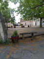
(S/E) From the town hall car park, head towards the village centre; turn left as you leave the car park. Walk right through the village, leaving the square further on to your right.

(1) As soon as you leave the village, turn into the first street on the right (Rue des Carrelots), then after 70 m, take the small, unpaved Chemin du Bousquet Biel on your left.

(2) Pass the Château de Savenès on your right and continue along the track, which ends after about 100 metres. Carry on along the dirt track that continues from the Chemin du Bousquet Biel. This track runs alongside a hedge until it joins the tarmac road known as the Chemin de la Corne. Follow this track down to the right until you reach the Route du Mas-Grenier. Then turn left and carry on to Le Lugatou.

(3) Just after the hamlet, take the first dirt track on your left. For safety’s sake, and before the bends, you can take the first field entrance on the left, just before the bends, to join this dirt track. Carry on along the hedge until you reach the edge of the woodland, then go down the embankment on the right and follow the field to the bridge leading to the D100.

(4) At the road, turn left and carry on to the next junction, where you’ll turn left towards Savenès. Then take the first track on your right, which goes round the cemetery and the village church on the right. Next, head down the small, shaded path that crosses the small wood on the right.

(5) When you reach the Côte de Laperière (tarmac road), follow it down to the junction with the D100. Then turn right and follow the road until you reach a dirt track on your left, just before the bend. Follow this track and you’ll come to the Chemin de Quesquils (gravel track).

(6) Turn right and, 150 metres further on, you’ll reach the junction at the Quesquils hut. Here, take the hairpin bend onto Chemin de la Roujette on your left to descend one last time to the D100.

(7) Turn right and continue for about 100 metres. At the junction, turn left towards the village of Savenès.

(8) At the next junction, turn right onto Chemin de Trauquebise. After about 80 metres, at a fork, keep left onto the tarmac road towards the water tower. Carry on straight ahead until you reach the Cap de Bio junction (elevation 154). Take the stony track opposite, which will lead you further on to Chemin d’Escufès.

(9) Carry on to the right for about 700 m, until you come to a house on your left. Immediately after this, take the stony track that branches off to your left just before the Segonde bridge. You are now on Chemin Sauvegarde, which becomes Chemin du Lièvre as soon as you re-enter the commune of Savenès. Carry on straight ahead until you reach the road (Côte d’Escufès).

(10) Turn left and, after about 20 metres, turn onto a small path on your right which will take you to the Escufès fountain. Walk round it and carry on until you reach the road, then turn right to climb the Côte d’Escufès.

(11) At the top of this hill, follow the road to the right towards the village of Savenès. Just before the bends, take a small dirt track on your right to avoid these dangerous bends with no visibility.

(12) Back on the main road, carry on and turn right onto Rue de la Mairie, where you’ll return to your starting point after about 350 metres (S/E).

Waypoints

  1. S/E : mi 0 - alt. 502 ft - Town hall car park
  2. 1 : mi 0.17 - alt. 492 ft - Leaving the village of Savenès
  3. 2 : mi 0.37 - alt. 505 ft - Château de Savenès
  4. 3 : mi 1.1 - alt. 397 ft - Lugatou
  5. 4 : mi 1.43 - alt. 397 ft - D100 road
  6. 5 : mi 2.12 - alt. 449 ft - Laperière Hill - Église Notre-Dame de l'Assomption (Savenès)
  7. 6 : mi 2.86 - alt. 499 ft - Quesquils Path
  8. 7 : mi 3.4 - alt. 436 ft - Return to the D100. Bridge over the - Galinas (ruisseau) - Affluent du ruisseau de Nadesse
  9. 8 : mi 3.7 - alt. 492 ft - Stop
  10. 9 : mi 4.97 - alt. 463 ft - Escufès Trail
  11. 10 : mi 6.41 - alt. 430 ft - Escufès Fountain
  12. 11 : mi 6.58 - alt. 489 ft - The hamlet of Escufès
  13. 12 : mi 7.08 - alt. 502 ft - Rue de la Mairie
  14. S/E : mi 7.29 - alt. 502 ft - Town hall car park

Notes

This walk is signposted in yellow.

You will find public toilets on the village square, available for self-service before point (1).

There are water points at the church (before point (5)) and at the Quesquils hut (between points (5) and (7)).
However, it is not advisable to drink the water from the washhouse just after point (7) or from the fountain after point (10).
In the event of rain, you can take shelter either at the church or at the Quesquils hut, which are normally always open.

Worth a visit

A bit of history.

The small hamlet of Escufès has a fountain with a distinctive character. The Escufès fountain consists of a series of basins and a fountain, including a large basin measuring over 100 m². It was used as a watering place for livestock, a watercress bed, a fishpond and for washing clothes.
Apart from the everyday practical uses the fountain served, it played a very important role in water management in Escufès. The fountain collected and channelled water via the basin.
Originally, the parish of Savenès was situated in the centre of the village, which was called Caujac. Decimated during the Hundred Years’ War, the population regrouped near the Château de la Salle, about 1 km away. The new settlement was established there.

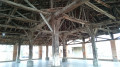
In the centre of the village (before the point (1)), you can visit the Saint-Fort Chapel, on the village square.
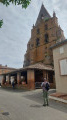
At point (2), you will find yourself in front of the listed Château de Savenès, also known as the 17th-century Château de la Salle. Continuing on from this point, you will see two 19th-century mills on your left, as well as the 15th- and 17th-century Church of the Assumption, which you will walk past shortly afterwards (just before point (5)).

You will then pass the Quesquils hut, between points (5) and (7) (a former hunters’ hut), which has been converted by the local Cantou Association into a reading hut (with free access to donate and borrow books).

You’ll pass the village’s old wash house on your left (just after the crossroads, after point (7)) and then the private château of Trauquebise, at the top of Rue du Lavoir, just before turning right.

Reviews and comments

5 / 5
Based on 1 review

Reliability of the description
5 / 5
Ease of following the route
5 / 5
Route interest
5 / 5
christine3111
christine3111

Overall rating : 5 / 5

Date of your route : Dec 10, 2023
Reliability of the description : ★★★★★ Very good
Ease of following the route : ★★★★★ Very good
Route interest : ★★★★★ Very good
Very busy route : Yes

Paths running alongside grassy fields: very handy when it rains (not too much mud).
A pleasant surprise at the Quesquils hut: a chance to sit down, have a picnic and take a break to read amidst the fields.

Machine-translated

Other walks in the area

For more walks, use our search engine .

The GPS track and description are the property of this route's author. Please do not copy them without permission.