Country:

 City:
City:


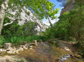
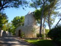
Park in the car park in the centre of the village of Le Tholonet.
(S/E) Take the road towards Aix for 450 m and turn right onto Chemin de la Paroisse. After the left-hand bend, you’ll reach a crossroads with several directions.
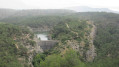
(1) Take the path on the left which climbs up the hill. About a hundred metres further on, keep to the right onto a more clearly marked path. You’ll reach a multi-way junction at a viewpoint overlooking the Vallon de la Cause.
(2) Continue along the path on the right, which descends into the valley and leads to a dam. Do not cross the dam; instead, continue along the path which initially runs along the right bank of the Cause, then crosses from one side to the other. Just as the stream bends to the right towards the Zola Dam, head up to the left, either to the track or by following a path that curves towards the dam towards a hydraulic structure. Climb up towards the dam and cross it to reach the opposite side.
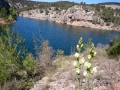
(3) Leave the track to the left and take the path that runs out over the lake, then rejoins the track, which you should follow for about 150 m. Then take the path on the left which descends towards the valley and then climbs again. Ignore the path branching off to the right and follow the one running along the eastern side of the lake. After about 300 m, turn right, heading east, following the left bank of the Vallon de la Cause. Cross a small tributary.
(4) Descend and cross the Cause stream, then climb the hill opposite to reach theGR® 653A.
(5) Take this path to the left and follow it along an almost flat route to reach a fire hydrant; continue for a further hundred metres to reach a crossroads of paths.
(6) Leave theGR® here and take the path on the right; further on, you’ll reach a junction with a wider track.
(7) Take this track to the left until you reach the Carrières de Bibémus car park, where you’ll rejoin theGR®653A.
(8) Enter the site and make your way through the various boulders to reach a wide track suitable for vehicles. Follow it down to a junction with another track at a pass.
(9) Leave the track and take the path heading due south, which climbs slightly before descending rapidly to reach the crossroads at the viewpoint over the Cause Valley, which you passed on the way out.
(2) Continue straight ahead, following the reverse route of the outward journey, to return to the original crossroads.
(1) Take the path on the left to reach the Roman dam quickly.
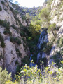
(10) Turn left to follow the course of the Cause upstream along a small canal for about 300 m until you reach a weir and the start of the gorges.
(11) Return to the previous junction.
(10) Turn left onto the path to join theGRP®2013Marseille Provence Métropole.
(12) Follow it to the right until you reach a fork.
(13) Turn right onto a barely visible and very steep path leading to the Toscan car park. Head up to the right, passing alongside an olive grove, and reach the Canal de Provence aqueduct; you can pass between the end of the aqueduct and the start of the tunnel.
(14) Continue straight on to reach the Tholonet cemetery, then head down towards the Moulin Cézanne and on to the Tholonet car park (S/E).




 Visorando Member
 Easy
Easy