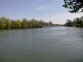
On the banks of the Oise in Cergy

This circular walk takes you along the banks of the Oise all the way round the Parc des Étangs de Cergy. Walk alongside the Oise on a peaceful path, admire the Axe Majeur – Cergy’s iconic architectural landmark – then continue your walk along the edge of the park. The return journey takes you along the other side of the Oise on a quiet, narrow path.

Details

66469673
Creation:
Last update:
Last review:
  • Walking
    Activity: Walking
  • ↔
    Distance: 7.21 mi
  • ◔
    Average duration: 3h 20 
  • ▲
    Difficulty: Moderate

  • ⚐
    Back to start: Yes
  • ↗
    Ascent: + 20 ft
  • ↘
    Descent: - 20 ft

  • ▲
    Highest point: 95 ft
  • ▼
    Lowest point: 62 ft

Photos

Description of the walk

Starting point: the car park at Place du Pont, next to Rue du Pont.

(S/E) From the car park, head straight towards the River Oise, without crossing the road or the roundabout. Ignore the steps on the right and find the path running alongside the river. Go under the Pont de Neuville, then continue straight along the path, keeping the River Oise on your left, until you reach the tarmac.

(1) Carry on along the road (Voie des Sabliers), which runs alongside the Parc de Loisirs des Étangs de Cergy. Continue straight on along this road with the park on your right and the River Oise on your left. In summer, when the weather is fine, barbecues are set up in the designated areas of the park and the smell of grilled sausages will whet your appetite. You’ll come to a junction with the road leading into the park and the entrance to a car park.

(2) Carry on straight ahead along the River Oise. As you approach the Axe Majeur (red bridge), ignore the path branching off to the right and carry on straight ahead to pass under the bridge.

(3) Underneath the bridge, carry on along the banks of the Oise (towpath), then ignore a path branching off to the right and continue in this direction until you reach the bridge crossing the river.

(4) Near the bridge, do not go under it but take a small flight of steps leading up over it. Cross the bridge, taking in the view of Port Cergy on your right, and, just past the railing, go down the steps on your left. Then take the path leading to a arbour; follow it until you reach a footpath along the banks of the Oise. Carry on until you reach the Axe Majeur again. Walk along the left-hand side of the pond until you arrive under the bridge, at the Gérard Philippe Amphitheatre.

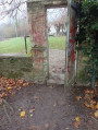
(5) Continue to follow the edge of the pond back towards the Oise and turn right. Carry on along the path by the water’s edge and go through a gate into a small park. Carry on along the path after this park. As you walk along Rue des Prés on your right, just before the first houses, look for the small passageway opposite No. 20, which allows you to leave this street and continue right along the banks of the Oise.

(6) Follow the riverbank until you reach a road (Chemin des Fauveaux) that is circular. Look out for the ‘flood marker’ opposite.

(7) Carry on straight ahead and, after the park, continue along the bank of the Oise (Chemin de la Rivière) until you reach the next bridge (Pont de Neuville).

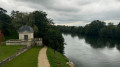
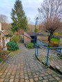
(8) Walk under the bridge and, immediately afterwards, take the steps leading up to the right. Cross the bridge via the wide footpath on the right-hand side. Enjoy the view of the Pavillon d’Amour in Neuville-sur-Oise. At the other end, go down the steps on the right and head towards the Place du Pont (S/E).

Waypoints

  1. S/E : mi 0 - alt. 82 ft - Place du Pont - Pavillon d'Amour
  2. 1 : mi 0.73 - alt. 72 ft - Voie des Sabliers - Oise (l')
  3. 2 : mi 1.38 - alt. 82 ft - Car Park P5
  4. 3 : mi 2.13 - alt. 82 ft - Main Route - Axe Majeur à Cergy-Pontoise (Val d'Oise)
  5. 4 : mi 3.34 - alt. 89 ft - Port Cergy Bridge - Port-Cergy
  6. 5 : mi 4.83 - alt. 75 ft - Gérard Philipe Amphitheatre
  7. 6 : mi 5.62 - alt. 75 ft - Rue des Prés - Lavoir des Dames Gilles
  8. 7 : mi 6.45 - alt. 75 ft - Circular route - Lavoir Maison du Parc
  9. 8 : mi 7.07 - alt. 79 ft - Pont de Neuville
  10. S/E : mi 7.21 - alt. 82 ft - Place du Pont

Notes

An alternative starting point is available at the Parc des Étangs de Cergy (2) (car park). Access is via the park entrance and then the Voie des Sabliers, but there is a charge in summer (April to October).

In summer, the Parc des Étangs is very busy. Take care along the road between (1) and (2). On this stretch, you may prefer to take the path that runs parallel to the road, slightly further inside the park – it’s impossible to get lost.

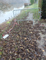
Please note that during periods of high water, some sections may be flooded, particularly between (3) and (4). In this case, simply take the paths running parallel to the road within the park.

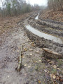
Between (4) and (5), then towards (6), a few sections may be a bit slippery or a little more challenging, but nothing too serious.

(7) Parc Raclet opening hours: 8.30 am to 8 pm between April and September, 9 am to 5 pm between October and March.
If the park is closed, take the road on the right (Chemin des Fauveaux) before the flood marker, then turn left (Grande Rue) until you reach Rue de la Fontaine Bénite on the left. Take this road, then follow a path on the left which leads to the River Oise.

Worth a visit

(S/E) Pavillon d’Amour (Neuville-sur-Oise).

Parc de Loisirs des Étangs de Cergy: a wide range of activities for children and adults, including tree-top adventure courses, water skiing, paintball, a swimming pool, canoeing, picnic and BBQ areas, and walks around the lakes...

(3) and (5) Axe Majeur.

(4) Port Cergy.

Video of this walk undertaken on 22 September 2024, starting from (2).

Reviews and comments

4.8 / 5
Based on 2 reviews

Reliability of the description
5 / 5
Ease of following the route
5 / 5
Route interest
4.5 / 5
clamed95
clamed95

Overall rating : 5 / 5

Date of your route : Mar 29, 2026
Reliability of the description : ★★★★★ Very good
Ease of following the route : ★★★★★ Very good
Route interest : ★★★★★ Very good
Very busy route : No

Squirrels, cormorants, swans, rabbits and ducks kept us company during this very pleasant walk.
The barbecue areas are sure to be packed this summer...
Definitely worth doing again.

Machine-translated

Bruno_14
Bruno_14
• Edited:

Yes, as a hike author myself, I am familiar with this problem of paths that change and are temporarily or permanently impassable. I even had a case a while ago where paths became private. I had to remove my hike from Visorando because there were no viable alternatives.
Enjoy your walks too... with Timon.

Machine-translated

NRBJ
NRBJ

On these banks of the Oise, floods sometimes prevent passage. I have had to take parallel paths closer to the Cergy ponds (between 3 and 4). The banks on the other side may also be impassable. It is best to avoid these periods of "high water".
These banks are often private but tolerate the passage of walkers, who are numerous on sunny days. On the other side of the gate, the small park does not seem to be private. I have sometimes seen fishermen or families picnicking there.
Enjoy your walks!

Machine-translated

Bruno_14
Bruno_14

Overall rating : 4.7 / 5

Date of your route : Dec 11, 2025
Reliability of the description : ★★★★★ Very good
Ease of following the route : ★★★★★ Very good
Route interest : ★★★★☆ Good
Very busy route : No

When I did this route on 11/12/2025, there was an impassable section between points 3 and 4.
Further on, on the way back, there was a barrier across the path with a small sign on the ground indicating that the path was temporarily inaccessible.
In both cases, I was able to get around it fairly easily and pick up the trail further on.
More inconveniently, further along the route, after passing through a gate, you wonder if you are on private property; I think it was a retirement home.
I met a few people, but the weather was gloomy, and the temperature was rather seasonal, even a little higher than normal for this time of year. I imagine that on sunny days, the proximity to urban areas must attract quite a few mountain bikers, joggers, walkers and hikers, with or without dogs.

Machine-translated

Other walks in the area

For more walks, use our search engine .

The GPS track and description are the property of this route's author. Please do not copy them without permission.