


Southern
Details
Creation:
Last update:
–
–
-
 Activity: Walking
 -
 Distance: 23.85 mi
 -
 Average duration: 15h 20
 -
 Difficulty: Not specified
 -
-
 Back to start: Yes
 -
 Ascent: + 5,000 ft
 -
 Descent: - 4,984 ft
 -
-
 Highest point: 1,982 ft
 -
 Lowest point: 243 ft
-
 Country:
United Kingdom
Country:
United Kingdom
-
 Area: Yorkshire Dales
 -
 City:
Barbon
City:
Barbon -
 Start/End: N 54.230033° / W 2.583702°
 -


 Hour-by-hour weather


Waypoints
- S/E : mi 0 - alt. 243 ft - Start on
- 1 : mi 0.04 - alt. 246 ft - Turn left onto Scaleber Lane
- 2 : mi 0.08 - alt. 246 ft - Turn left onto A683
- 3 : mi 0.08 - alt. 246 ft - Turn right onto Stonedross Lane
- 4 : mi 0.35 - alt. 276 ft - Turn left onto Moorthwaite Lane
- 5 : mi 0.41 - alt. 279 ft - Turn slight right
- 6 : mi 0.73 - alt. 305 ft - Keep right
- 7 : mi 0.75 - alt. 305 ft - Turn right
- 8 : mi 0.88 - alt. 322 ft - Turn sharp left
- 9 : mi 1.04 - alt. 351 ft - Turn left
- 10 : mi 1.48 - alt. 384 ft - Turn right
- 11 : mi 1.5 - alt. 390 ft - Turn right
- 12 : mi 7.54 - alt. 968 ft - Keep right
- 13 : mi 7.56 - alt. 965 ft - Keep right
- 14 : mi 7.71 - alt. 935 ft - Turn right
- 15 : mi 8.83 - alt. 597 ft - Turn sharp right
- 16 : mi 9.2 - alt. 436 ft - Turn left
- 17 : mi 9.21 - alt. 433 ft - Turn right
- 18 : mi 9.25 - alt. 404 ft - Turn right
- 19 : mi 9.49 - alt. 328 ft - Turn left
- 20 : mi 9.88 - alt. 325 ft - Turn right
- 21 : mi 9.9 - alt. 331 ft - Keep right onto Birks Lane
- 22 : mi 10.07 - alt. 364 ft - Turn right
- 23 : mi 10.12 - alt. 348 ft - Keep left
- 24 : mi 10.28 - alt. 354 ft - Turn slight left
- 25 : mi 10.4 - alt. 374 ft - Turn left onto Busk Lane
- 26 : mi 10.41 - alt. 374 ft - Turn right
- 27 : mi 10.56 - alt. 410 ft - Turn sharp left
- 28 : mi 10.6 - alt. 420 ft - Turn right
- 29 : mi 10.67 - alt. 423 ft - Turn left onto Station Road, A684
- 30 : mi 10.74 - alt. 410 ft - Turn right onto Woodside Avenue
- 31 : mi 10.88 - alt. 433 ft - Turn right onto Woodside Avenue
- 32 : mi 10.93 - alt. 449 ft - Turn left onto Howgill Lane
- 33 : mi 11 - alt. 476 ft - Keep right onto Howgill Lane
- 34 : mi 11.06 - alt. 492 ft - Turn right
- 35 : mi 11.17 - alt. 551 ft - Turn right
- 36 : mi 11.2 - alt. 584 ft - Turn left
- 37 : mi 11.22 - alt. 597 ft - Keep right
- 38 : mi 11.32 - alt. 748 ft - Keep left
- 39 : mi 11.92 - alt. 1,542 ft - Turn right
- 40 : mi 11.93 - alt. 1,542 ft - Turn left
- 41 : mi 12.27 - alt. 1,093 ft - Keep left
- 42 : mi 12.52 - alt. 748 ft - Turn slight left
- 43 : mi 12.63 - alt. 597 ft - Keep right
- 44 : mi 12.64 - alt. 584 ft - Turn right
- 45 : mi 12.68 - alt. 551 ft - Turn left
- 46 : mi 12.79 - alt. 492 ft - Turn left onto Howgill Lane
- 47 : mi 12.92 - alt. 449 ft - Turn right
- 48 : mi 12.97 - alt. 433 ft - Turn left onto Woodside Avenue
- 49 : mi 13.11 - alt. 410 ft - Turn left onto Station Road, A684
- 50 : mi 13.18 - alt. 423 ft - Turn right
- 51 : mi 13.25 - alt. 420 ft - Turn left
- 52 : mi 13.28 - alt. 410 ft - Turn sharp right
- 53 : mi 13.44 - alt. 374 ft - Turn left onto Busk Lane
- 54 : mi 13.45 - alt. 374 ft - Turn right
- 55 : mi 13.56 - alt. 354 ft - Turn slight right
- 56 : mi 13.78 - alt. 364 ft - Turn left onto Birks Lane
- 57 : mi 13.84 - alt. 361 ft - Keep left onto Birks Lane
- 58 : mi 13.94 - alt. 331 ft - Turn slight left
- 59 : mi 13.97 - alt. 325 ft - Turn left
- 60 : mi 14.35 - alt. 328 ft - Turn right
- 61 : mi 14.6 - alt. 404 ft - Turn left
- 62 : mi 14.64 - alt. 433 ft - Turn left
- 63 : mi 14.65 - alt. 436 ft - Turn right
- 64 : mi 15.01 - alt. 597 ft - Turn sharp left
- 65 : mi 16.13 - alt. 935 ft - Turn left
- 66 : mi 20.88 - alt. 1,621 ft - Keep right
- 67 : mi 22.35 - alt. 390 ft - Turn left
- 68 : mi 22.36 - alt. 384 ft - Turn left
- 69 : mi 22.8 - alt. 351 ft - Turn right
- 70 : mi 22.81 - alt. 348 ft - Keep left
- 71 : mi 22.97 - alt. 322 ft - Turn sharp right
- 72 : mi 23.1 - alt. 305 ft - Turn left
- 73 : mi 23.44 - alt. 279 ft - Turn slight left onto Moorthwaite Lane
- 74 : mi 23.49 - alt. 276 ft - Turn right onto Stonedross Lane
- 75 : mi 23.76 - alt. 246 ft - Turn left onto A683
- 76 : mi 23.77 - alt. 246 ft - Turn right onto Scaleber Lane
- 77 : mi 23.8 - alt. 246 ft - Turn right
- S/E : mi 23.85 - alt. 243 ft
Other walks in the area
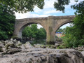
Devil's Bridge, Radical Steps - Kirkby Lonsdale
 Association / Club / Walk leader
 1.31 mi
+75 ft
-75 ft
0h 40
1.31 mi
+75 ft
-75 ft
0h 40
 Easy
Easy
 Departure from Casterton (Westmorland and Furness)
This route starts from Devil's Bridge, goes along River Lune before heading up to Radical Steps and through Kirkby Lonsdale village. Along the way, you will find welcoming benches.
Winder and Arant Haw from Sedbergh
 Visorando Member6.99 mi
+1,759 ft
-1,755 ft
4h 45
Visorando Member6.99 mi
+1,759 ft
-1,755 ft
4h 45
 Moderate
Departure from Sedbergh (Westmorland and Furness)
Moderate
Departure from Sedbergh (Westmorland and Furness)
Winder and Arant Haw are two hills included in this delightful walk from Sedbergh. The Howgill Fells are an integral part of the Yorkshire Dales National Park yet they display a unique character. The walking is good, the views superb and the paths quiet. Who could ask for more?
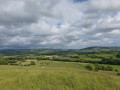
Heversham and Heversham Head trig point
 2.62 mi
+322 ft
-305 ft
1h 30
Easy
Departure from Heversham (Westmorland and Furness)
2.62 mi
+322 ft
-305 ft
1h 30
Easy
Departure from Heversham (Westmorland and Furness)
This walk starts from the church in Heversham and goes through farmlands so you can enjoy an incredible view from Heversham Head trig point.
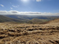
Fell Head and The Calf, from Howgill, near Sedbergh
 6.84 mi
+1,841 ft
-1,736 ft
4h 45
Moderate
Departure from Sedbergh (Westmorland and Furness)
6.84 mi
+1,841 ft
-1,736 ft
4h 45
Moderate
Departure from Sedbergh (Westmorland and Furness)
This walk climbs to the Calf via Fell Head. Starting from the small hamlet of Howgill, near Sedbergh, this route sees few walkers. Offering good views to the Shap Fells and the higher hills of the Yorkshire Dales, this is a walk for the connoiseur.
Blea Moor and Denthead from Ribblehead
8.28 mi
+1,010 ft
-1,010 ft
4h 40
Moderate
Departure from Ingleton (North Yorkshire)
A Yorkshire Dales route that includes a traverse of Blea Moor from Ribblehead. The return route follows a section of the Dales Way across Gayle Moor. The walk includes some unavoidable road walking.
Fairy steps from Sandside village
4.31 mi
+384 ft
-387 ft
2h 20
Easy
Departure from Beetham (Westmorland and Furness)
Family walk to see the fairy steps starting from the village of Sandside.
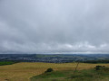
Benson Knott from Meal Bank
 3.08 mi
+781 ft
-781 ft
2h 05
Easy
Departure from Skelsmergh and Scalthwaiterigg (Westmorland and Furness)
3.08 mi
+781 ft
-781 ft
2h 05
Easy
Departure from Skelsmergh and Scalthwaiterigg (Westmorland and Furness)
This circular walk brings you up to Benson Knott to get an incredible 360-degree view of Kendal.
Kendal to Ambleside via Longsleddale and Garburn Pass
17.74 mi
+2,287 ft
-2,280 ft
10h 10
 Difficult
Departure from Kendal (Westmorland and Furness)
Difficult
Departure from Kendal (Westmorland and Furness)
This route follows the path of the first quarter of the Lakes District Challenge 2022. It takes some parts of part of the Dales Way, magnificent views of Longsleddale, climbs up to Garburns Pass with views into Troutbeck and Windermere.
For more walks, use our search engine .
The GPS track and description are the property of this route's author. Please do not copy them without permission.

