A walk around the Aiako rocky outcrops

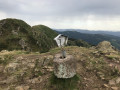
This route is known by the codePR®-GI-1010. The Basque name ‘Aiako harriko tontorrei bira’ translates into English as ‘the tour of the Three Crowns summits’ (Vuelta a las cimas de Peñas de Aia in Spanish). And that describes exactly what it is: a beautiful circular route around the summits of the Three Crowns.

Details

n°28496865
Creation:
Last update:
Last review:
  • Walking
    Activity: Walking
  • ↔
    Distance: 6.71 mi
  • ◔
    Average duration: 4h 55 
  • ▲
    Difficulty: Moderate

  • ⚐
    Back to start: Yes
  • ↗
    Ascent: + 2,090 ft
  • ↘
    Descent: - 2,083 ft

  • ▲
    Highest point: 1,998 ft
  • ▼
    Lowest point: 1,093 ft

Photos

Description of the walk

To reach the start point from Irun, head towards the Aiako Harria Natural Park, climb the winding road up to the pass and then descend to a car park at the Col d’Elurretxe, at an altitude of 490 m.

(S/E) Head south along the descending path which winds its way down to the Col d’Aritxulegi.

(1) Turn left towards the north-east. Pass the “Aialde” restaurant before rejoining the road from Lesaka to Oiartzun.

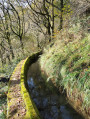
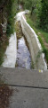
(2) Turn left towards the north, following the Domiko canal.

(3) Leave the canal bank and head up to the left towards the north-west.

(4) Turn left towards the south-west onto the path, which winds a few times before returning to the car park (S/E).

Waypoints

  1. S/E : mi 0 - alt. 1,640 ft - Elurretxe Pass car park
  2. 1 : mi 2.41 - alt. 1,611 ft - Col d'Aritxulegi
  3. 2 : mi 3.22 - alt. 1,168 ft - Road from Lesaka to Oiartzun
  4. 3 : mi 4.87 - alt. 1,152 ft - Leave the canal bank
  5. 4 : mi 5.9 - alt. 1,660 ft - Hairpin bend to the left
  6. S/E : mi 6.71 - alt. 1,640 ft - Elurretxe Pass car park

Notes

The description may seem brief, but the signposting on the ground is very well maintained.

Always be cautious and plan ahead when you're outdoors. Visorando and the author of this route cannot be held responsible for any accidents occurring on this route.

The GR® and PR® markings are the intellectual property of the Fédération Française de Randonnée Pédestre.

Reviews and comments

4 / 5
Based on 2 reviews

Reliability of the description
4 / 5
Ease of following the route
4 / 5
Route interest
4 / 5
bighoud1
bighoud1
• Edited:

Overall rating : 3.3 / 5

Date of your route : Jul 29, 2024
Reliability of the description : ★★★☆☆ Average
Ease of following the route : ★★★★☆ Good
Route interest : ★★★☆☆ Average
Very busy route : No

This route is disappointing: no views of the peaks in the massif; the first section is over difficult, rugged terrain; the stretch along the canal is dangerous (narrow parapet, risk of falling); the end is more pleasant.

Machine-translated

GERMAINY
GERMAINY

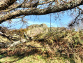
This route is very interesting and varied, with open stretches and sections through the woodland. We did it in autumn beneath the shimmering canopy of the woodland, enjoying stunning views to the east towards Kopako Karria and to the west towards the San Sebastián hinterland. The peaks of the Three Crowns can be glimpsed from the path, but often you’re walking below them and have to look up to see Txurrumurru!
One point is worth mentioning, although it isn’t included in the route description. For quite a while – thirty to forty-five minutes – you have to walk alongside a water supply channel. The path passes through some very narrow sections and along the tops of parapets, which can be dangerous. One of us, who suffers from vertigo, didn’t enjoy it. It’s best to be warned.

Machine-translated

JEAN LUC MOUESCA
JEAN LUC MOUESCA

Overall rating : 4.7 / 5

Date of your route : May 08, 2023
Reliability of the description : ★★★★★ Very good
Ease of following the route : ★★★★☆ Good
Route interest : ★★★★★ Very good
Very busy route : No

A very varied walk with its diverse landscapes and different types of terrain (grass, footpaths, rocks, concrete slabs)
Part of the walk (after the restaurant) is on flat ground, walking along concrete slabs covering a small canal. It feels just like walking along the levadas on the island of Madeira! Very relaxing.
Please note: at the fork at point 2, the trail markings change from red/white/yellow to white/yellow.

Machine-translated

Other walks in the area

For more walks, use our search engine .

The GPS track and description are the property of this route's author. Please do not copy them without permission.