


Shrewton_Yarnbury
Details
Creation:
Last update:
-
 Activity: Walking
 -
 Distance: 7.74 mi
 -
 Average duration: 3h 50
 -
 Difficulty: Not specified
 -
-
 Back to start: Yes
 -
 Ascent: + 308 ft
 -
 Descent: - 305 ft
 -
-
 Highest point: 525 ft
 -
 Lowest point: 256 ft
-
 Country:
United Kingdom
Country:
United Kingdom
-
 City:
Orcheston
City:
Orcheston -
 Start/End: N 51.199668° / W 1.902826°
 -


 Hour-by-hour weather


Waypoints
- S/E : mi 0 - alt. 269 ft - Start on
- 1 : mi 0.03 - alt. 266 ft - Turn right onto The Hollow
- 2 : mi 0.05 - alt. 269 ft - Turn slight left onto Tanners Lane
- 3 : mi 0.41 - alt. 256 ft - Turn right onto Maddington Street, A360
- 4 : mi 0.48 - alt. 259 ft - Turn left onto The Common
- 5 : mi 0.83 - alt. 285 ft - Turn right
- 6 : mi 3.06 - alt. 476 ft - Turn sharp right
- 7 : mi 3.51 - alt. 499 ft - Turn sharp right
- 8 : mi 4.06 - alt. 525 ft - Keep right
- 9 : mi 4.06 - alt. 525 ft - Turn left
- 10 : mi 4.43 - alt. 476 ft - Turn left
- 11 : mi 6.91 - alt. 269 ft - Turn left onto The Common
- 12 : mi 7.11 - alt. 259 ft - Turn left onto Maddington Street, A360
- 13 : mi 7.25 - alt. 256 ft - Turn left
- 14 : mi 7.25 - alt. 256 ft - Turn left onto High Street
- 15 : mi 7.65 - alt. 262 ft - Turn left onto The Hollow
- 16 : mi 7.68 - alt. 262 ft - Turn left onto The Hollow
- 17 : mi 7.71 - alt. 266 ft - Turn right
- S/E : mi 7.74 - alt. 269 ft
Other walks in the area
Pewsey Vale Villages; Wharf Circular
 Visorando Member
 8.80 mi
+194 ft
-220 ft
4h 15
8.80 mi
+194 ft
-220 ft
4h 15
 Average
 Departure from Pewsey (Wiltshire)
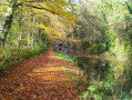
Starting from Bouverie Hall in the centre of Pewsey, this circular walk explores the village’s historic landmarks and the surrounding Wiltshire countryside. The route begins with a gentle stroll past St John the Baptist Church, followed by the Holy Family Catholic Church and Holy Cross Church, reflecting the area’s rich religious heritage.
Leaving Pewsey behind, the path follows quiet lanes and field tracks towards Wilcot, where the Golden Swan offers a welcome spot for refreshments. From here the route turns east, passing through peaceful farmland and alongside the canal to reach The Waterfront Bar and Bistro on Marlborough Road.
Continuing northwards, the walk takes in Jones’s Mill Nature Reserve, a haven for wildlife managed by Wiltshire Wildlife Trust, before looping by the Trout Farm and returning towards Pewsey. The final stretch leads back into the village, finishing near The Coopers Arms, a traditional pub perfect for a well-earned rest before returning to Bouverie Hall.
Milk Hill the highest point in Wiltshire
2.80 mi
+322 ft
-335 ft
1h 35
 Easy
Departure from Alton (Wiltshire)
Easy
Departure from Alton (Wiltshire)
A pleasant Wiltshire walk across chalk downland to the highest point in the county. The walk also includes some other interesting features typical of this area.
From Milton Lilbourne to Easton Royal and on the Downs to Giant's Grave
 5.46 mi
+348 ft
-361 ft
2h 50
Average
Departure from Milton Lilbourne (Wiltshire)
5.46 mi
+348 ft
-361 ft
2h 50
Average
Departure from Milton Lilbourne (Wiltshire)
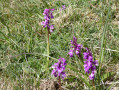
Across field tracks to Easton Royal, then up onto the Downs and along to Giant's Grave prehistoric long barrow with wonderful views across Pewsey Vale before returning to Milton Lilbourne
Milton Lilbourne scenic downland towards Pewsey
 5.61 mi
+407 ft
-400 ft
2h 55
Easy
Departure from Milton Lilbourne (Wiltshire)
5.61 mi
+407 ft
-400 ft
2h 55
Easy
Departure from Milton Lilbourne (Wiltshire)
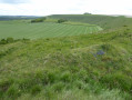
Along the downs past Giant's Grave to drop down to Pewsey, then return across fields via Kepnal and Fyfield to Milton Lilbourne.
Middle Winterslow to Pitton circular route
5.79 mi
+397 ft
-397 ft
3h 00
Average
Departure from Winterslow (Wiltshire)
The first part follows the Clarendon Way along the ridge from West Winterslow to Pitton. Excellent views across the downland and Salisbury Plain to the north. The return is through woodland and forest,
Pewsey Downs from Wootton Rivers
7.85 mi
+482 ft
-472 ft
4h 00
Average
Departure from Wootton Rivers (Wiltshire)
This Wiltshire walk climbs onto the Pewsey Downs from where there are excellent views across the Vale of Pewsey. The route uses a number of national trails before returning along the towpath of the Kennet and Avon Canal and offers a range of scenery from rolling downs to the open aspect of the Vale of Pewsey.
For more walks, use our search engine .
The GPS track and description are the property of this route's author. Please do not copy them without permission.

