


 Country:
 City:
City:


Start: Shillingford (SU 594 928)
(S) From the bus stop, turn away from the village along the main road and turn left on the footpath which leads to the river.
(1) Turn right and follow the River Thames for nearly a mile.
(2) Cross the footbridge over the mouth of the River Tame and keep following the Thames Path.
(3) Keep following the Thames Path, which soon crosses the river by the weir and meanders through a wetland area for a further two and a half miles before reaching Clifton Hampden Bridge.
(4) Turn right, carefully cross the bridge and go down to the riverbank again.
A little further on, Clifton Lock marks the beginning of the Clifton Cut, which was constructed to bypass a wiggly section of the river. At the other end, there is a weir where the river diverges.
Continue through the water meadows for another two miles, passing under the railway bridge.
Just before the village, the Culham Cut slices off another section of the river.
(5) Cross the road and soon come to Culham Lock.
The Cut is less than a mile long and rejoins the river on a bend at the start of Culham Reach.
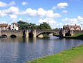
(6) Cross the Back Water where it joins the river as the town of Abingdon looms up on the far bank. Go through a pleasant recreational area and soon come the Abingdon Bridge.
(7) At Abingdon Bridge, there are two options:
- When the Benson weir walkway is closed, the Thames Path diversion crosses the bridge, then turns right along Abbey Close, passes the church and descends to the Abbey Meadows. The path rejoins the main route on the other side of the weir.
- If there is no diversion, which is the option shown on the map of this route, continue to the weir walkway, cross to the left and then cross the Abbey Stream to the right.
(8) Turn right and pass through a wooded area to a chicane where the path rejoins the main river. The woodland continues until the path goes under the railway line again, then the aspect opens up, and the riverside flowers and grasses become even more abundant. Keep following the River Thames for another mile.
(9) Take the footpath on the left which goes across a field and reaches a lane at Lower Radley. Turn left and follow the road round to a junction. Turn left and cross the bridge to Foxborough Road. Turn left and left again for the station.(E)
 Tourism professional
 Easy
Easy  Visorando Member
 Association / Club / Walk leader
 Moderate
