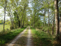
From the Naurouze weir to Montgiscard (Le Pradelot) along the Canal du Midi

Explore the Canal du Midi, with its locks, structures and other engineering works designed to facilitate navigation. This circular route follows the greenway from Seuil de Naurouze to Montgiscard – Le Pradelot.

Details

n°29979296
Creation:
Last update:
Last review:
  • Touring/Gravel
    Activity: Touring/Gravel
  • ↔
    Distance: 35.59 mi
  • ◔
    Duration according to the author: 4 hrs 
  • ▲
    Difficulty: Moderate

  • ⚐
    Back to start: Yes
  • ↗
    Ascent: + 125 ft
  • ↘
    Descent: - 128 ft

  • ▲
    Highest point: 636 ft
  • ▼
    Lowest point: 502 ft
  • ⚐ Country: France
  • ⚐ City: Montferrand (11320)
  • ⚑
    Start/End: N 43.350961° / E 1.822695°
  • ❏
    IGN map(s): Ref. 2144E, 2144O, 2145E, 2145O, 2244O, 2245O

  • ◶
    Type of surface:
  •  
     
    ■ 11% Road ■ 89% Byway
  • Hour-by-hour weather

Photos

Description of the route

Head to Labastide-d’Anjou. On leaving the town centre towards Avignonet-Lauragais, turn left onto the Route de l’Ourmette (D217). Continue along the Route de Ségala (D218), which is a continuation of the same road. You’ll reach the Seuil de Naurouze, where there is a picnic area and a car park.

(S/E) As you leave the car park, turn left onto Route de Ségala (D218) and go round the Rigole du Midi on the right. At the first junction, turn left onto Chemin de Pierre Paul Riquet.

(1) At the T-junction, turn right. At the next junction, cross the Chemin de l’Écluse and take the cycle path or Voie Verte (V80) opposite, with the Canal du Midi on your left. Continue along this path without leaving it. Pass under the railway line, under the A61-E80 motorway, Lock No. 16 at Borrel, then the one at Encassan, and continue along the Voie Verte.

(2) At the Renneville Lock, pass the hamlet of Les Saules on your right and, at the right-hand bend in the road, turn left to rejoin the Voie Verte (cycle path). Continue along this path without leaving it and pass the Renneville rest area.

(3) Cross the Aqueduc des Voûtes.

(4) Pass the Gardouch Lock.

(5) Pass the Gardouch Canal Bridge, the Laval Lock, then go under the A66-E9 motorway and continue along the Voie Verte without leaving it

(6) At the Négra or Thésauque Canal Bridge, at the Y-junction, take the left-hand lane, Route de Villenouvelle. Pass the Impasse de Cambel on your right, then in the bend, and just before the bridge over the canal, turn right to rejoin the cycle path. Continue straight on without leaving the path.

(7) Pass the Pont d’en Serny, Lock No. 10 at Le Sanglier, and continue straight on along the towpath. Pass Lock No. 9 at Ayguesvives and Lock No. 8 at Montgiscard. Continue for approximately 1,200 metres until you reach the hamlet of Le Pradelot, situated on the left bank of the canal.

(8) Turn round and return via the same route.

(1) Carry on straight ahead along the tree-lined path, the Seuil de Naurouze, to the car park (S/E).

Waypoints

  1. S/E : mi 0 - alt. 630 ft - Route de Ségala, D218 - Déversoir de Naurouze
  2. 1 : mi 0.4 - alt. 630 ft - Out-and-back route. Naurouze weir
  3. 2 : mi 5.86 - alt. 581 ft - Écluse de Renneville
  4. 3 : mi 7.24 - alt. 564 ft - Aqueduc des Voûtes - Hers-Mort (rivière) - Affluent de la Garonne
  5. 4 : mi 8.39 - alt. 584 ft - Écluse de Gardouch
  6. 5 : mi 8.63 - alt. 558 ft - Gardouch canal bridge - Gardijol (rivière) - Affluent de l'Hers-Mort
  7. 6 : mi 11.82 - alt. 554 ft - Négra Canal Bridge or the - Thésauque (rivière) - Affluent de l'Hers-Mort
  8. 7 : mi 13.02 - alt. 545 ft - Pont d’en Serny
  9. 8 : mi 17.86 - alt. 509 ft - Local area: Le Pradelot - Canal du Midi
  10. S/E : mi 35.59 - alt. 627 ft - Car park at Seuil de Naurouze - Écluse de l'Océan

Notes

Picnic areas: (S/E) Seuil de Naurouze

Between (2) and (6) Access to the Renneville rest area is available.

Between (6) and (8) Access to the Ayguesvives rest area is available.

Otherwise, benches are provided at regular intervals along the Voie Verte.

There are no shelters or water points along the route. Things to see in the local hamlets, at the locks and in the villages you pass through.

No special equipment is required, other than that needed for mountain biking.

Route completed on 28 July 2022.

Worth a visit

(S/E) The Riquet Obelisk marks the highest point of the Canal du Midi. It was erected by the heirs of Pierre-Paul Riquet in his honour. He was the initiator, designer and builder of the Canal du Midi, which links the Mediterranean to the Atlantic.

The Naurouze Weir lies on the watershed at an altitude of 194 m, between the Mediterranean Sea and the Atlantic Ocean.

(3) The Aqueduc des Voûtes, designed by Vauban, spans the River Hers-Mort.

(4) The Gardouch Lock.

(6) The Négra Canal Bridge, also designed by Vauban, spans the River Thésauque.

(7) The Pont d’en Serny

Reviews and comments

5 / 5
Based on 1 review

Reliability of the description
5 / 5
Ease of following the route
5 / 5
Route interest
5 / 5
Ganoutche
Ganoutche

Overall rating : 5 / 5

Date of your route : May 13, 2024
Reliability of the description : ★★★★★ Very good
Ease of following the route : ★★★★★ Very good
Route interest : ★★★★★ Very good
Very busy route : No

A lovely walk with magnificent scenery.
The climb up to the cross is well worth the effort

Machine-translated

For more walks, use our search engine .

The GPS track and description are the property of this route's author. Please do not copy them without permission.