Miosson Trail in Nouaillé-Maupertuis

A short walk between the village of Nouaillé and the shaded footpaths.

Details

4032436
Creation:
Last update:
Last review:
  • Walking
    Activity: Walking
  • ↔
    Distance: 2.76 mi
  • ◔
    Average duration: 1h 20 
  • ▲
    Difficulty: Easy

  • ⚐
    Back to start: Yes
  • ↗
    Ascent: + 118 ft
  • ↘
    Descent: - 102 ft

  • ▲
    Highest point: 433 ft
  • ▼
    Lowest point: 335 ft

Photos

Description of the walk

The route starts at the car park on Place du Souvenir, between Nouaillé Abbey and the Maison pour Tous.

(S/E) Opposite the hiking information board, turn right and leave the car park through the gap in the low wall. Turn left onto the gravel path, Chemin de l’Aumônerie, and continue straight on along the dirt track.

Take the wooden staircase on the right that leads between the gardens. At the top of the stairs, continue uphill to the left to reach the Route de Poitiers (D12). Turn right onto the Route de Poitiers, then left to cross at the pedestrian crossing and continue straight ahead along the footpath. Continue straight ahead along Rue de Bellevue. Ignore the crossroads and then the two streets on the left.

(1) After the 90° right-hand bend, turn left into Rue de Bernareggio, then carry on straight ahead along the path that runs behind the residential gardens (not shown on the map).

(2) At the end of the path, turn right onto the old Roman road. When the white dirt track ends at a tarmac road, turn right into the Coteau residential area, onto Rue de Montvinard.

(3) Just past No. 46, turn left onto the path between two gardens. Continue along this path, which crosses a small wooden bridge over the Miosson, then runs alongside a fenced-off private area.

(4) When the path joins the Route de Nieuil (D12), turn right (watch out for vehicles as you walk alongside the main road).
Just after house no. 18 on the left, turn left onto the Chemin de Régombert. At the end of the path, on theGR® de Pays des Trois Batailles de Poitiers, turn right (blue signposting towards Nouaillé). At the roundabout (Croix Bergère), carry on straight ahead along Rue des Fermes. Continue straight ahead along this street and then along Rue de la Vieille Forge.

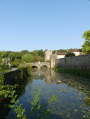
(5) At the junction with the Route des Roches (D142), carry on straight ahead along Rue du Querreux, towards the abbey. After crossing the bridge over the Miosson, at Plan des Douves, walk past the small car park on the right and turn right onto the Sentier des Douves (alternatively: continue along the road to pass through the abbey grounds).
Turn left onto Rue de l’Abbaye to reach Place du Souvenir (S/E).

Waypoints

  1. S/E : mi 0 - alt. 338 ft - Place du Souvenir
  2. 1 : mi 0.34 - alt. 430 ft - Bernareggio
  3. 2 : mi 0.63 - alt. 394 ft - Ancient Roman road
  4. 3 : mi 1.06 - alt. 394 ft - Le Coteau
  5. 4 : mi 1.76 - alt. 394 ft - Junction with Route de Nieuil (D12)
  6. 5 : mi 2.43 - alt. 361 ft - Le Quéreux
  7. S/E : mi 2.76 - alt. 338 ft - Place du Souvenir

Notes

Blue signposting in both directions, covering almost the entire route.

Worth a visit

- Nouaillé Abbey.
- Other walks in Nouaillé-Maupertuis (see the information board in the car park at Place du Souvenir).
- The Nouaillé 1356 association organises medieval events in the village in spring and early summer, centred on the Abbey and the Third Battle of Poitiers (Hundred Years’ War).

Always be cautious and plan ahead when you're outdoors. Visorando and the author of this route cannot be held responsible for any accidents occurring on this route.

The GR® and PR® markings are the intellectual property of the Fédération Française de Randonnée Pédestre.

Reviews and comments

4.2 / 5
Based on 3 reviews

Reliability of the description
4.3 / 5
Ease of following the route
4.3 / 5
Route interest
4 / 5
User 20479024

Overall rating : 4 / 5

Date of your route : Mar 21, 2026
Reliability of the description : ★★★★☆ Good
Ease of following the route : ★★★★☆ Good
Route interest : ★★★★☆ Good
Very busy route : Yes

The distance of the route is incorrect. Apparently it’s 1 km longer.
Kind regards
Mj Potocki

Machine-translated

User 8298958

Overall rating : 4.3 / 5

Date of your route : Aug 11, 2025
Reliability of the description : ★★★★★ Very good
Ease of following the route : ★★★★☆ Good
Route interest : ★★★★☆ Good
Very busy route : No

It's a shame that there is one very dangerous spot on the route, with no visibility and no footpath for 100 metres apart from the road. Very dangerous for children

Machine-translated

Juju2933
Juju2933

Overall rating : 4.3 / 5

Date of your route : Mar 03, 2023
Reliability of the description : ★★★★☆ Good
Ease of following the route : ★★★★★ Very good
Route interest : ★★★★☆ Good
Very busy route : Yes

A short, very pleasant and easy walk. The route is very easy to follow. Perfect for beginners.

Machine-translated

Other walks in the area

For more walks, use our search engine .

The GPS track and description are the property of this route's author. Please do not copy them without permission.