


Refine your search for walks in Menhir de la Haute Pierre (Champeaux)
Menhir de la Haute Pierre (Champeaux) walks


 Menhir Trail (Champeaux)
 Local authority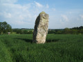
 3.03 mi
 +138 ft
 -138 ft
 1h 30
1h 30
 Easy
Easy
 Departure from Champeaux (Ille-et-Vilaine)
Take a stroll along the Plan d’Eau de la Cantache, a leisure area much loved by locals: fishing, birdwatching, walking… You’ll pass close to the Haute Pierre menhir.
FFR-certified route, marked with yellowPR® signs, supplemented by green arrows bearing the number 15 (anti-clockwise). Suitable for both walking and mountain biking.
Walks near Menhir de la Haute Pierre (Champeaux)
From Vitré to Argentré-du-Plessis via the Valière lake
 13.51 mi
+377 ft
-390 ft
6h 35
13.51 mi
+377 ft
-390 ft
6h 35
 Difficult
Departure from Vitré (Ille-et-Vilaine)
Difficult
Departure from Vitré (Ille-et-Vilaine)
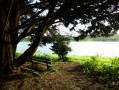
This route is the first stage of a 96 km circular through the Vitré countryside. Consisting mainly of sunken lanes, this route will take you, among other places, to the Château des Rochers-Sévigné and the Valière lake.