Country:

 City:


The walk starts from the car park at Place de la Poste, opposite the Auberge de Ruffieu.
NB: Make sure to enter ‘Ruffieu’ (without an ‘x’) if you’re using a sat-nav to get to the starting point, as there’s another place called ‘Ruffieux’ relatively nearby.
(S/E) From the large hiking sign on the Place de la Poste, start opposite on Rue de la Mairie, walking past the inn, and follow this road past the church and then the local council offices.
(1) Turn left onto Rue du Mollard, heading uphill, then turn right at the very top.
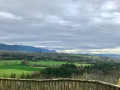
(2) Take the first left onto Route de Valorse. Continue straight on along this road for around 750 metres. On your right, you’ll find Notre-Dame des Sapins, offering your first view of the valley.
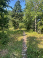
(3) At the first major bend on Route de Valorse, a hiking sign indicates to take the stone path on the right. Follow it for 50 metres, then carry on straight ahead along the path leading opposite.
(4) At the next junction, turn right, following the signs for the Tour de Pays Balcon du Valromey (yellow and red markings), until you reach the next road.
(5) When you reach this small tarmac road, leave the GRP® for a moment by turning right and following the road downhill for 600 metres along a series of hairpin bends.
(6) At the “Les Beudines” hiking sign, leave the road by turning left and continue up the path on the left.
(7) At Le Chatelard, at an altitude of 838 metres, turn right until you reach the next junction.
(8) Turn right, following the GRP® again.
(9) Carry on straight ahead along the GRP®, skirting the private property on your left. Continue straight ahead until you reach the large trough opposite, a few dozen metres further on. Carry on past the large trough in the same direction.
(10) At the “Chez Mamie” junction, turn right and leave the GRP® for good. Follow this path downhill to the Route du Petit Village.
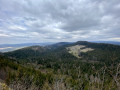
(11) Follow the road downhill. Make sure you keep the Route de Bucleloup on your left. A lovely view opens up onto the Grand Colombier, directly opposite, with the Dent du Chat massif in the background.
(12) At Les Pelas, turn right onto a wide track at the first opportunity. Follow this wide track downhill until you rejoin a tarmac road (Chemin de Saras). Follow this tarmac road downhill.
(13) Before reaching the bottom, at the A-road, turn left onto a short path that takes you across it. Follow another small, inconspicuous path just opposite, which leads to the first fountain in Mardenson.
(14) Continue to the small tarmac road (Chemin de Préoux). Turn left and follow the small tarmac road for 1.5 km to the hamlet of Préoux.
(15) In Préoux, take a short 500-metre round trip to the left to the ferry.
(15) Once back at the junction by the “Préoux” hiking sign, leave the road and head towards Fontaine Froide opposite.
Please note: just after the first fence crossing, do not enter the field but follow the yellow markings, taking the path which is slightly less clearly marked at the start. The path runs between two fences and two hedges and heads mainly southwards. Continue until you cross the Séran (which is often dry at this point during the summer months).
Carry on along this path, following the yellow paint markings, until you rejoin the county road just above the Vendrolière lake. A small path between two hedges on the left allows you to delay rejoining the road by nearly 100 metres.
Follow the road uphill, along the verge, to the next junction.
(16) At the junction, turn right onto the road signposted towards Bassieu. Stay on the road for 500 metres. Only leave the road at the signpost indicating you should turn right onto a wide path.
(17) At “En Maravaz”, turn right onto the wide track until you reach the next junction.
(18) Turn right at this junction towards Ruffieu. Cross the Pont des Tines briefly and head up to Ruffieu along the main road.
(19) Back on the village’s Grande Rue, turn right at the fountain. Walk past the communal oven on the left and continue to the starting point (S/E).
 Visorando Member
 Easy

 Difficult