Grand Colombier Alpine Pastures Trail

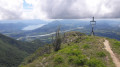
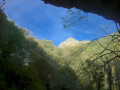
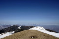
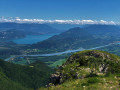
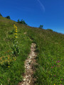
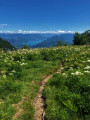
A signposted route in the Grand Colombier Massif leading to the Roche de Chanduraz and its magnificent views over Lake Bourget, the Rhône and the southern Bugey. Please note that the pass road is closed from November to April, making this walk inaccessible during this period.

Details

n°82439108
Creation:
Last update:
Last review:
–
  • Walking
    Activity: Walking
  • ↔
    Distance: 3.25 mi
  • ◔
    Average duration: 2h 00 
  • ▲
    Difficulty: Easy

  • ⚐
    Back to start: Yes
  • ↗
    Ascent: + 577 ft
  • ↘
    Descent: - 554 ft

  • ▲
    Highest point: 4,659 ft
  • ▼
    Lowest point: 4,098 ft

Photos

Description of the walk

To start the walk, head to the Frappe bend – the last major bend on the climb up to the Col du Grand Colombier from Culoz or Anglefort – and park just outside the bend.

Follow the ‘SA’ stickers on the junction signs.

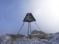
(S/E) Head south along the path, where a hiking signpost is situated alongside the path and is visible from the bend.

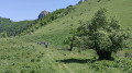
(1) Cross the cattle grid and continue southwards, leaving the Chalet du Berger on your left. Please respect the owner’s privacy and do not block access to the property.

(2) At La Grange à Masse, turn right when you reach the point between the two houses.

(3) When you reach En Pryse, follow the path that branches off to the left towards La Roche de Chanduraz.

(4) After passing through the fence, at the fork, follow the path that goes straight on, leaving the wider track that branches off to the right. The next section becomes increasingly exposed as you approach the end of La Roche. Those who are afraid of heights can enjoy the view without going all the way to the end. Please note that the very end is inaccessible.

(5) Turn back towards the “En Pryse” hiking sign.

(3) Back at En Pryse, follow a path that climbs up opposite. Several parallel paths, carved out by local women during their stays in the mountain pastures, lead to a small pass overlooking the Auberge du Grand Colombier. Descend along the path that goes round the Auberge.

(6) Leave the inn on your left, then the road on your right, and continue straight on downhill along the small tarmac road.

(7) Turn right onto the pass road and follow it downhill for a few hundred metres to reach the car park at the start of the route (S/E).

Waypoints

  1. S/E : mi 0 - alt. 4,380 ft - Virage de la Frappe
  2. 1 : mi 0.04 - alt. 4,396 ft - Shepherd’s chalet
  3. 2 : mi 0.36 - alt. 4,350 ft - Grange à Masse
  4. 3 : mi 1.17 - alt. 4,285 ft - In Pryse
  5. 4 : mi 1.5 - alt. 4,199 ft - Fork in the path
  6. 5 : mi 1.75 - alt. 4,098 ft - Chanduraz
  7. 6 : mi 2.89 - alt. 4,524 ft - Auberge du Grand Colombier
  8. 7 : mi 2.96 - alt. 4,491 ft - Route to the Col du Grand Colombier
  9. S/E : mi 3.25 - alt. 4,380 ft - Virage de la Frappe

Notes

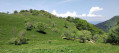
Whilst exploring the Grand Colombier mountain pastures, walkers are asked to behave respectfully towards the herds, the shepherds and the environment.
- Avoid sudden movements towards the herds.
- Walk round the herds if the cows are on the path.
- Close gates behind you to prevent the animals from escaping.
- Respect the shepherd’s hut by not trespassing on this private area.
- Keep your dog on a lead at all times.
- Leave no trace of your visit, apart from your footprints.
- Do not pick wild flowers.
- Stay on the marked paths.

There is no water or toilet facilities along the route. Toilets and a snack bar/souvenir shop are located at the pass, 5 minutes from the car park at the start.

As mentioned in the description, the Roche de Chanduraz path is a little exposed towards the end of the walk, and the tip of the rock is not accessible on foot, but this does not prevent you from enjoying the view.

This circular walk has very few shaded sections; however, as it is situated at an altitude consistently above 1,300 metres, the air is much cooler than down below during the summer months.

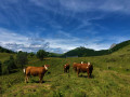
At least from June to the end of September, this walk takes you through mountain pastures inhabited by young cows, which may be gathered along the path; this is why it is essential to keep your dog on a lead at all times and to avoid startling the herd by behaving appropriately.

Worth a visit

A favourite spot for chamois, the Roche de Chanduraz juts out at the southern tip of the Grand Colombier massif, overlooking the village of Béon and the Marais de Lavours nature reserve. Although the very tip of the rock is inaccessible, this outcrop offers a remarkable view of Lake Bourget and the surrounding mountains: the Chartreuse, Vercors and Bauges massifs, and the Belledonne range.

Other walks in the area

For more walks, use our search engine .

The GPS track and description are the property of this route's author. Please do not copy them without permission.