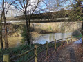
Baude Local Path, between the plain and the marshes.

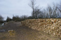
Montreuil is situated on the edge of the former Gulf of Pictons and was long known as Montreuil-sur-Mer. Explore the village of Baude with its typical stone buildings, then continue through two distinct landscapes: the wet marsh and the drained marsh, separated by a levee, before finishing at the Communal de Baude: a vast 75-hectare meadow which is home to around a hundred head of cattle from May to November.

Details

n°18982083
Creation:
Last update:
Last review:
  • Walking
    Activity: Walking
  • ↔
    Distance: 3.18 mi
  • ◔
    Average duration: 1h 30 
  • ▲
    Difficulty: Easy

  • ⚐
    Back to start: Yes
  • ↗
    Ascent: + 10 ft
  • ↘
    Descent: - 10 ft

  • ▲
    Highest point: 16 ft
  • ▼
    Lowest point: 3 ft

Photos

Description of the walk

The start is at the Communal car park in Baude

Yellow markings

(S/E) Head towards Rue du Communal. Walk through the hamlet of Baude for 500 m. After house number 17 on the street, turn right, then turn right again after 100 m.

(1) Follow Rue du Marais to the fork in the road where two routes split: (the 5 km and 9 km routes). Ignore Rue du Port d’Écoué (9 km route) and turn right onto the path (5 km route). Continue to the four-way junction.

(2) Turn left and head towards another four-way junction.

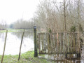
(3) Take the path on the right opposite the entrance to a meadow (iron gate) and reach a footbridge.

(4) Cross the footbridge and take the embankment on the right. Continue straight on for a good kilometre until you reach another footbridge on the right.

(5) Take this footbridge to follow the banks of the Communal and reach the starting bridge (S/E).

.

Waypoints

  1. S/E : mi 0 - alt. 13 ft - Communal car park - Gite de Baude
  2. 1 : mi 0.67 - alt. 10 ft - 5 km route
  3. 2 : mi 0.8 - alt. 10 ft - Crossroads
  4. 3 : mi 1.1 - alt. 7 ft - Crossroads
  5. 4 : mi 1.69 - alt. 7 ft - Footbridge
  6. 5 : mi 2.45 - alt. 7 ft - Footbridge
  7. S/E : mi 3.18 - alt. 13 ft - Communal car park

Notes

Part of the path belongs to a land association and is therefore private. It is mainly used by farmers. Please respect the area and their work.

Bring mosquito repellent in summer.
An easy path, but there are numerous tunnels dug by coypu along the embankment.

Worth a visit

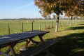
There are information boards and a picnic table at the start of the walk.

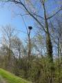
Wildlife can be spotted along this route: grey herons, storks, hares, roe deer, hoopoes, etc., not to mention the coypu!

Plants and flowers specific to the marsh can be found all along the route: burdock, purple loosestrife, marsh mallow, comfrey, teasel, etc.

On the embankment, a few remains (low walls, stones, rose bushes, laurels) indicate the presence of numerous dwellings (or huts) in the last century. The inhabitants, or ‘huttiers’, lived off hunting and fishing (eels) in this watery world.

Reviews and comments

4.7 / 5
Based on 1 review

Reliability of the description
5 / 5
Ease of following the route
5 / 5
Route interest
4 / 5
Isambert
Isambert

Overall rating : 4.7 / 5

Date of your route : Jul 27, 2024
Reliability of the description : ★★★★★ Very good
Ease of following the route : ★★★★★ Very good
Route interest : ★★★★☆ Good
Very busy route : No

A short and easy walk, but quite varied, with a long stretch along a leafy ‘levée’, ideal in hot weather.

Machine-translated

Other walks in the area

For more walks, use our search engine .

The GPS track and description are the property of this route's author. Please do not copy them without permission.