Country:

 City:
City:


Start from the Town Hall Square in Niederhaslach.
(S/E) From the town hall, head towards the Collegiate Church of Saint-Florent.
(1) Leave the church, following the Red Cross signposts to the cemetery.
(2) Turn left, following the Blue Triangle / Blue Saltire signs. Follow the RD218, following the Blue Rectangle markings (GR®®531) along the way, to the Oberhaslach town hall.
(3) At the junction, head uphill to the right, following the Blue Rectangle / Yellow Saltire / Yellow Disc signs for 50 m.
Then turn left (no signposting),
(4) Take Rue Saint-Florent to the Saint-Florent Chapel.
(5) Retrace your steps from the chapel to rejoin the marked path via the street on the left and follow the Blue Rectangle corresponding to the ‘Sentier des Pèlerins de Saint-Florent’ walk. Follow the Blue Rectangle along this street, which turns into a track. The track becomes a lovely path before joining a Yellow Rectangle signpost.
(6) Turn left onto a wide path leading to the large ‘Carrefour des Anlagen’ junction.
(7) From there, leave the ‘Sentier des Pèlerins’ and turn right, following the Yellow Cross markings to the ‘Carrefour du Brigadier Jérôme’ junction.
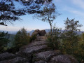
(8) Head down to the right, following the Yellow Cross / Red Saltire signposting, to the Rocher de Pfaffenlapp. Pass a path on your right and reach a junction.
(9) Continue straight on, following the same markings.
(10) From the rock, retrace your steps for 200 m until you reach the second junction.
(8) Turn right and follow the Red Saltire markings. Pass a path on your right and reach a junction.
(9) Turn right onto the path and follow the Red Saltire markings to the next junction with the Blue Triangle.
(11) Follow these markings to the left towards the Rocher de Breitberg.
(12) Pass the rock and continue left on the ‘Blue Triangle’ trail to rejoin the ‘Red Saltire’ trail. Follow it due north through a beautiful forest along a poorly marked path. Keep a close eye out for the trail markers.
(13) When you reach the Breitberg T-junction, turn right onto the path marked ‘Red Saltire’ and, after a long descent, you’ll come out onto a wide track where you’ll join the ‘Yellow Saltire’ markings. Head down to the right for 100 m to reach a large crossroads: the remains of a large, centuries-old oak tree are on the right.
(6) Continue left, following the Red Saltire markings, to the Ringelstahl Forest House, then head straight on along the RD75 for about 400 m. As you pass, take a moment to admire the beautiful Haslach Forest House (private property). At the junction, cross the road and turn right onto the path, still marked ‘Red Saltire’, until you reach a track suitable for vehicles.
(14) Turn left onto this track for about 200 m to reach the RD75. From there, continue to the right for about 2.5 km, following the same markings, until you reach the Carrefour de la Trinité.
(15) Turn right, following the ‘Blue Saltire’ markings towards Niederhaslach, to reach the Stèle de la Trinité after 200 m. Continue downhill towards the village. As you pass, follow a ‘Blue Triangle’ marking coming from the left to reach the edge of the forest. From there, enter the village of Niederhaslach to return to the cemetery.
(2) Then follow the Red Cross signpost on the left to reach the town hall car park (S/E).


 Tourist office

 Visorando Member