Punta Scaldasole and i Pozzi

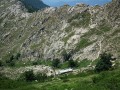
An original way to explore the magnificent Pozzi by climbing Punta Scaldasole, which overlooks them.
This walk is classified as difficult due to the short final climb, but the rest is easy.

Details

2183562
Creation:
Last update:
Last review:
  • Walking
    Activity: Walking
  • ↔
    Distance: 9.21 mi
  • ◔
    Average duration: 6h 05 
  • ▲
    Difficulty: Difficult

  • ⚐
    Back to start: Yes
  • ↗
    Ascent: + 2,146 ft
  • ↘
    Descent: - 2,139 ft

  • ▲
    Highest point: 6,824 ft
  • ▼
    Lowest point: 5,312 ft
  • ⚐ Country: France
  • ⚐ City: Bastelica (20119)
  • ⚑
    Start/End: N 41.99996° / E 9.1243°
  • ❏
    IGN map(s): Ref. 4252OT, 4252OTR
  • Hour-by-hour weather

Photos

Description of the walk

Park in the car park at the Val d’Ese ski resort.

(S/E) Walk through this small resort to reach the slopes leading to the ski lifts.

(1) Continue along the track that heads off to the left and climbs towards the ridges.

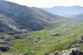
(2) Continue along the path that follows the ridge, with a few rather lovely viewpoints.

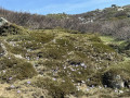
(3) Carry on straight ahead. The path is no longer signposted, but there are a few cairns to help you find your way. The final short climb is a bit tricky and requires you to use your hands on some fairly steep sections. There are a few cairns.

(4) Head back down the same way to the previous point.

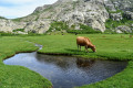
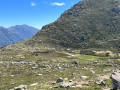
(3) Head down to the left towards Les Pozzi and make your way to the rocky outcrop situated in the middle of the Les Pozzi area, which offers a lovely view.

(5) Go round the area to the left to reach the sheepfolds a little further down. It is also possible to go round to the right.

(6) At the sheepfolds, take the path that branches off to the right and begins the return journey to the resort.

(7) Take the path that veers slightly to the right.

(1) Then continue along the same path you took on the way out, which leads back to the resort (S/E).

Waypoints

  1. S/E : mi 0 - alt. 5,315 ft - Car park at Val d’Ese station
  2. 1 : mi 0.12 - alt. 5,354 ft - Junction of the circular loop
  3. 2 : mi 1.42 - alt. 6,375 ft - Arrival on the Scaldasole ridge
  4. 3 : mi 2.37 - alt. 6,411 ft - Scaldasole Pass
  5. 4 : mi 3.35 - alt. 6,824 ft - Punta Scaldasole
  6. 5 : mi 5.19 - alt. 5,938 ft - Rocky overhang in the middle of Les Pozzi
  7. 6 : mi 6.1 - alt. 5,725 ft - Pozzi sheepfolds
  8. 7 : mi 6.43 - alt. 5,387 ft - Crossroads
  9. S/E : mi 9.21 - alt. 5,322 ft - Car park at Val d’Ese ski resort

Reviews and comments

4.4 / 5
Based on 3 reviews

Reliability of the description
4.3 / 5
Ease of following the route
4.3 / 5
Route interest
4.7 / 5
Zoumbo
Zoumbo

Overall rating : 3.7 / 5

Date of your route : Jul 31, 2025
Reliability of the description : ★★★☆☆ Average
Ease of following the route : ★★★★☆ Good
Route interest : ★★★★☆ Good
Very busy route : Yes

A visit to the pozzi from Ese is a must.
A visit to the refreshment bar run by the family who also run the resort is a must for lovers of the site, without whom it would be much less welcoming.
The journey there, although steep, is easy on a wide track that is easy to walk along despite the gullies.
Turn around regularly to admire the dominant view with changing perspectives of Ajaccio Bay, Bastelica and Lake Tolla.
Once at the top, the path that follows the ridge offers more beautiful views without being dizzying, as the slope is steep but not abrupt. The route is almost flat with few stones.
Please spare the dung beetles that cross your path and contribute to the balance of nature.
When you reach the junction that descends towards the pozzi, the path becomes more challenging with large boulders and stones. Low-cut shoes will show their limitations, but the route is short to this magnificent plateau.
The pozzi are beyond words and an absolute must-see.
The return journey is more complicated.
Bear in mind that the beech trail will take you back down to the station, where you will have to climb up and down several times.
So if you're not here for a bit of a workout, go back the way you came. It will be shorter, quicker and with much less elevation gain.
Another thing for those who are afraid of heights: the beech trail crosses a rocky ledge on a cliff about 20 metres high. It's wide enough to get across, even if you're feeling nervous from the previous climbs and descents, but it's nothing like the way up.
The final descent is through meadows and heavily eroded passages, which really finishes you off.
The refreshment bar, once you return after a six-hour break including lunch, is a blessing.

Machine-translated

oponcin
oponcin

Overall rating : 5 / 5

Date of your route : Aug 23, 2023
Reliability of the description : ★★★★★ Very good
Ease of following the route : ★★★★★ Very good
Route interest : ★★★★★ Very good
Very busy route : No

The Pozzi in pictures: https://youtu.be/UJEQSXbONqk?si=6FMoVqsM...
One of the most beautiful spots in Corsica: a walk to the Pozzi starting from the Col de Verde
The walk takes you through a stunning forest of pine and beech trees
In the shade right up to the junction with the path coming from the Val d’Ese
Return via the Cassetta de Gialgone sheepfold, where you rejoin the GR20, which you had left at the wooden bridge on the way out

Machine-translated

Cham1
Cham1

Overall rating : 4.7 / 5

Date of your route : Sep 02, 2020
Reliability of the description : ★★★★★ Very good
Ease of following the route : ★★★★☆ Good
Route interest : ★★★★★ Very good
Very busy route : No

A superb walk. Varied and magnificent scenery. The view as you reach the Pozzi plateau is stunning. The only bit that’s a bit of a drag is the climb at the start, along the tracks.

Machine-translated

Other walks in the area

For more walks, use our search engine .

The GPS track and description are the property of this route's author. Please do not copy them without permission.