Country:

 City:
City:


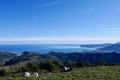
From Perpignan, head towards Spain (Girona) via the D914 expressway, cross the border at Portbou, and pass through Llança on the N260. 5 km further on, park along the N260 at La Valleta in a car park next to a bar-restaurant. The entrance to the car park or the bar is rather odd; you have to leave the very busy road immediately.
See practical information ¹
(S/E) From the car park, head towards Carrer de La Valetta and turn immediately right towards Ribera de Valleta.
Cross it as soon as possible by wading across, follow a low wall with wire fencing on your left, and after a few metres, turn left. Look out for and follow the red-green and yellow markings. Cross another small stream. Head towards a very steep, clearly visible stony track that climbs up the slope. A power line indicates the direction to follow. You’ll reach Coll de Madres (where there’s a small building, a pylon and an underground water tank). The red-green markings end here.
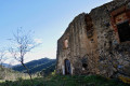
(1) Turn left and continue climbing, following the yellow markings. Leave the track leading down opposite you. Climb along the ridge. The path levels out and curves slightly to the right. You’ll reach the Ermita de Sant Genis del Terrer. There’s a lovely view and the religious building, though incomplete, is well maintained.
(2) Return to the path and continue the ascent. The Clot de la Valleta path is clearly marked on the ground.
At the next fork (altitude 239m), continue straight ahead along the ridge. Carry on towards a forest track to reach the Coll de les Portes.
(3) Cross the track. At the junction, look for the red-white-and-yellow signpost. Continue straight ahead for 10 metres. Climb to the left along a steep path that passes between three oak trees. Continue along the ridge. Keep an eye out for the red-green markings. The path veers to the left, north-west, then runs along a ledge facing due north.
Continue towards a flat area resembling a pass (altitude 367m). On your right is Puig Tifell.
(4) Turn left, heading north-west. On your right is a self-filling water supply in a large plastic container intended for livestock. The path continues along the ridge. Red-green and yellow markings. You’ll reach an open area at Coll del Llop.
(5) Leave the track and continue to the right, climbing up the ridge path. Pass Puig del Llop (altitude 455m).
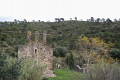
Descend steeply along the ridge path towards the ruins of Mas Patiràs (altitude 355m). A stunning view unfolds before you.
Below on the right, between the two ruined buildings, there is a beautiful stone trough with a natural water supply.
Join the track and head right along it. At the fork in the tracks, turn right. At the left-hand bend in the track, there are information boards about this area on the right. Continue along this track for about 250 metres.
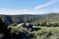
(6) Turn left up a steep slope, heading towards the Patiràs Dolmen. Follow the yellow markings carefully; they are clearly visible and in good condition. Further up, join a good forest path that turns left, heading due south. Turn right at the next fork. Leave the steep path coming from the Patiràs farmhouse on your left.
Continue south-west to the ridge. Yellow markings.
Then climb up a very steep path, at a 90° angle to the right, along the ridge, heading north-west. You’ll reach a flat area at the summit, where there is a building fitted with an aerial. This is Puig d’Esquers, a triangulation point, marked by a cylindrical concrete post. Climb up to it for a 360° view.
(7) Join a track to the left of the building. Descend along this track for 80 metres. At the right-hand bend, turn left, heading due north, along a path towards an open area to reach the Coll de Sant Miquel. Yellow-white markings. Take the opportunity to look at the information board. The view to the west is spectacular.
(8) Look for and follow the yellow markings. Head straight ahead, descending into the forest. Follow the path, which is very clearly marked on the ground.
Please note: After about 250m, the path and the yellow markings split. Keep left on level ground.
Leave the path leading down to the fountain on your right.***
You’ll soon pass a rock in the middle of the path and reach the Sant Miquel de Colera Chapel, which is in excellent condition.
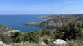
Here, too, there is a magnificent panoramic view overlooking the Mediterranean, Portbou, Colera and Llançà. This spot is ideal for a midday break. There is a fountain further down on the right.***
(9) Turn round and head back to Coll de Sant Miquel.
(8) Turn right onto the track that descends very gently, heading south-south-west for 1 km (altitude 457 m).
Please note: you will need to leave this track. Signpost.
(10) Turn right onto a stony path that descends very steeply towards the valley floor. You’ll reach an open area of pastureland leading towards the Chapel of Sant Marti de Vallmala, which is incomplete but well preserved.
(11) Turn left, heading due south, onto the track which climbs slightly. Join a wider track at around 350m.
Note: If short on time or encountering difficulties, it is possible to descend directly a few metres after the chapel, turning right onto the Vilamaniscle path.
(12) Turn right, heading due south, onto this wide track, and continue for a few hundred metres.
At the next fork, carry on straight ahead along the wide track. The track then turns due west.
The ruins of a farmhouse are visible on your left, below you.
Please note: you will need to leave the track here. There is a cairn. The path is clearly visible.
Head down this path towards the ruins of Mas Guanter.
(13) Follow the stone walls. Pass between a tree and these walls. Join a wider grassy path, continue downwards and turn right, heading due north towards the white-painted Mas de Baix. Stop at an oak tree marked with a yellow sign.
(14) Turn left and head down towards the Torrent de la Balmeta. Yellow markings. The path is shown on the OSM map.
You’ll need to walk along the stream, alternating between the right and left banks about fifteen times until you reach your destination. See practical information ².
(15) Join a track and follow it straight ahead alongside the stream. Cross numerous fords. The track comes to an end. Continue along the path which runs alongside and crosses the stream several times.
Head towards a chapel and reach the end of a track suitable for vehicles. Turn left, crossing a lovely wooden footbridge. Arrive at the Ermita de Sant Silvestre. A very beautiful spot, well-maintained and easily accessible.
Carry on along the same bank and, a little further on, cross another wooden footbridge.
(16) Continue along the left bank of the stream via a lovely path. Pass a picnic area on your left. Reach a junction of tracks.
(17) Wooden signpost. At the bend to the right on the track, turn left onto the grass, following the Ribera de Valleta. Very soon, turn left off the track and cross the Ribera several more times. You’ll come to a small track; continue downhill alongside the stream. After a final ford (95m), the track stays on the right bank and continues towards the village. Note the pretty Roman-style bridge on your left. Turn right and head back to the car park where you started (S/E).


 Visorando Member
 Easy
Easy 
 Moderate