Country:
 City:
City:


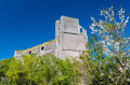
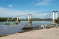
PLEASE NOTE: Access to the Montjean-sur-Loire viewpoint is closed until further notice. You will need to go via the town hall car park to reach the town hall grounds.
Route marked with floor signage: follow the green footprints
Along the trail: 11 information panels
Start in front of the Cap Loire Discovery Park
(S/E) Take Rue des Cettes, which climbs to the left as you leave the car park. At the T-junction, turn left past the library, then after 50 metres take the path on the right leading towards the Loire. Cross the Quai des Mariniers road with care to join the path directly opposite. Turn right.
(1) Continue along this path until you reach the bridge.
(2) Cross via the pedestrian crossing, then continue along the quay for about 800 m before turning right at the Chevalement de la Tranchée, on Rue du Moulin à Eau. Follow the path, turning left in front of the cemetery; go round the edge of the cemetery whilst staying on the road. Turn right at the next junction.
(3) After the fork to the left, turn right towards the Church of Saint-Symphorien. Walk round the church and turn right before the town hall, then head down through the church gardens.
(4) Walk down Rue du Pilori and turn right into Rue de la Mairie. Cross Rue d’Anjou with care and walk through the Prieuré gardens near the Montjean-sur-Loire swimming pool and the City Stade.
(S/E) You’ll arrive in front of the Cap Loire Discovery Park.

 Tourist office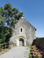
 Moderate

 Visorando Member
 Local authority