From La Pommeraye to Chalonnes-sur-Loire

Towards the end of the circular GR® de Pays route, the path plunges into the heart of the Vallée des Moulins, sometimes climbing higher, sometimes winding along its base, before leading you back to the Loire and its scenic landscapes, revealing in particular the Île de Chalonnes over the final few kilometres of your walk.

This walk is part of a multi-day hike: GRP® Au fil de l'Èvre et de l'Hyrôme

Details

99310862
Creation:
Last update:
Last review:
  • Walking
    Activity: Walking
  • ↔
    Distance: 7.09 mi
  • ◔
    Average duration: 3h 45 
  • ▲
    Difficulty: Moderate

  • ⚐
    Back to start: No
  • ↗
    Ascent: + 574 ft
  • ↘
    Descent: - 781 ft

  • ▲
    Highest point: 318 ft
  • ▼
    Lowest point: -89 ft

Description of the walk

(S) From the main street, turn right onto Avenue des Lilas, then turn right onto Rue des Camélias and continue until you reach the business park.

(1) Then follow Rue du 8 Mai to the end. At the T-junction, turn left and follow the signs for the equestrian centre, taking the first path on the right between the houses. Then keep to the right and go straight on. When you reach the equestrian centre, continue along the path which leads out onto the road. Cross the road to take the path directly opposite (take care when crossing).

(2) Then carry on straight ahead until you can go no further. You’ll come out onto a large car park and its covered area; turn right to cross the stream (Rando’clim path). You’ll arrive at La Traversière.

(3) Keep to the left. Then continue straight ahead until you can go no further. You’ll come out onto a large car park and its covered area; turn right to cross the stream (Rando’clim path).

(4) Continue along the path into the valley and cross the stream several more times until you reach a road running between buildings. This will take you to the D751 county road. Cross it and head left up the road for a few metres before joining a path that branches off from it.

(5) Reach L’Espérance and follow the path on the right; further on, on the right after the crash barrier, you’ll find a new path leading downwards, which you should take before reaching the departmental road. Pass the houses at Le Poirier, then take the road on the right and follow it until you cross the stream.

(6) Continue along the extension of the road via the path running alongside the Loire. Gain some height and catch a few glimpses of the river before turning right and arriving at Bellevue.

(7) Carry on along the road and the path leading off it to reach Chalonnes-sur-Loire, continuing straight ahead.

(8) Leave the grassy car park and walk through Rue de la Licorne and Rue de l’Enfer amongst the houses, keeping to the left. Join Rue Thiers.

(9)Cross itcarefully and continue along the narrow Rue de la Tannerie opposite. Ignore the next two junctions and carry on straight ahead; a few metres after the second junction, take the narrow passage on the left leading to the Loire, passing under the main street (Château des Évêques and the Saint-Pierre tower). Walk along the banks of the Loire on the right to reach the Chalonnes-sur-Loire bridge (E).

Waypoints

  1. S : mi 0 - alt. 266 ft - Rue des Mauges
  2. 1 : mi 0.33 - alt. 299 ft - Business park
  3. 2 : mi 1.21 - alt. 213 ft - Start of the footpath in the valley
  4. 3 : mi 2.32 - alt. 246 ft - La Traversière
  5. 4 : mi 2.95 - alt. 85 ft - Rando Clim Trail
  6. 5 : mi 3.6 - alt. 75 ft - L’Espérance
  7. 6 : mi 4.43 - alt. 39 ft - Crossing the Ruisseau des Moulins
  8. 7 : mi 5.58 - alt. 184 ft - Bellevue - La Loire
  9. 8 : mi 6.4 - alt. 56 ft - Car park
  10. 9 : mi 6.64 - alt. 79 ft - Rue de la Tannerie
  11. E : mi 7.09 - alt. 56 ft - Bridge at Chalonnes-sur-Loire - La Loire

Worth a visit

The Vallée des Moulins and its Rando’Clim trail: below La Pommeraye flows the Ruisseau des Moulins, which runs through a valley lined with numerous water and windmills, bearing witness to the agricultural activity of the past. The use of both water and wind power in this area can be explained by the millers’ needs: millers of the time owned a mill of each type nearby, so that they could grind grain without relying solely on the water level in the stream or the strength of the wind when one of the two was lacking.
As well as the remarkable setting, the route follows in the footsteps of the local Rando’Clim trail. This type of trail, found in the Pays-de-la-Loire region, is designed to encourage walkers to contribute to studies on the impact of climate on the evolution of plant species: observing leaves and twigs, commenting on fruits, and so on. This participatory approach is sustained by walkers’ feedback on nearly 18 trees along the 1.6-kilometre trail (representing 9 different species).

Contribute to the research via the form available on this website.

Nearby attractions:

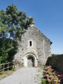
• Saint-Aubin Chapel in Châteaupanne: Montjean-sur-Loire
• Banks of the Loire
• Château and Saint-Pierre Tower: Chalonnes-sur-Loire
• Saint-Maurille Fountain: Chalonnes-sur-Loire
• Île de Chalonnes: Chalonnes-sur-Loire
• Notre-Dame Church: Chalonnes-sur-Loire

Between (5) and (6): at Le Poirier, you can turn left to reach the Saint-Aubin Chapel near the Châteaupanne quarry, home to the world’s oldest wood: in 2006, two plant fossils known as Armoricaphyton chateaupannense were discovered, whose stems were made of wood. This discovery pushes back the date of the first appearance of wood by 10 million years, to 407 million years ago. The plant is only 10 to 20 cm tall and is thought to prove that wood appeared before leaves and seeds.

Always be cautious and plan ahead when you're outdoors. Visorando and the author of this route cannot be held responsible for any accidents occurring on this route.

The GR® and PR® markings are the intellectual property of the Fédération Française de Randonnée Pédestre.

Other walks in the area

For more walks, use our search engine .

The GPS track and description are the property of this route's author. Please do not copy them without permission.