Walk in Bournel

A circular loop starting from Bournel. Through the countryside and over the ridges to discover the beautiful landscapes of Lot-et-Garonne.

Details

n°19382013
Creation:
Last update:
Last review:
  • Walking
    Activity: Walking
  • ↔
    Distance: 3.97 mi
  • ◔
    Average duration: 2h 00 
  • ▲
    Difficulty: Easy

  • ⚐
    Back to start: Yes
  • ↗
    Ascent: + 187 ft
  • ↘
    Descent: - 177 ft

  • ▲
    Highest point: 515 ft
  • ▼
    Lowest point: 305 ft
  • ⚐ Country: France
  • ⚐ City: Bournel (47210)
  • ⚑
    Start/End: N 44.620129° / E 0.67119°
  • ❏
    IGN map(s): Ref. 1838SB
  • Hour-by-hour weather

Photos

Description of the walk

Park in the town hall car park, near the church.

(S/E) Opposite the town hall, take the road to the left for about 250 m.

(1) At the Madeleine crossroads, turn right onto the track and continue straight on until you reach the hamlet of Jean Joly.

(2) At the hamlet, turn right onto the track which joins a road; follow this to the right. At the first three-way junction, go straight on and, at the fork, take the track on the right. Drive up to the first houses at the end of the track.

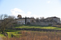
(3) Turn right and follow the track that goes round Montaut le Jeune. At the foot of the ruins of a castle tower, take the small track on the left that climbs uphill and follow it to a small road. Turn right and head for the first junction.

(4) Turn right towards Colombier. Follow the road and then the track. Pass between the houses and follow the track until you reach a road.

(5) Walk about 20 metres to the right and take the path opposite for about 700 metres until you reach a path on the right which leads straight down into Bournel.

(6) Carry on straight ahead and take the first track on the right which leads down to a road.

(7) At the crossroads by the wayside cross, turn right and follow the road to Bournel to return to the car park by the town hall and the church (S/E).

Waypoints

  1. S/E : mi 0 - alt. 338 ft - Town hall car park - Église Sainte-Madeleine (Bournel)
  2. 1 : mi 0.17 - alt. 341 ft - Madeleine Crossroads
  3. 2 : mi 1.09 - alt. 374 ft - Jean Joly
  4. 3 : mi 1.68 - alt. 492 ft - Montaut-le-Jeune
  5. 4 : mi 2.28 - alt. 492 ft - Junction
  6. 5 : mi 2.77 - alt. 512 ft - Crossroads at the - Prieuré du Mesnil Saint-Martin (Montaut)
  7. 6 : mi 3.19 - alt. 505 ft - Descent towards Bournel (shortcut available)
  8. 7 : mi 3.56 - alt. 430 ft - Calvaire crossroads
  9. S/E : mi 3.97 - alt. 338 ft - Town hall car park - Église Sainte-Madeleine (Bournel)

Notes

Alternative route:
(6) The path on the right allows you to return quickly to the starting point, thereby shortening the route by about 1 km.

Worth a visit

(S/E) Visit the Church of Sainte-Marie-Madeleine.

(3) Turn your head to the left and enjoy a typical landscape of the Lot-et-Garonne. The same delightful view, but on the right as you approach Colombier and all the way to .

Reviews and comments

5 / 5
Based on 1 review

Reliability of the description
5 / 5
Ease of following the route
5 / 5
Route interest
5 / 5
Cereijo
Cereijo

Overall rating : 5 / 5

Date of your route : Aug 12, 2024
Reliability of the description : ★★★★★ Very good
Ease of following the route : ★★★★★ Very good
Route interest : ★★★★★ Very good
Very busy route : No

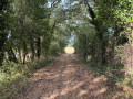
A well-shaded walk, ideal in summer when it’s hot. There’s a picnic table along the route at the top of the Côte de Montaut.

Machine-translated

Other walks in the area

For more walks, use our search engine .

The GPS track and description are the property of this route's author. Please do not copy them without permission.