Circular Montaut route via Bournel and Montaut-le-Jeune

From Montaut to Bournel through orchards and woodland, then from Bournel to Montaut-le-Jeune through woodland and the countryside. Finally, to complete the circular route, return to Montaut along a ridge offering beautiful views.

Details

n°19422759
Creation:
Last update:
Last review:
  • Walking
    Activity: Walking
  • ↔
    Distance: 4.83 mi
  • ◔
    Average duration: 2h 30 
  • ▲
    Difficulty: Easy

  • ⚐
    Back to start: Yes
  • ↗
    Ascent: + 299 ft
  • ↘
    Descent: - 308 ft

  • ▲
    Highest point: 512 ft
  • ▼
    Lowest point: 305 ft

Photos

Description of the walk

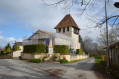
Parking is available on the church square in Montaut.

(S/E) At the signpost on your left, turn right onto Rue de la Fontaine, then left onto Rue de la Mairie. Follow this road down to the D257, cross carefully and take the small path opposite which leads downhill. Then continue along the path, veering slightly to the right, between the two hazelnut fields. Walk past the Priory of Mesnil Saint-Martin, then turn right onto the road.

(1) At the bend, leave the road and follow the path to the left for about 700 metres.

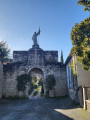
(2) Take the first path on the right. Walk downhill into the village of Bournel and continue straight on until you reach the war memorial. Take the road on the left, leaving the Church of Sainte Marie-Madeleine on your right. Follow this road to the Calvary of La Madeleine.

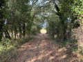
(3) Take the path on the right. Walk for about 1.2 km and follow the path on the right through the woodland.
Ignore the turn-off to Jean Joly on the left, carry on straight ahead and turn right onto the track to rejoin the road. Follow it carefully, turning right at the fork.

(5) Leave the road and take the path on the right immediately after the C7 road. Head uphill and follow the path to the top. Before you reach the first houses, take the path on the right which goes round the hamlet of Montaut le Jeune.

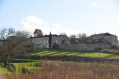
(6) At the foot of the castle’s ruined tower, take the narrow track on the left uphill until you come out onto a small road. Follow this small road to the right until you reach the sign for the hamlet of Colombier.

(7) Turn right towards Colombier. Walk between the houses and continue along the path

(1) As you emerge from the woodland, take the road towards the priory. Walk past it and follow the path you took at the start in the opposite direction until you reach the car park on the church square (S/E).

Waypoints

  1. S/E : mi 0 - alt. 502 ft - Car park on the church square
  2. 1 : mi 0.67 - alt. 509 ft - Junction of the circular loop
  3. 2 : mi 1.08 - alt. 505 ft - Crossroads towards Bournel
  4. 3 : mi 1.55 - alt. 341 ft - Calvary of La Madeleine
  5. 4 : mi 2.45 - alt. 381 ft - Jean Joly
  6. 5 : mi 2.86 - alt. 341 ft - Prats del Castel crossroads
  7. 6 : mi 3.17 - alt. 472 ft - Castle tour
  8. 7 : mi 3.66 - alt. 492 ft - Colombier crossroads
  9. S/E : mi 4.83 - alt. 502 ft - Car park on the church square

Reviews and comments

4.3 / 5
Based on 2 reviews

Reliability of the description
5 / 5
Ease of following the route
4 / 5
Route interest
4 / 5
User 27178010

Overall rating : 4.3 / 5

Date of your route : Aug 11, 2025
Reliability of the description : ★★★★★ Very good
Ease of following the route : ★★★★☆ Good
Route interest : ★★★★☆ Good
Very busy route : No

Some parts are not that easy. Nice overview of the castle ruins excavations.

Machine-translated

Lolododo
Lolododo

Overall rating : 4.3 / 5

Date of your route : Jan 29, 2024
Reliability of the description : ★★★★★ Very good
Ease of following the route : ★★★★☆ Good
Route interest : ★★★★☆ Good
Very busy route : No

The first part of this route is very pleasant, right up to the village of Bournel. The second part, through woodland, is best tackled in dry weather. If it has rained, the ground remains slippery. It’s best to wear a pair of shoes with studs to avoid slipping. Highlights: scenic views, the priory, the descent to the little village of Bournel and its church, and the peace and quiet along the paths through the orchards.

Machine-translated

Other walks in the area

For more walks, use our search engine .

The GPS track and description are the property of this route's author. Please do not copy them without permission.