Ponta da Atalaia

A short walk in Sagres, the last village before the Atlantic Ocean at the south-western tip of Europe.

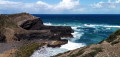
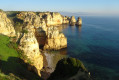
This circular walk will take you to Ponta da Atalaia and Sagres harbour, with views of the Fortaleza de Sagres and the islands opposite the harbour.

Details

1971954
Creation:
Last update:
Last review:
  • Walking
    Activity: Walking
  • ↔
    Distance: 2.55 mi
  • ◔
    Average duration: 1h 25 
  • ▲
    Difficulty: Easy

  • ⚐
    Back to start: Yes
  • ↗
    Ascent: + 233 ft
  • ↘
    Descent: - 220 ft

  • ▲
    Highest point: 115 ft
  • ▼
    Lowest point: -10 ft

Photos

Description of the walk

The walk starts from the car park near the Tourist Office, right next to the skatepark.

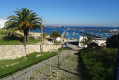
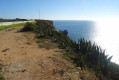
(S/E) Follow the road across the car park towards the sea and turn left. Just before the junction with Rua Infante Dom Henrique, turn right onto the footpath. Continue along this path overlooking the sea until you reach Ponta da Atalaia.

(1) Then continue along the wooden walkway which branches off to the left towards the north-east. At the end of this paved path, carry on along the track to the right. Stay on the main path until you reach an abandoned, graffiti-covered house on the right.

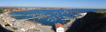
(2) Go round the back of the house to reach the cliff edge and enjoy a beautiful view of Sagres fishing harbour and the archipelago offshore. Then turn left onto the track to join the road at a roundabout. Head down to the right to reach the harbour and walk to the end to watch, depending on the time of day, the fish being unloaded from the glass-fronted room of the “A Sereia” snack bar.

(3) Retrace your steps along the quays to a large car park between the two large breakwaters. Head back up the stairs on the left (remember to look back now and then to enjoy the view) and follow the road straight on to return to the starting point at the skatepark (S/E).

Waypoints

  1. S/E : mi 0 - alt. 95 ft - Car park near the Tourist Office
  2. 1 : mi 0.74 - alt. 10 ft - Ponta da Atalaia - Ponta da Atalaia
  3. 2 : mi 1.21 - alt. 102 ft - Abandoned and graffiti-covered house
  4. 3 : mi 1.7 - alt. 13 ft - Sagres Harbour
  5. S/E : mi 2.55 - alt. 98 ft - Car park near the Tourist Office

Notes

An easy walk. A pair of trainers is all you need.

Be aware of the heat in summer; make sure you take some water with you.

Worth a visit

Nearby, you can visit Sagres Fortress.

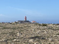
Don’t miss Cabo de São Vicente and its lighthouse, a few kilometres further on – the south-westernmost point in Europe – as well as the fishermen balancing on the cliffs!

Reviews and comments

4.6 / 5
Based on 3 reviews

Reliability of the description
4.7 / 5
Ease of following the route
4.7 / 5
Route interest
4.3 / 5
Jacques POTET
Jacques POTET

Overall rating : 4 / 5

Date of your route : Sep 23, 2024
Reliability of the description : ★★★★☆ Good
Ease of following the route : ★★★★★ Very good
Route interest : ★★★☆☆ Average
Very busy route : No

As well as this very short route, I’d recommend taking the path that starts in Sagres and leads to the Cape St Vincent lighthouse.
The path along the cliffs is spectacular, and halfway along, Beliche Beach offers a chance to take a break and have a swim in the ocean, weather permitting.

Machine-translated

les tourterelles
les tourterelles

Overall rating : 4.7 / 5

Date of your route : Sep 11, 2023
Reliability of the description : ★★★★★ Very good
Ease of following the route : ★★★★☆ Good
Route interest : ★★★★★ Very good
Very busy route : Yes

Whilst visiting Portugal, we made the most of the coastal walking trails.
All the trails are well signposted and there are plenty of them.
Make sure you’re properly kitted out and take plenty of water with you, given the heat.

Machine-translated

Bidochon54
Bidochon54

Overall rating : 5 / 5

Date of your route : Nov 17, 2021
Reliability of the description : ★★★★★ Very good
Ease of following the route : ★★★★★ Very good
Route interest : ★★★★★ Very good
Very busy route : No

That's really nice!!!

Machine-translated

For more walks, use our search engine .

The GPS track and description are the property of this route's author. Please do not copy them without permission.