Country:
 City:
City:


The start is accessible by car from the Moorea Beach car park, alongside the D111.
(S/E) Cross the road (D111) carefully straight away, take the Chemin des Frati which climbs through residential neighbourhoods and leads to a left-hand bend on the descent.
(1) Turn off onto the dirt track on the right, pass the hairpin bend and look for a path on the left just before you reach a house.
(2) Take this path and you’ll soon reach the PR® (yellow markings). Turn left and, amidst medium-height vegetation with a few shaded areas, follow the path along the mountainside. Ignore a path branching off to the right into the valley and continue until you reach a road leading down towards the departmental road.
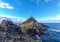
(3) Enjoy the superb view of the Sanguinaires Islands and the Genoese tower of La Parata. Continue along the road to the left and descend to the departmental road.
(4) Follow it to the right along the paved path on the left-hand side until you reach the car park.
(5) Carry on straight ahead and walk along the left-hand side of the first hillock until the tarmac ends.
(6) Carry on straight ahead to the tip of the headland.
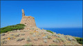
(7) Take a few steps back, take the stairs and climb up to the Genoese tower.
(8) From the tower, you’ll enjoy an exceptional view of the islands, as well as the coastline and the countryside. Turn round and head back to the road you took on the way there.
(6) Ignore it and turn off onto the path on the left, which starts to the left of the steps leading up to the brasserie. Follow it along the coast, passing above the car park, until you reach a track suitable for vehicles.
(9) Walk a few metres to the right, then turn onto the path on the left. Follow it until you reach the junction you passed on the way out.
(3) Cross the road and continue along the path opposite. Follow the route back the way you came to reach the Moorea Beach car park (S/E).

 Visorando Member
 Moderate
 Difficult