Pic du Mondarrain via the route around the Pic d’Ezcondray

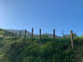
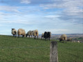
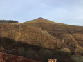
A lovely walk, with a short stretch of road at the start, which is very quiet. After that, it’s a steady climb up to the Pic du Mondarrain. A few wooded areas provide some shade. The final ascent is over rocky terrain; you may need to use your hands at times, but this is only occasionally necessary. On the descent from Mondarrain, there’s a brief, slightly more challenging section – a few metres where you’ll need to hold on to some rings set into the rock. However, this section can probably be bypassed via other paths shown on the maps if it really is too difficult; the idea was to complete a circular route.

Details

102086138
Creation:
Last update:
Last review:
  • Walking
    Activity: Walking
  • ↔
    Distance: 4.45 mi
  • ◔
    Average duration: 3h 45 
  • ▲
    Difficulty: Moderate

  • ⚐
    Back to start: Yes
  • ↗
    Ascent: + 2,001 ft
  • ↘
    Descent: - 2,005 ft

  • ▲
    Highest point: 2,448 ft
  • ▼
    Lowest point: 443 ft

Description of the walk

Park at the junction of the tracks south of Haranea; further on, parking is prohibited.

(S/E) Turn left onto the road, which has virtually no traffic. Reach the hamlet of Panparrina, keep to the right on the road, negotiate a series of short hairpin bends, and you’ll then come to a path junction.

(1) Leave the road and turn right onto the path. Begin a long, relatively easy climb. You’ll reach a path junction directly below the Pic d’Ezcondray.

(2) Continue straight ahead up the slope until you reach a junction with four paths running almost perpendicular to one another.

(3) Carry on straight ahead, due south, ending with a steeper slope as you climb Pic du Mondarrain.

(4) Turn left through 180° to begin the descent; take care here: make use of the few rings provided to secure yourself for a few metres. Continue down an easier slope, pass the Col d’Amezketa, and shortly afterwards you’ll come to a crossroads with several routes at the edge of a copse.

(5) Stay on the path on the right and descend until you reach the road at a place called Legarreko Lepoa.

(6) Take the road on the left and head towards the junction you passed on the way out.

(1) Turn right onto the road and, heading in the opposite direction to the outward journey, return to the Haranea car park (S/E).

Waypoints

  1. S/E : mi 0 - alt. 446 ft - Haranea car park
  2. 1 : mi 0.49 - alt. 837 ft - junction of the circular loop
  3. 2 : mi 1.06 - alt. 1,266 ft - Crossroads below the - Pic d'Ezcondray
  4. 3 : mi 1.37 - alt. 1,509 ft - Four-way junction
  5. 4 : mi 2.03 - alt. 2,372 ft - Mondarrain
  6. 5 : mi 2.74 - alt. 1,549 ft - Col d'Amesketa
  7. 6 : mi 3.43 - alt. 1,175 ft - Back onto the road - Col de Légarré (Legarreko lepoa en basque)
  8. S/E : mi 4.45 - alt. 443 ft - Haranea car park

Notes

No water source.
(3) To shorten the walk, you can take the path on the left to go directly to (5)

Worth a visit

(4) Pic du Mondarrain: enjoy a 360° view of the Basque Country.

Other walks in the area

For more walks, use our search engine .

The GPS track and description are the property of this route's author. Please do not copy them without permission.