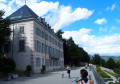
Pic de la Greysinière and Tête de Guizière from Les Serrigues

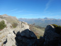
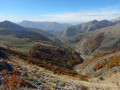
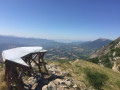
A hike in the hills above Gap offering exceptional panoramic views. Montagne de Ceüze, Massif de Bure, Dévoluy, Écrins, Embrunais, Blanche, Monges... A rollercoaster ride along the ridge. Flowers and mushrooms abound!
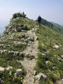
A tricky section between (3) and (4).

Details

27934002
Creation:
Last update:
Last review:
  • Walking
    Activity: Walking
  • ↔
    Distance: 5.63 mi
  • ◔
    Average duration: 4h 20 
  • ▲
    Difficulty: Difficult

  • ⚐
    Back to start: Yes
  • ↗
    Ascent: + 2,001 ft
  • ↘
    Descent: - 1,985 ft

  • ▲
    Highest point: 6,289 ft
  • ▼
    Lowest point: 4,452 ft

Photos

Description of the walk

Public transport does not go this far. You will need to take your own vehicle and park in the car park on the left after the hamlet of Les Serrigues, coming from Gap, on the site of a former quarry.

(S/E) Walk to the back of the car park and take the path leading up into the forest directly in front of you.

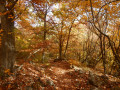
(1) At the Serrigues Hautes signpost, turn right towards Col de Gleize. The path climbs gradually, alternating between forest and scree.

(2) At the Col de Gleize signpost, near the gate, head towards Pic de la Greysinière. The path climbs through the forest via numerous hairpin bends up to Pic de la Greysinière.

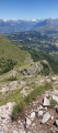
(3) Caution: Continue due south along the path along the ridge. The climb may be difficult for those prone to vertigo. Fortunately, the markings (yellow lines and arrows) help you find the best routes. Take care not to stray from the path.

(4) After this somewhat challenging section, the path continues across open mountain pasture! But be warned, this is where the rollercoaster ride begins!

(5) At the Col de Côte Gelée:
- you can take a shortcut by following the path that descends the eastern slope and joins the route taken on the ascent.
- Otherwise, continue along the ridge. There are two more hills to climb before reaching the Col de Guizière.

(6) Turn left towards Les Serrigues, route no. 3. Begin a somewhat steep, rocky descent lasting about ten minutes.

(7) At the Gap signpost – Alt 1540 m, keep straight ahead towards Les Serrigues. Descend through the forest until you reach the Les Serrigues Hautes signpost.

(1) Head straight on along the short section of path taken on the way out to return to the car park (S/E).

Waypoints

  1. S/E : mi 0 - alt. 4,459 ft - Serrigues car park.
  2. 1 : mi 0.32 - alt. 4,659 ft - Serrigues Hautes marker. Altitude 1,418 m
  3. 2 : mi 2.48 - alt. 5,561 ft - Signpost - Col de Gleize
  4. 3 : mi 3.07 - alt. 6,122 ft - Start of the tricky section - Pic de la Greysinière (1881m)
  5. 4 : mi 3.41 - alt. 6,263 ft - End of the tricky section
  6. 5 : mi 3.82 - alt. 6,102 ft - Col de la Côte gelée (1862m)
  7. 6 : mi 4.8 - alt. 5,404 ft - Col de Guizière (1649m)
  8. 7 : mi 4.98 - alt. 5,069 ft - Gap marker. Altitude 1540 m
  9. S/E : mi 5.63 - alt. 4,459 ft - Serrigues car park.

Notes

No water points or toilets along the route.
A tricky section between (3) and (4). Route not recommended for those prone to vertigo.
Best undertaken in dry weather and when there is no wind. There are no handrails, but effective signposting helps you navigate the less difficult sections.

Reviews and comments

5 / 5
Based on 4 reviews

Reliability of the description
5 / 5
Ease of following the route
5 / 5
Route interest
5 / 5
laporte2001
laporte2001

Overall rating : 5 / 5

Date of your route : Sep 07, 2025
Reliability of the description : ★★★★★ Very good
Ease of following the route : ★★★★★ Very good
Route interest : ★★★★★ Very good
Very busy route : No

A beautiful walk that can also be started from the Col de Gleize. There are a few sections that require a bit of climbing/descending, but nothing too difficult if you know how to find a few easy handholds. The trail is very clearly marked on this section, which takes about 30 minutes if you're careful. Not suitable for pets. I would also avoid taking children under 12, unless they are experienced climbers (and careful). I would also avoid it in wet conditions (risk of rain or rain in the previous hours).
The views are very beautiful, and there are fewer people than on other trails in the area in summer.

Machine-translated

Patricia13
Patricia13

Overall rating : 5 / 5

Date of your route : Jun 10, 2025
Reliability of the description : ★★★★★ Very good
Ease of following the route : ★★★★★ Very good
Route interest : ★★★★★ Very good
Very busy route : No

I agree with the previous comments: a very tricky section indeed. The only sign going up into the woods warning of a tricky section is, in my opinion, completely inadequate given the difficulties involved, not to mention the length! We embarked on this route somewhat by chance, and we regretted it a little... On top of that, the sky was very overcast (Canadian wildfires) and we were barely able to enjoy the Vieux Chaillol, which was still covered in snow.

Machine-translated

MichelJ
MichelJ

Overall rating : 5 / 5

Date of your route : Jun 05, 2024
Reliability of the description : ★★★★★ Very good
Ease of following the route : ★★★★★ Very good
Route interest : ★★★★★ Very good
Very busy route : No

The signposting along the tricky section of the hike was very well done.

Machine-translated

quencez
quencez

Overall rating : 5 / 5

Date of your route : Aug 15, 2023
Reliability of the description : ★★★★★ Very good
Ease of following the route : ★★★★★ Very good
Route interest : ★★★★★ Very good
Very busy route : No

a lovely hike with magnificent views of the ridges
a steady climb

Machine-translated

Other walks in the area

For more walks, use our search engine .

The GPS track and description are the property of this route's author. Please do not copy them without permission.