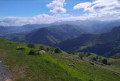
Pic d’Arradoy via the Chemin du Génie

A circular route to climb Pic d’Arradoy, starting from the orientation table and passing via the Chemin du Génie

Details

11262319
Creation:
Last update:
Last review:
  • Walking
    Activity: Walking
  • ↔
    Distance: 3.66 mi
  • ◔
    Average duration: 2h 30 
  • ▲
    Difficulty: Easy

  • ⚐
    Back to start: Yes
  • ↗
    Ascent: + 915 ft
  • ↘
    Descent: - 915 ft

  • ▲
    Highest point: 2,156 ft
  • ▼
    Lowest point: 1,493 ft

Description of the walk

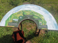
Car park at the Arradoy orientation table.

(S/E) Head east along the track towards the orientation table and continue to a crossroads.

(1) Continue along the path heading north-east, ignoring the straight path, to stay within a wooded area until you reach another junction.

(2) Head eastwards straight ahead and take a wide bend to rejoin the road.

(3) Turn left onto the road, pass under a power line and ignore a road branching off to the right.

(4) Turn left onto the Chemin du Génie, which winds its way up to the summit of the Pic d’Arradoy.

(5) Continue down the opposite slope towards the south-west, passing close to a reservoir, to reach a junction you passed on the way out.

(2) Turn right and return along the same path, in the opposite direction, to the car park (S/E).
Waypoints

  1. S/E : mi 0 - alt. 1,519 ft - Car park at the Arradoy orientation table
  2. 1 : mi 0.36 - alt. 1,617 ft - Crossroads
  3. 2 : mi 0.59 - alt. 1,755 ft - Crossroads
  4. 3 : mi 1.34 - alt. 1,493 ft - Route de l’Arradoy
  5. 4 : mi 1.9 - alt. 1,647 ft - Chemin du Génie
  6. 5 : mi 2.79 - alt. 2,156 ft - Summit of the - Pic d'Arradoy
  7. S/E : mi 3.66 - alt. 1,519 ft - Car park at the Arradoy orientation table

Reviews and comments

4.6 / 5
Based on 4 reviews

Reliability of the description
4.8 / 5
Ease of following the route
5 / 5
Route interest
4 / 5
Murielle Biez
Murielle Biez

Overall rating : 5 / 5

Date of your route : Jul 06, 2026
Reliability of the description : ★★★★★ Very good
Ease of following the route : ★★★★★ Very good
Route interest : ★★★★★ Very good
Very busy route : No

A lovely walk! The descent from Arradoy was a bit tricky as there were lots of stones on our shoes, so we slipped a few times
To get to the starting point, the road is narrow – two cars can’t pass each other

Machine-translated

User 5066694

Overall rating : 4 / 5

Date of your route : Oct 22, 2025
Reliability of the description : ★★★★☆ Good
Ease of following the route : ★★★★★ Very good
Route interest : ★★★☆☆ Average
Very busy route : Yes

Well-marked trail. Short hike, barely 2 hours. However, the starting point is difficult to find. Narrow mountain road.
Beautiful view of the pass before reaching the summit.
Next time, we will set off from the village of Ispoure to make the hike longer.

Machine-translated

Coline Guillemin
Coline Guillemin

Overall rating : 4.7 / 5

Date of your route : Mar 10, 2025
Reliability of the description : ★★★★★ Very good
Ease of following the route : ★★★★★ Very good
Route interest : ★★★★☆ Good
Very busy route : No

Hello,

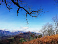
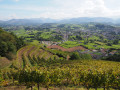
A gentle walk, with a good climb halfway through. We did it with two children (aged 11 and 2 in a rucksack), and they were very happy. There are lots of trees (no leaves at this time of year) at the top, so you don’t get a 360-degree view, but the whole walk offers very pretty, sweeping views all along the way, so you can see plenty of the mountainous landscape all around. The picnic area at the start and finish is great for children! You can have a barbecue there (be careful with fires!).

Machine-translated

EMeule
EMeule

Overall rating : 4.7 / 5

Date of your route : Aug 15, 2024
Reliability of the description : ★★★★★ Very good
Ease of following the route : ★★★★★ Very good
Route interest : ★★★★☆ Good
Very busy route : No

A very pleasant route, though it’s best done in the opposite direction: you climb up to the peak first and then enjoy the walk through the woodland, with some lovely views. The walk is easy and well signposted; it took us 2 hours with a baby in a baby carrier. Be careful, however, as the road leading to the start of the walk is narrow and a bit tricky (two cars cannot pass each other).

Machine-translated

Other walks in the area

For more walks, use our search engine .

The GPS track and description are the property of this route's author. Please do not copy them without permission.