


 Country:




Start at Heuston Station. Easily accessible by tram, there is also a car park near the station.
(S/E) Cross the Liffey via the Sean Heuston Bridge, then turn left onto Parkgate Street. The section along this road is of little interest apart from a few Victorian buildings in housing estates, but it is a necessary route to reach the other, much more interesting parts.
(1) When you reach the junction with South Circular Road, turn left, cross the Liffey again and then turn right when you see the sign for the “Irish National War Memorial”. Walk past the sports grounds and you’ll arrive at Memorial Park. This park is not at all sombre; on the contrary, it’s a very peaceful and well-maintained spot, frequented by walkers (often with their dogs). Walk past the Dome-Shaped Temple and then through the Garden of Remembrance, though you can, of course, wander around the park as you please before reaching the banks of the ‘wild’ Liffey: the Liffey Tow Path.
(2) Walk upstream on the left-hand side. Along the entire length of the Liffey Tow Path, it’s hard to believe you’re in the city. You’re surrounded by greenery and water; only a few buildings here and there rise slightly above the vegetation. You’re also likely to see plenty of rowing boats on the river, as several clubs have their premises in this area.
(3) Once you reach the end of this tarmac path, you’ll be in the ‘Chapelizod’ neighbourhood. Walk a little further past the houses until you reach Anna Livia Bridge, which you then cross. Turn left and then straight right to reach Phoenix Park. To find your way easily, head up the small street just before the Park Lane Deli (where you can stop for a coffee or a sandwich).
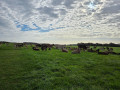
(4) You’ll then enter Phoenix Park. Here too, the route shown is merely a guide; you can adapt it to suit your preferences, and you’re quite likely to stray from it when you cross the “Fifteen Acres” to admire the stags, does and fawns roaming freely there, or to carry on to Ashton Castle for a quick look around. If you follow the route, you’ll pass the President’s Residence (the President’s, in this case) and then walk alongside the zoo, finishing with the short stretch below Chesterfield Avenue. Exit via Conyngham Road, turning left and then keeping to the right. You’ll then return to Heuston Station (S/E).
 Visorando Member

