


 Country:
 City:


In the centre of Levernois, park in the car park on the right-hand side of the Route du Golf, near the Bistrot du Bord de l’Eau.
(S/E) Opposite the restaurant, turn right and follow the footpath alongside the road, then cross the Bouzaize.
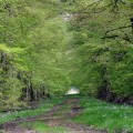
(1) Take the street on the left at the sign for the Hôtel des Allées du Green. Cross the Bouzaize again and walk alongside the golf course on your left. At the end of the street, continue straight ahead along the path through the woodland.
(2) Turn left, then leave the woodland and follow a wider path.
(3) At the crossroads, follow the winding path on the left – this is a fitness trail running alongside a path which you can also take. Further on, you’ll join the path which becomes Rue de la Plaine. At the junction, head slightly to the right and you’ll reach the village’s main street (Grande Rue).
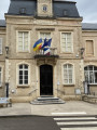
(4) Turn left, walk past the church, then the town hall. At the junction, turn left.
(5) Turn right onto Rue du Moulin. A little further on, pass the old mill on your right, cross the Bouzaize and immediately take the path on the left which runs alongside the little river. You’ll come to a road. Turn left to cross the Bouzaize one last time, then take the path on the right which runs alongside the river and rejoins the Route du Golf. The car park (S/E) is just on the left.
 Visorando Member
 Moderate

 Association / Club / Walk leader
 Tourist office

