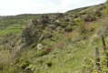
A short walk to Saint-Priest

A lovely, short family walk with plenty of shade.

Details

609960
Creation:
Last update:
Last review:
  • Walking
    Activity: Walking
  • ↔
    Distance: 2.66 mi
  • ◔
    Average duration: 1h 40 
  • ▲
    Difficulty: Easy

  • ⚐
    Back to start: Yes
  • ↗
    Ascent: + 479 ft
  • ↘
    Descent: - 489 ft

  • ▲
    Highest point: 1,657 ft
  • ▼
    Lowest point: 1,253 ft

Description of the walk

Car park in front of St-Priest town hall, by the hiking information sign.

(S/E) Take the small road to the right of the town hall. When you reach a junction, just after a bend and a descent, take the road on the right, just above the mill. Continue straight on, following the river.

(1) When you reach the ‘Le Vidalin’ hiking signpost, follow the sign opposite for ‘Saint-Priest Village’ (3.3 km).
Carry on along this path through the forest, following the Ouvéze. Pass through two gates and remember to close them properly.

(2) At the “Les Rieux” signpost, turn left towards Saint-Priest Village (2.9 km). Cross a ford and continue to a wide track just before the hamlet of Lascombes.

(3) Turn left to cross the small hamlet of Lascombes and, after the last house, take the path leading uphill to the right, running alongside the house.

(4) At the “Lascombes” signpost, head left towards Saint-Priest village for 2.8 km. Cross a bridge

(5) When you reach the “Rancs Fourchas” signpost, turn left towards Saint-Priest village (2.1 km), (Les Eygasses 0.8 km).
Follow the path downhill to the hamlet of Les Eygasses. At the junction, turn right then left. Follow the signs for Saint-Priest village, continuing straight ahead.
Cross a bridge and you’ll come to a junction.

(1) Leave the tarmac road on your right and take the small grassy path straight ahead. You’ll reach the first houses in the village; at the junction, turn right towards the town hall (S/E).


Waypoints

  1. S/E : mi 0 - alt. 1,385 ft - Car park opposite the town hall
  2. 1 : mi 0.37 - alt. 1,312 ft - Vidalin signpost, on the left
  3. 2 : mi 0.64 - alt. 1,302 ft - Hiking signpost at Les Rieux, turn left
  4. 3 : mi 0.88 - alt. 1,499 ft - Turn left towards Lascombes
  5. 4 : mi 1.06 - alt. 1,545 ft - Lascombes signpost, on the left
  6. 5 : mi 1.47 - alt. 1,657 ft - Rancs Fourchas signpost, on the left
  7. S/E : mi 2.66 - alt. 1,385 ft - Car park opposite the town hall

Notes

Car park: in front of the town hall
No drinking water points, but there are quite a few streams along the way (please note: I’m not sure if there’s any water in summer)
Do remember to close the gates so that the animals don’t escape.
Wear sturdy shoes on the descent between Rancs Fourchas and Les Eygasses.
A slightly steep but short climb from Vidalin to Les Rieux.

Reviews and comments

4.2 / 5
Based on 3 reviews

Reliability of the description
4 / 5
Ease of following the route
4.3 / 5
Route interest
4.3 / 5
Nasta18
Nasta18

Overall rating : 4 / 5

Date of your route : Jan 21, 2024
Reliability of the description : ★★★★★ Very good
Ease of following the route : ★★★★☆ Good
Route interest : ★★★☆☆ Average
Very busy route : No

Please note: I tried this route today, but at point 1 there is no signpost, and the path to take has been closed since October 2023 due to a rockslide.
Otherwise, having done it before, this route is lovely as it’s peaceful and set in a pretty little village. But there are too many roads for my liking.

Machine-translated

Dufy
Dufy

Overall rating : 4 / 5

Date of your route : Mar 11, 2021
Reliability of the description : ★★★☆☆ Average
Ease of following the route : ★★★★☆ Good
Route interest : ★★★★★ Very good
Very busy route : No

Short walk around Saint-Priest (07)

The description for point 1 is the same as that for point 2 on the map
The description for point 2 is the same as that for point 3
The description for point 1 is missing; it should be placed between “above the moulinage” and “Continue straight on along the river”
It could be written as follows
(1) Instead of turning left towards the bridge, carry on straight ahead along the river, pass through two gates and remember to close them properly.
(2) When you reach a ‘Le Vidalin’ signpost......

Machine-translated

Bigjack07
Bigjack07

Overall rating : 4.7 / 5

Date of your route : Jan 24, 2021
Reliability of the description : ★★★★☆ Good
Ease of following the route : ★★★★★ Very good
Route interest : ★★★★★ Very good
Very busy route : No

An interesting, fairly easy walk. There are a few inaccuracies regarding the route, particularly the distances between the signposts. Nevertheless, it’s fairly easy to find your way. There are some lovely views.

Machine-translated

Other walks in the area

For more walks, use our search engine .

The GPS track and description are the property of this route's author. Please do not copy them without permission.