Petit Som, starting from La Correrie

A climb to one of the peaks of the Chartreuse, the Petit Som, starting from the car park at the Musée de la Grande Chartreuse, La Correrie.
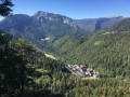
An unusual route to the Petit Som via the rear of the Grande Chartreuse Monastery, Notre-Dame de Casalibus, the Saint-Bruno Chapel, the Habert de Bovinant and the Col de Léchaud.
The descent towards Sous le Petit Som avoids the Pas de Loup by taking the ‘cheminée’ route. You then reach the Col de la Ruchère before descending towards Habert Billon, the reservoir and the Grande Chartreuse Monastery.

Details

n°35500989
Creation:
Last update:
Last review:
  • Walking
    Activity: Walking
  • ↔
    Distance: 8.58 mi
  • ◔
    Average duration: 6h 50 
  • ▲
    Difficulty: Difficult

  • ⚐
    Back to start: Yes
  • ↗
    Ascent: + 3,350 ft
  • ↘
    Descent: - 3,346 ft

  • ▲
    Highest point: 5,778 ft
  • ▼
    Lowest point: 2,789 ft

Description of the walk

Park in the Correrie car park next to the Musée de la Grande Chartreuse.

(S/E) Walk round the museum and head for the junction where the footpaths start (signposted).

(1) Turn left onto the path at the edge of the woods. Begin a gentle climb through the woods, which ends briefly at a cross. Continue downhill, skirting the east wall of the Grande Chartreuse Monastery. Reach the junction with a wide track.

(2) Take this track to the right until you reach the junction with the Chemin du Pavé.

(3) Keep to the right on the track. After a few hairpin bends and an easy walk, you’ll reach Notre-Dame de Casalibus.

(4) Continue on to the Saint-Bruno Chapel.

(5) Turn back.

(4) Back at Notre-Dame de Casalibus, continue along the track until you reach its end at the crossroads in the hamlet of Bourdoire.

(6) Turn onto the path on the right and continue the ascent. At the next crossroads, turn left onto theGRP® du Tour de Chartreuse. Pass under the Pas du Loup and, further on, reach the multi-way junction at Habert de Bovinant.

(7) Keep left on theGRP® trail, following the yellow and red markings. Reach the Col de Léchaud.

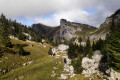
(8) Leave theGRP® here and continue straight ahead to reach the summit of the Petit Som.

(9) Here you have two options:
- head back the way you came to the Col de Léchaud, turn right onto theGRP® to reach the Pas du Loup, keep to the right on theGRP® to reach the Col de la Ruchère,
- head straight ahead down the gully , taking great care as the descent is steep and not recommended in slippery conditions, to reach the Col de la Ruchère directly (route choice).

(10) Leave theGRP® and head left onto the Sentier de la Prairie de la Folie. Enjoy a pleasant walk through this mountain pasture to discover the Habert de Billon.

(11) Take the path leading down to the left, known as the Chemin du Pavé. You will then reach the crossroads you passed on the way there.

(3) Retrace your steps along the route you took on the way out to reach the Monastère crossroads, which you also passed on the way out.

(2) Turn right and follow this road back to the Correrie car park (S/E).

Waypoints

  1. S/E : mi 0 - alt. 2,802 ft - Correrie car park
  2. 1 : mi 0.16 - alt. 2,887 ft - Starting point junction
  3. 2 : mi 1.52 - alt. 3,212 ft - Couvent de la Grande Chartreuse
  4. 3 : mi 2.01 - alt. 3,612 ft - Crossroads of the circular loop
  5. 4 : mi 2.44 - alt. 3,809 ft - Église Notre-Dame de Casalibus (Saint-Pierre-de-Chartreuse)
  6. 5 : mi 2.54 - alt. 3,845 ft - Chapelle Saint-Bruno (Saint-Pierre-de-Chartreuse)
  7. 6 : mi 2.94 - alt. 4,124 ft - Bourdoire
  8. 7 : mi 3.77 - alt. 5,348 ft - Habert Bovinant
  9. 8 : mi 4.31 - alt. 5,577 ft - Col de Léchaud
  10. 9 : mi 4.65 - alt. 5,653 ft - Petit Som (1772m)
  11. 10 : mi 5.17 - alt. 4,649 ft - Col de la Ruchère
  12. 11 : mi 6.35 - alt. 4,183 ft - Habert Billon
  13. S/E : mi 8.58 - alt. 2,802 ft - Correrie car park

Worth a visit

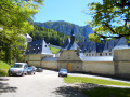
(S/E) La Correrie
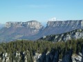
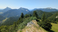
(8) Le Petit Som: take the time to admire the 360° panorama:
- to the north, Lake Bourget, the Granier, the Col de l’Alpette, Le Pinet and, behind them, Mont Blanc,
- to the east, Roches Rousses and the Dent de l’Ours,
- to the south, the Grand Som,
- to the west, the Col de la Ruchère with the Prairie du Col, then the Prairie de la Folie towards Habert Billon.

Reviews and comments

4.8 / 5
Based on 2 reviews

Reliability of the description
5 / 5
Ease of following the route
4.5 / 5
Route interest
5 / 5
Aseven3
Aseven3

Overall rating : 5 / 5

Date of your route : Oct 14, 2026
Reliability of the description : Not used / Not applicable
Ease of following the route : ★★★★★ Very good
Route interest : ★★★★★ Very good
Very busy route : No

The walk took less time than expected (4 hours in total, 5½ hours including the optional lunch break and short stops).
Setting off from the Pont des Allemands and then from Notre Dame de Casalibus, we headed towards the Col de La Ruchère before continuing on to the Petit Som chimney.
This was a very wise decision given how wet and slippery the rock and ground were on the ascent up the ‘Cheminée de Petit Som’, which gets very little sun. This was the only technical section of the hike.
From the cross, we descended to the Col de Léchaud, then made a short climb opposite to see the Dent de l’Ours and the Col du Frêt, before beginning the descent via the Pas du Loup, which is much easier to navigate than the ‘Cheminée’ and can be tackled either way. From there, we returned to the Col de la Ruchère, then made our way to the Habert de Billon meadow before reaching the monastery and, via the main avenue, the car park at the Pont des Allemands.
A very beautiful and enjoyable walk through woodland and mountains, offering magnificent views and scenery; it was a real treat throughout, despite the effort. Very quiet in the morning, though you’ll come across a few more people heading up from Le Cleyat and La Ruchère from around midday onwards. A peaceful yet challenging walk that requires a minimum level of skill and fitness. Moderate to difficult; best avoided in unsettled or rainy weather.
We didn’t follow the GPX file as the route is very well signposted and marked; no problems there.

Machine-translated

Isabelle Cloux
Isabelle Cloux

Overall rating : 4.7 / 5

Date of your route : Aug 16, 2024
Reliability of the description : ★★★★★ Very good
Ease of following the route : ★★★★☆ Good
Route interest : ★★★★★ Very good
Very busy route : Yes

I didn’t see any point in taking the path (1) that goes round the monastery; it’s in poor condition, with fallen trees and wire fencing blocking the way towards the monastery, and it doesn’t offer any better views of the building than the main path does (you can get a lovely panoramic view of the monastery via the main path as you head up towards the cistern and the cross).
I even found it rather tedious given its condition… I realise it saves you having to walk back and forth along the main path, but I don’t think that’s a drawback, as the path is so lovely, and you don’t see the same things going one way as you do the other.
If you don’t want to see the chapel and Notre-Dame de Casalibus (which is closed), you might as well take the GR from the start, which joins the route just before the Pas du Loup.
I didn’t find the chimney section difficult; I was half expecting something like the one at Le Paradis towards the Dent de Crolles. Don’t worry, you just need to be careful, but it’s perfectly manageable.
And I really enjoyed the return journey through the meadows and mountain pastures, as three-quarters of the ascent is through the forest, which is very dense and very tall; it’s quite stifling and dark, so you’re glad to see the light again just before the Habert de Bovinant.
I wouldn’t say it’s difficult; you just need to be careful if you take the ‘chimney’ (which is more like a rather narrow scree slope).
It’s still a very beautiful walk.

Machine-translated

Other walks in the area

For more walks, use our search engine .

The GPS track and description are the property of this route's author. Please do not copy them without permission.