Country:
 City:


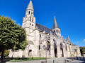
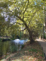
Note: as the route follows several PR® trails (yellow markings) intermittently, please disregard the corresponding markings.
Off the marked route
(S) Poissy station: take the ‘Centre Ville / Place Georges Pompidou’ exit. Cross the square, then walk along Avenue Maurice Berteaux on the right.
(1) At the first junction, cross at thesecond pedestrian crossing, then take Boulevard Victor Hugo. At the second junction, turn right onto Boulevard de la Paix. Take the first right onto Rue du Général de Gaulle, then the first left onto Rue des Trois Maillets.
(2) At the junction with Rue du Bœuf, carry on straight ahead, go through the gate and then under the archway beneath the buildings of the Résidence du Cep. Cross the service lane, then Avenue du Cep (traffic lights). Continue straight ahead onto Rue de l’Abbaye, passing one junction. At the pedestrian crossing, cross over to join the path running beneath the buildings, opposite Rue des Prêcheurs. Continue straight on until you reach Rue de l’Église.
(3) Turn left onto Avenue Meissonier.
GRP® (red and yellow markings)
Follow it to the left, pass Rue de la Caserne, then walk alongside the CAF des Yvelines buildings until you reach the pedestrian crossing. Cross opposite the prison, then turn right onto Avenue Meissonier (traffic lights). Turn left, then immediately right into the passageway under the gatehouse of the former Royal Priory of Saint-Louis, which houses the Toy Museum.
(4) Walk up the cobbled street through the abbey enclosure to a small square.
No signposting
Carry on straight ahead, skirting the Abbaye Nursery School, then enter Meissonier Park through the gate. Continue along a wide path, passing the Maison de Fer. At the Fork in the road, turn right down a concrete path to the pond. Go round it on the right, then walk along the other side until you reach the statue of Ernest Meissonier on your right. Leave the park through the gate.
(5) Cross Avenue du Bon Roi Saint-Louis (traffic lights) and enter the car park. Walk along the right-hand side of the car park for about 120 metres, then turn left through the underpass beneath the railway lines to reach Avenue Émile Zola.
GR® (red and white markings)
Cross the road before turning left. Cross the bridge leading to Île de Migneaux. Continue in the same direction along Chemin du Bord de l’Eau, then Chemin des Pêcheurs, at the entrance to the town of Villennes-sur-Seine.
(6) After passing a sailing club, go under the railway bridge, then head up Chemin de la Sourde. Turn right onto Rue des Iselles and continue to Rue de Poissy. Carry on in the same direction for about a hundred metres, then turn right onto Avenue Georges Clémenceau. Go under the market hall, then past Saint-Nicolas Church. Cross the road (with care) to reach the pedestrian path running alongside Place de la Libération. Walk past the Espace des Arts, then past the entrance to a private property.
(7) Turn immediately left into Parc Fauvel. Walk alongside a fence on your left, cross the second bridge over the pond, then turn left and walk up a flight of steps to the park’s exit on Rue des Écoles.
Unmarked section
Turn right onto this street and follow it to Place de la Fontaine. Walk round the square to take Rue du Coquart, on the opposite corner. At the junction, head down Rue Michel Giraux. At the crossroads, turn left onto Avenue du Maréchal Foch. Follow it for about 800 metres.
(8) At the junction after Médan Town Hall, turn right, then take the underpass beneath the railway lines. Turn left onto Rue de Seine, then right. Follow the Seine for 100 metres before heading up Rue Émile Zola on the left. Cross over the railway lines (Zola’s house on the right). Turn left onto Rue Pasteur, then right onto Rue Buquet (Église Saint-Germain Saint-Clair on the right). Cross Rue Pierre Curie, then follow it to the right until you reach the Fork in the road. Turn left onto Rue de Breteuil (take care in this area).
(9) As you come out of the bend, turn right onto Chemin des Poiriers. Continue straight on for about 1 km. Near the D1, head back down via Chemin de la Vallée Goujon to Rue de Vernouillet. Turn left to go round the roundabout, crossing (with care) the slip roads joining the D1, then the access road to Vernouillet (D154).
(10) Head towards the town entrance by following the street for 150 metres, then turn right onto the pedestrian ramp leading to the Parc de la Maison des Buissons. Continue along the path that starts opposite the house, following a low wall on your left. Turn left after the low wall, then walk alongside the tennis courts on your right. Leave the park, cross a small lane, then walk past the early years centre buildings on your right until you reach Rue Jean Mahler. Turn left to cross Rue Pierre Bosco, then walk up to Boulevard de l’Europe. Cross it carefully (there is a pedestrian crossing on the right, after the junction with Rue Jean Mahler). Turn left and continue to the roundabout.
(11) Turn right onto Rue Eugène Bourdillon. After a bend, pass Rue Girardin on your right. At the junction, turn right towards Saint-Étienne Church.
(12) At the junction in front of the church, turn right onto Rue Paul Doumer. Walk past Vernouillet Town Hall, then head left towards the CCAS (Communal Centre for Social Action) building. Take the steps, then cross Place de la Mairie. Climb the wide steps to reach Place du Général de Gaulle on your right. Continue past the shops on your left. Then walk up Avenue du Clos des Vignes, before turning right onto Rue Albert Labrousse, then left onto Rue Louis Pottier. After about a hundred metres, turn right onto Sente de la Fleur de Lys until you reach Avenue Montaigne. Cross the road (with care).
(13) Walk down the avenue, then turn left onto Rue Albert Labrousse. At the junction, take Rue du Fond Noêl Gilles on the right. Follow it until you reach Avenue Montaigne again. Continue down to the roundabout, then head left to the pedestrian crossing to cross Boulevard Georges Clémenceau (take care). Then turn right to reach Rue Paul Doumer on the left.
GR® (red and white markings)
Walk down Rue Paul Doumer until you reach Grande Rue. Turn left onto it (note the Art Nouveau-style building at No. 7, the Arthur Rimbaud Cultural Centre), and continue to the junction just past No. 15. From here, you can reach Vernouillet / Verneuil station by turning right onto Rue Clère, then continuing straight on along Place du Général de Gaulle.
Off the marked route
(14) Continue along Grande Rue. After about 90 metres, turn left through the gateway to Parc du Champclos (not shown on maps), which houses the music and dance school (see note). Cross the park via the path on the right, then, when you reach a small square, take the exit on the right onto Rue Delapierre. Walk along Place Mendès France on the pavement running alongside the town hall park, then past Saint-Martin’s Church, until you reach the T-junction. Note: if the park is closed, continue along Grande Rue until the junction with Rue Delapierre, then turn left onto Rue Delapierre.
(15) Turn left onto Rue Bègue until you reach Boulevard André Malraux. Cross it in two stages (traffic lights) before continuing opposite onto Rue de l’Étang (to the left of the square). Continue along this street, which turns left at the Fork in the road, then straight on at the next junction, until you reach No. 9.
(16) Turn right onto Chemin Federico Garcia Lorca. Walk past the buildings on your right to enter the Jardin d’Aguilar. Walk up through the garden, keeping to the left-hand path – which is more tree-lined – until you reach the playground. Go round it on the left, then climb the slope alongside the vineyards until you reach Rue du Hameau. Turn left onto this street, then right at the roundabout. Pass Allée des Magnolias, then turn right onto a concrete path after No. 18. Continue straight on until you reach Rue des Vignes. Cross it, then continue straight ahead into the Jardin Marcel Gotlib. At the exit, turn left to cross Avenue Alexis de Tocqueville, then right onto a tree-lined path for about 400 metres, until you reach a cemetery.
(17) Opposite the entrance to the new cemetery, go down the street branching off to the right, then turn immediately left onto the path blocked to vehicles by a large metal barrier. At the next junction, turn right (if the path is closed, refer to WP 17bis). At the next two forks in the road, take the left-hand fork. Then turn right onto a wide track situated slightly higher up. At the next junction, turn left between plots 17 and 18 to reach the Carrefour du Chêne Ferré.
(17bis) As forestry work is scheduled to continue in this area until 2035, an alternative route is indicated here. Opposite the entrance to the new cemetery, head down Rue de Bazincourt, which branches off to the right. Follow it for approximately 660 metres until you reach the entrance to the town’s old cemetery, which is surrounded by a stone wall. Turn left, keeping the wall on your right, when the path branches off to the right. Pass through the metal barriers to reach the Allée des Saules opposite. Walk down alongside the car parks until you reach Boulevard André Malraux. Turn left onto it and cross it just before a roundabout. Go round the roundabout on the right until you reach Rue du Parc Noir (a cul-de-sac). At the junction, continue along this street. At the next junction, turn left onto Rue des Rosiers. Then turn left at the T-junction onto Rue du Pré Rousselin. At the roundabout, take Rue Jean Moulin on the right, then continue left along Allée du Gros Chêne, past the residential car parks. 120 metres before the final roundabout, turn right to reach Clairières de Verneuil station.
(18) Take thesecond path on the right, between plots 10 and 12. At the next junction, turn left onto Chemin Georges Remy, running alongside plot 10, then straight on alongside plot 9. At the next junction, turn right towards the memorial to Commander H.W. Shurlds. Take the path leading off to the left of the memorial, then turn left again at the Fork in the road.
(19) Pass a junction with a sandier track, then take the less well-marked path opposite. At the T-junction that follows, turn right onto a wide track. At the next junction, take the first track on the left. Stay on this track, ignoring the side paths, until you reach Route de Verneuil. Cross it (with care) to reach, on the opposite side, a path marked by a square-section post (about 15 metres to the left of an electricity substation). Continue to a clearing.
(20) At the junction near an oak tree, turn right onto a path that winds its way to an open space. Turn left (with your back to a car park), then straight on until you reach a T-junction. Turn right and head towards the edge of the forest. Facing a roundabout, turn left to reach, on the opposite side, the Clairières de Verneuil station (E).
 Visorando Member
 Easy

 Association / Club / Walk leader