Le Luc via the Roman road to Belcastel

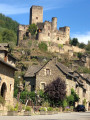
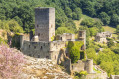
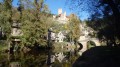
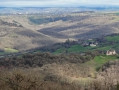
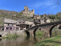
This walk, suitable for everyone, takes you up to the heights of Belcastel, where you can enjoy a panoramic view of the village.

Details

n°43277121
Creation:
Last update:
Last review:
  • Walking
    Activity: Walking
  • ↔
    Distance: 4.31 mi
  • ◔
    Average duration: 2h 35 
  • ▲
    Difficulty: Easy

  • ⚐
    Back to start: Yes
  • ↗
    Ascent: + 728 ft
  • ↘
    Descent: - 705 ft

  • ▲
    Highest point: 1,995 ft
  • ▼
    Lowest point: 1,339 ft

Photos

Description of the walk

Starting point: opposite the Vieux Pont

(S/E) Follow the river downstream towards the Pont Neuf (GR®62) until you reach the small bridge at the edge of the village.

(1) Take thefirst road leading uphill to the right, south-west, towards Luc-Haut, and continue to the cross at Mazens-le-Bas.

(2) Turn right, then carry on straight ahead until you reach Maison Neuve (end of the road). You’ll come to a crossroads.

(3) Keep to the right and pass La Griffoulade. You’ll come to a junction.

(4) Turn right. This path is said to follow the route of the Roman road from Rodez (Segodunum) to Limoges (Augustoritum) and the route taken to Santiago de Compostela. After 200 m, you’ll reach the hamlet of Luc-Haut, at a fork in the road.

(5) Turn right and, at the first junction, leave the road and take the path opposite, which leads back down towards Belcastel via La Bastide.

(6) Before reaching the road, at the hairpin bend, turn left and then keep to the right until you reach the road at a road bridge. (An alternative route is available by turning left to go round the castle.) Admire Belcastel (panoramic view) and begin the descent leading down to the village.

(1) When you reach the junction marking the end of the circular route, turn left to rejoin the (S/E).

Waypoints

  1. S/E : mi 0 - alt. 1,342 ft - Opposite the Old Bridge - Château de Belcastel
  2. 1 : mi 0.12 - alt. 1,348 ft - Bridge. Junction of the circular loop - Aveyron (rivière)
  3. 2 : mi 0.51 - alt. 1,647 ft - Mazens le Bas
  4. 3 : mi 1.75 - alt. 1,886 ft - Maison Neuve
  5. 4 : mi 2.67 - alt. 1,946 ft - Junction before Luc-Haut
  6. 5 : mi 2.78 - alt. 1,959 ft - Crossroads at Luc-Haut
  7. 6 : mi 3.39 - alt. 1,808 ft - La Bastide
  8. S/E : mi 4.31 - alt. 1,342 ft - Opposite the Old Bridge - Château de Belcastel

Notes

- Wear suitable footwear.
- Take some food and drink with you.
- Hikers follow the route at their own risk. They remain responsible for any accidents they may suffer and for any damage they may cause to others (forest fires, damage to property, pollution, etc.).
- Check that your vehicle is parked in an authorised area; parking in the village is regulated (by municipal by-law).
- Stick to the marked trails and do not take shortcuts. If the route has been altered, follow the new signposting.
- Keep a low profile. We are not the only ones using the paths; be considerate of others.
- Take your rubbish away with you. Leave no trace of your visit; do not throw anything on the ground; carry a rubbish bag with you.
- Keep your dog on a lead, particularly near homes or livestock.
- Close gates and fences behind you, and walk around crops. We should respect the work of those who shape and preserve our environment.
- Observe the rules in certain areas.
- Do not light fires. Areas with dense vegetation (forests) or those that are too exposed (scrubland, dry heathland, etc.) can catch fire very quickly.
- Do not drink water from streams. Clear water does not necessarily mean it is safe to drink.
- Check hunting seasons; some routes may be dangerous.

Worth a visit

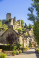
You’ll enjoy a view of Belcastel, one of the ‘Most Beautiful Villages in France’, with its castle and village, both of which were restored in the20th century.

Always be cautious and plan ahead when you're outdoors. Visorando and the author of this route cannot be held responsible for any accidents occurring on this route.

The GR® and PR® markings are the intellectual property of the Fédération Française de Randonnée Pédestre.

Reviews and comments

5 / 5
Based on 1 review

Reliability of the description
5 / 5
Ease of following the route
5 / 5
Route interest
5 / 5
Maiko
Maiko

Overall rating : 5 / 5

Date of your route : Jan 28, 2024
Reliability of the description : ★★★★★ Very good
Ease of following the route : ★★★★★ Very good
Route interest : ★★★★★ Very good
Very busy route : No

A lovely walk with plenty of scenic views.
On the way back, there’s a panoramic view of the village of Belcastel.
The climb is at the start.
Much of the walk follows a small road with little or no traffic before joining the Roman road.
Eliane

Machine-translated

Other walks in the area

For more walks, use our search engine .

The GPS track and description are the property of this route's author. Please do not copy them without permission.