


 Country:
 City:
City:


Start: Thornhill P&R, Oxford (SP 566 072)
(S) From the P&R, go under the subway into Merewood Avenue, then cross to Delbush Avenue and follow it to a footpath junction.
(1) Turn right and follow the path to the road at Forest Hill.
(2) Turn right, then left along the High Street. Keep ahead on the main road, but before the corner and the White Horse pub, take the side road on the left.
(3) Keep ahead at the path junction and follow the path to the bridge.
(4) Continue to the wood and turn right, now on the Oxfordshire Way (Unmarked).
(5) At the path junction at the end of the woods, turn right, then left at the second path junction. At the next junction, turn right on the hedged path.
(6) Turn left, then right on the road and cross the M40. Keep ahead at the crossroads into the village of Waterperry.
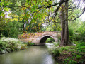
(7) Rejoin the path skirting the gardens and keep ahead. At the footpath sign, cross to the other side of the boundary and continue to the 18th Century Bow Bridge.
(8) Pass the mill, turn left at the lane, and just past the church, turn right through the gate, then bear left through the odd gate and right through another before going along a grassy path at the edge of the golf course.
(9) Turn right at the footpath sign and keep ahead with trees on the left. Cross the watercourse and at the end of the plantation bear left to reach the A 418.
(10) Carefully cross and turn left along the verge. At the end of the lay-by, take the footpath on the right to a grassy path across the meadow. Continue across a stile, then around properties. Turn right on an unmarked footpath to a lane, then jink left and right across a field to a residential road.
(11) Walk across into School Lane to a stile, then bear left across two fields and keep to the boundary up the hill.
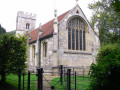
(12) Bear right on the lane at Albury and follow the Oxfordshire Way signs past St John the Baptist Church. Keep ahead up the hill and reaching a white road, bear right on the Oxfordshire Way, then left through the farmyard. After the gate bear left along the boundary into Rycote Park.
(13) Reaching the drive, turn right on the footpath, then double back past the 15th Century chapel. Follow the signs through the copse, then keep ahead on an enclosed path to the woods. Again, follow the signs to reach the main road.
(14) Cross Rycote Lane and follow the Oxfordshire Way signs across the golf course. Pass to the right of the clubhouse and solar panels to reach the cross-track.
(15) Turn left to leave the Oxfordshire Way. At the t-junction, turn left on a bridleway and keep ahead on the drive down the hill and into Morton.
There is a seat at the war memorial.
(16) At the junction by the second seat, turn left on a minor road which leads to a paved footpath to the right. Turn left on a cross-track, cross the cycleway with care and continue into the residential area and around the recreation ground. Continue to Thame High St and the X20 bus stops.(E)
 Visorando Member
 Easy
Easy  Moderate
  Association / Club / Walk leader
 Tourist office
