Radley to Oxford

This is the fourteenth and final stage of the multi-day route "Railways and Waterways, between Oxford and London".

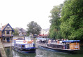
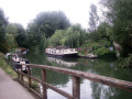
This riverside walk transitions gently from tranquil water meadows past Sandford and Iffley Locks, through a nature reserve, into the bustling outskirts of Oxford, where the boathouses of the various Oxford Colleges are evidence of the strong rowing culture of the city.

This walk is part of a multi-day hike: Railways and Waterways, between Oxford and London

Details

100525040
Creation:
Last update:
Last review:
  • Walking
    Activity: Walking
  • ↔
    Distance: 7.00 mi
  • ◔
    Average duration: 3h 15 
  • ▲
    Difficulty: Moderate

  • ⚐
    Back to start: No
  • ↗
    Ascent: + 36 ft
  • ↘
    Descent: - 30 ft

  • ▲
    Highest point: 213 ft
  • ▼
    Lowest point: 167 ft

Description of the walk

Start: Radley Station (SU 525 988)

(S) Leave the station through the car park. Turn right on Foxborough Road and right again over the bridge at the Thames Path sign.

(1) Bear left at the junction and at the bend in the road, take the footpath on the left to Sandford Lock.

(2) At the next Thames Path sign, leave the track and bear right across the middle of the field. Go under powerlines, enter woodland and continue to the riverbank.

(3) Turn left on the Thames Path.

(4) At the path junction just before the bridge to the lock, the Thames Path has been diverted inland, but to visit the lock and/or the Kings Arms, go over the bridge.

(5) From the Sandford Lock, turn back to the Thames Path diversion.

(4) To follow the diversion, turn left before the bridge, then turn right towards the railway.

(5) Follow the cycleway alongside the railway for nearly a mile.

(7) To rejoin the Thames Path, turn right then bear left across the field to the river bank.

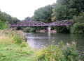
(8) Turn left and follow the Thames Path under the dismantled railway and cross the Hinksey Stream.
The Thames is now generally referred to as the Isis. The traffic on the A423 becomes louder.
Cross the road at the traffic lights and proceed to Iffley Lock and the Isis River Farmhouse.

(9) Keep following the Isis.
Although the route is now well into the suburbs of Oxford, there are plenty of green spaces. The river activities of the various colleges become more apparent. A row of boathouses marks the confluence of the River Cherwell and the Isis.
Go under the A4144, then the main line railway. Pass Osney Lock, cross Osney Island and soon reach the A429.

(10) Climb the steps on the far side of the bridge, turn right and follow the signs to the station.(E)

Waypoints

  1. S : mi 0 - alt. 197 ft - Radley Station
  2. 1 : mi 0.52 - alt. 184 ft - Junction - Bear left
  3. 2 : mi 1.09 - alt. 187 ft - Thames Path sign - Bear right
  4. 3 : mi 1.51 - alt. 177 ft - Riverbank - Turn left
  5. 4 : mi 2.16 - alt. 167 ft - Thames Path diversion
  6. 5 : mi 2.26 - alt. 174 ft - Sandford Lock
  7. 6 : mi 2.56 - alt. 203 ft - Railway - Turn right on the Cyclepath
  8. 7 : mi 3.45 - alt. 197 ft - Rejoin the Thames Path - Turn right
  9. 8 : mi 3.53 - alt. 184 ft - Riverbank - Turn left
  10. 9 : mi 4.25 - alt. 184 ft - Iffley Lock
  11. 10 : mi 6.8 - alt. 194 ft - A429 - Club steps and turn right
  12. E : mi 7 - alt. 203 ft - Oxford Station

Notes

Travel Information:

  • Start - Radley Station is on the main line to Oxford and Reading (Change at Didcot Parkway)
  • Finish - From Oxford Station, there are fast trains to Reading, where there are connections to London Terminals and all stations on the route.

OS Explorer Map

180

Grid References

  • Start SU 525 988
  • Finish SU 505 063

Refreshments and facilities

(7) To visit the Tandem pub, turn left and climb steeply over the railway.

Worth a visit

Other walks in the area

For more walks, use our search engine .

The GPS track and description are the property of this route's author. Please do not copy them without permission.