One way Dalcairney Falls & Auchenroy from Dalmellington
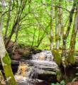
This walk brings you to visit the Dalcairnie Linn Waterfall. If you would like, extend it up to Auchenroy hill.
Technical sheet No. 29321796


Description
Start : Parking next to Dalmellington Community Centre, across from Jet Garage. Grid ref. NS 475 060
(D/A) From the car park, cross the main road (A713) and into Craigengillan Estate (signposted at the entrance).
(1) Cross over the bridge and turn right, following the burn on your right-hand past the Scout garden.
(2) At the road (B741), turn left and follow it to the bridge over the River Doon.
(3) Do not follow the trail at the layby going over the burn, instead, turn left before the bridge and over the wooden bridge, past the hut and onto the Dalcairney road and turn left. Follow the road for around 2km. Stay on the road up past the farm, falls are on the left when you get to the bridge.
(4) From here you can return to the start or continue to Auchenroy Hill. If you choose the second option, turn left and follow the road uphill past the sheep pens. Continue to follow the road going through the tall metal gate, passing through another roughly 700 metres later.
(5) Once approaching the wooden gate to Auldcraigoch, look to your right and go through the walker's gate, (slim metal gate next to the large one), and follow the walkway up to the next gate. Continue to follow the walkway then straight up the hill to the kissing gate, turn left over the style and follow the trail uphill.
After about 100 metres the trail becomes faint, but head left (North-West) a little and pick up another trail going straight up. You should not go too far, if you start going downhill, return back a little and head uphill. The cairn is at the summit.
(6) From Auchenroy summit, return to the first large metal gate just passed the sheep pens then follow the same route back to the car. (D/A)
Waypoints :
D/A : km 0 - alt. 167 m - Dalmellington Community Centre
1 : km 0.19 - alt. 166 m - Bridge
2 : km 0.78 - alt. 162 m - B741
3 : km 1.41 - alt. 162 m - Wooden bridge - River Doon
4 : km 3.62 - alt. 197 m - Dalcairnie bridge - Dalcairnie Linn Waterfall
5 : km 4.86 - alt. 227 m - Auldcraigoch
6 : km 6 - alt. 360 m - Auchenroy summit
D/A : km 12.01 - alt. 167 m - Dalmellington Community Centre
Useful Information
Start : Parking next to Dalmellington Community Centre, across from Jet Garage. Grid ref. NS 475 060
Parking : Parking next to Dalmellington Community Centre, across from Jet Garage.
Note : As with all walks, please remember the Scottish Outdoor Access Code.
For more information contact Doon Valley Walkers here.
Visorando and this author cannot be held responsible in the case of accidents or problems occuring on this walk.
Other walks in the area


This walk goes up Benwhat Monument from Dalmellington past the heritage of an old mining village.


An astonishingly beautiful short walk through a deep wooded glen following the River Doon as it begins it’s journey between Loch Doon and the Firth of Clyde at Doonfoot, Ayr. Expect waterfalls a-plenty! Form a loop by returning to the start via the hill path. The footpaths are uneven and narrow in places and you can expect boggy conditions on the high path. Be sure to take a camera as there are MANY photo opportunities!


This one-way walk brings you across the moor to Loch Bradan, with Loch Finlas to your right and Loch Doon all the way to Bradan dam. On the way, can you spot Olaf Cairn; a slab of stone standing up near Loch Bradan that looks like Olaf the snowman from Disney’s Frozen ?


Whilst in the village of Straiton you cannot help but wonder about the monument atop Craigengower (331m / 1086ft). This circular walk takes you up it’s steep slopes to the summit before a more gentle descent towards the Water of Girvan, returning to the start via pleasant riverside and woodland trails.


One of those hidden gems Ayrshire has to offer! This is an easy walk starting in the village of Straiton and taking you into a wooded glen to visit some surprisingly spectacular waterfalls.


This is a circular walk beginning in the quaint rural Ayrshire village of Straiton. Initially the route heads uphill to follow rough and sometimes overgrown, boggy tracks through an area of woodland. Enjoy fine views down into the village and the Galloway hills beyond. The return leg of the walk loops back into Straiton on a variety of terrain including farm tracks, grassy fields and surfaced roads.


This circular walk will bring you to visit Minehead. Then, go up to reach Coran of Portmark offering amazing views over Loch Doon Below on a clear day and come back via Black Craig.


This walk starts from Loch Doon Castle and goes up Wee Hill of Craigmulloch & Craiglee summits.
For more walks, use our search engine.
The GPS track and description are the property of the author.