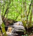
One of those hidden gems Ayrshire has to offer! This is an easy walk starting in the village of Straiton and taking you into a wooded glen to visit some surprisingly spectacular waterfalls.
(D/A) Leave the car park from the main entrance, cross Kirkmichael Road and turn left (North West). Almost immediately take the road on your right (North East) signposted Fowler’s Croft.
Walk along this residential street passing some pretty cottages on your left-hand side and a small burn on your right-hand side.
(1) At the end of the road follow a narrow track straight ahead into the trees (path not shown on map). You will emerge onto B741/Dalmellington Road.
(2) Turn left (East) and walk along the roadside for 750m. Shortly after passing a farm road on your right, you will come to a small parking area on your left-hand side (The walk can be shortened and the B road avoided by parking here).
You will see a footpath leading through a dry stone wall to a picnic bench. From the picnic bench follow the track right (North East) - only shown on OS map - which will lead you into the woods and past a series of lovely waterfalls. The Lambdoughty Burn should be on your left-hand side.
(3) After approx 500m cross a footbridge and follow the footpath (not shown on map) West along the other side of the burn, this time with several sets of steps and footbridges keeping things interesting.
(4) Eventually the path reaches it’s lowest point at a large footbridge and starts to head quite steeply uphill back to the picnic bench (2).
From here retrace your steps back to the car park (D/A)
Waypoints :
D/A : km 0 - alt. 109m - Car park off Kirkmichael Road, Straiton (KA19 7NF)
1 : km 0.29 - alt. 112m - Narrow track leading to B741, not shown on map
2 : km 1.15 - alt. 157m - Small parking area
3 : km 1.73 - alt. 184m - Footbridge
4 : km 2.24 - alt. 150m - Footbridge
D/A : km 3.45 - alt. 109m - Car park off Kirkmichael Road, Straiton (KA19 7NF)
For more information and a walk review visit Gillian's Walks
Transport
Terrain
A mixture of tarmac roads and woodland footpaths. Several sets of steps.
Visorando and this author cannot be held responsible in the case of accidents or problems occuring on this walk.
This is a circular walk beginning in the quaint rural Ayrshire village of Straiton. Initially the route heads uphill to follow rough and sometimes overgrown, boggy tracks through an area of woodland. Enjoy fine views down into the village and the Galloway hills beyond. The return leg of the walk loops back into Straiton on a variety of terrain including farm tracks, grassy fields and surfaced roads.
Whilst in the village of Straiton you cannot help but wonder about the monument atop Craigengower (331m / 1086ft). This circular walk takes you up it’s steep slopes to the summit before a more gentle descent towards the Water of Girvan, returning to the start via pleasant riverside and woodland trails.
A brilliant and fairly easy circular walk from the Stinchar Bridge to the top of Cornish Hill, returning via the secluded and peaceful Cornish Loch. Fantastic views on a clear day!
An astonishingly beautiful short walk through a deep wooded glen following the River Doon as it begins it’s journey between Loch Doon and the Firth of Clyde at Doonfoot, Ayr. Expect waterfalls a-plenty! Form a loop by returning to the start via the hill path. The footpaths are uneven and narrow in places and you can expect boggy conditions on the high path. Be sure to take a camera as there are MANY photo opportunities!
Beautifully scenic forestry tracks take you along to Kirstie’s Cairn, a memorial to young local farmer Christopher McTaggart who lost his life there in a blizzard in 1913.
A stunning circular route through the idylic South Ayrshire countryside, the Fairy Knowe Trail is most definitely one of Scotland’s hidden gems. The walk follows a variety of forest tracks, mossy tree corridors, and hillside footpaths to reach a viewpoint known as the Fairy Knowe. After a short but steep descent, the track returns to the start following the course of the Water of Gregg.
The walk starts and ends as a beach walk from Croyburnfoot, returning via Culzean Country park. The walk takes in woodland tracks to climb to the summit of Mochrum Hill, which overlooks the county park and gives fine views over the Ayrshire coast and surrounding countryside.
An easy walk starting at Seafield in Ayr and passing through Prestwick en route to Troon Marina. After the initial section through Ayr’s industrial backroads, you can enjoy sandy beaches and concrete promenades for the remainder of the route. Finish with the excitement of Troon’s cliff walk along the Ballast Bank.
For more walks, use our search engine.
The GPS track and description are the property of the author.