


Old Man Of Coniston
Details
Creation:
Last update:
–
–
-
 Activity: Walking
 -
 Distance: 8.60 mi
 -
 Average duration: 6h 15
 -
 Difficulty: Not specified
 -
-
 Back to start: Yes
 -
 Ascent: + 2,605 ft
 -
 Descent: - 2,582 ft
 -
-
 Highest point: 2,615 ft
 -
 Lowest point: 617 ft
-
 Country:
United Kingdom
Country:
United Kingdom
-
 Area: Lake District
 -
 Start/End: N 54.395606° / W 3.169763°
 -


 Hour-by-hour weather
 City:
City:


Waypoints
- S/E : mi 0 - alt. 650 ft
- 1 : mi 6.5 - alt. 2,352 ft - Stopover 1
- 2 : mi 6.5 - alt. 2,352 ft - Continue
- S/E : mi 8.6 - alt. 650 ft
Other walks in the area
Little Stand, The Crinkles and Bowfell : From Cockley Beck
 Visorando Member
 8.60 mi
+2,789 ft
-2,759 ft
6h 25
8.60 mi
+2,789 ft
-2,759 ft
6h 25
 Difficult
 Departure from Ulpha (Cumberland)
A lovely walk taking in the excellent and interesting Crinkle Crags and with great views down Great Langdale, over to the Scafell group and south down the Duddon Valley. The start up Little Stand and the descent from Ore Gap are without the heavily trodden paths now common in the Lake District.
There are a few small parking spaces near Cockley Beck heading west towards Hardknott Pass. Please park sensibly so other walkers and climbers and get in too.
The Scafells from Eskdale
11.77 mi
+3,927 ft
-4,039 ft
8h 50
Difficult
Departure from Eskdale (Cumberland)
This challenging Lake District walk includes Scafell and Scafell Pike in a single circuit using the long approach from the Esk Valley. There are some sections of the route that require care and experience in map reading is essential.
Harter Fell and Low Birker Tarn (Eskdale)
6.62 mi
+2,260 ft
-2,267 ft
5h 00
Difficult
Departure from Eskdale (Cumberland)
Harter Fell occupies a relatively isolated position overlooking the Eskdale valley and this Lake District walk offers some wonderful views towards Scafell and Scafell Pike. The route also includes a visit to pretty Low Birker Tarn, which sees relatively few visitors.
Hardknott fort and Tongue Pot
 4.78 mi
+725 ft
-725 ft
2h 50
4.78 mi
+725 ft
-725 ft
2h 50
 Easy
Departure from Eskdale (Cumberland)
Easy
Departure from Eskdale (Cumberland)
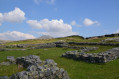
Walk to Hardknott fort and Tongue Pot. Dog friendly walk. Perfect walk to go wild swimming.
Slight Side from Whahouse Bridge
2.95 mi
+2,156 ft
-0 ft
3h 15
 Moderate
Departure from Eskdale (Cumberland)
Moderate
Departure from Eskdale (Cumberland)
A Lake District walk to a summit often only visited in passing. The route starts in Eskdale and takes a direct approach to the top.
YHA hopping in The Lake District - YHA Eskdale to YHA Coniston Holly How
 Association / Club / Walk leader10.16 mi
+3,947 ft
-3,983 ft
8h 05
Difficult
Departure from Eskdale (Cumberland)
Association / Club / Walk leader10.16 mi
+3,947 ft
-3,983 ft
8h 05
Difficult
Departure from Eskdale (Cumberland)
The YHA is a great institution and I guess most fell walkers have stayed at a hostel at some time in their lives. Funny how they were created "to help all, especially young people of limited means, to a greater knowledge, love and care of the countryside, particularly by providing hostels or other simple accommodation for them on their travels". Here's a collection of routes starting or finishing at a YHA in The Lakes. Along the way are 3 Wainwrights, 4 tarns and 1 pub.
Seathwaite tarn
 5.66 mi
+948 ft
-948 ft
3h 25
Moderate
Departure from Dunnerdale-with-Seathwaite (Westmorland and Furness)
5.66 mi
+948 ft
-948 ft
3h 25
Moderate
Departure from Dunnerdale-with-Seathwaite (Westmorland and Furness)
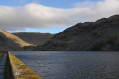
Lovely circular walk to Seathwaite tarn from the village of Seathwaite.
Hall Dunnerdale to Dow Crag and the Old Man back via Seathwaite Tarn
14.30 mi
+3,163 ft
-3,133 ft
9h 20
Difficult
Departure from Dunnerdale-with-Seathwaite (Westmorland and Furness)
A long and interesting walk from Hall Dunnerdale which could also be started from other places nearby. You will take in some lovely rolling countryside followed by a gradual ascent up a picturesque valley before making the climb up to Brown Pike. From here you are on the high Lakeland fells and take in numerous tops including the Old Man of Coniston. You descend carefully to Seathwaite Tarn and then back to Seathwaite where the Newfield Inn will welcome you with great beer and food.
For more walks, use our search engine .
The GPS track and description are the property of this route's author. Please do not copy them without permission.

