Country:

 City:


From Le Boulou, take the D115, passing through Céret and Amèlie-les-Bains, and head to Prats-de-Mollo-la-Preste. Cross the River Tech and the roundabout after the bridge, turn right towards La Preste via theD115A, and immediately turn right down into the large car park. Toilets are available.
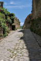
(S/E) From this car park below, near the River Tech, head back up towards the roundabout across the grassy terraces. Turn left onto the pavement to cross the road bridge over the River Tech and stay on the paved pavement on the left until you reach the gate of the fortified town. Continue straight ahead, climbing a flight of stairs made of wide, high concrete steps. Then continue uphill along a street with its cobbled pavements (in the literal sense of the word) until you reach the corner of the cemetery.
Yellow and white markings
(1) Turn right and head uphill, following the cemetery wall to its end. Continue up the steep, well-marked path, which first turns right then left, until you reach a cross-track much higher up. Fort Lagarde is on your right.
(2) Cross it and continue uphill opposite across the pasture for about fifty metres. Look out for a signpost: ‘Sant Guillem’; head down to the right following this direction, cross the stream (signposted ‘Saint-Jean’) and carry on until you reach another track suitable for vehicles (elevation 971) with an old wooden signpost.
(3) Cross it, heading towards Cavanelle (Cabanelles), and further up you’ll reach this still-inhabited spot with plenty of livestock. You’ll finally emerge at a junction of four tracks in a large area used for storing agricultural equipment (elevation 1105) with a wooden enclosure on your right. Please respect this area. Thank you.
(4) At the signpost, strangely situated at the junction of the two tracks on the right, take the second stony, motorable track on the right, heading towards Sant Guillem. Head due north, north-west along this track.
At an altitude of around 1,140 m, pass a track on your left; 100 m further on, turn sharply left and arrive at a fork (elevation 1,182).
(5) Pass another track on the left and eventually come to a gate consisting of a high wire fence and a small gate at the edge of the woodland.
(6) Without going through this gate, head up to the right, keeping the fence on your left. A little further up, you’ll reach a patch of sparse woodland where you’ll spot a wooden gate on your left (alt. 1,220 m).
(7) Go through it and close it behind you, then climb very steeply along a lovely, fairly wide, grassy path. You’ll reach a track (alt. 1,330 m).
(8) Follow it to the right, continuing to climb steeply along this good path. You’ll reach the highest point of this path, at an electric fence (alt. 1,385 m). Puig de les Lloses is up to the right.
(9) Cross the fence and head down the other side along a sloping path through the woods. A little further on, you’ll reach a junction (alt. 1,400 m) with a variety of signposts. I’ve added the direction ‘Sant Guillem’ to the old wooden sign on the right. * (see section: Practical Information).
Yellow markings
(10) Turn right and walk for about 50 metres, then confirm the direction to Sant Guillem via a new signpost. I don’t know how they manage to make the signposting so confusing.
Now follow this lovely path as it climbs north-westwards. It veers north-east, then continues to climb due north. You’ll emerge into a vast grazing area at Coll de Comella (elevation 1557). I’ve patched up the wooden signpost.
Yellow and red markings for theGRP® Tour du Vallespir
(11) Look out for the markings on a tree in the woodland, 50 metres to the left. Leave the direction of Sant Guillem and set off along this lovelyGRP® trail via a lovely descent through the woodland. After following this very pleasant, easy path, you’ll reach a vast open area where three tracks meet at Faig Xintat. A lovely spot for a break.
Red and white markings forthe GRT®83, which takes over from theGRP®
(12) Turn left onto theGRT®83via the track that looks abandoned (with bushes growing in the middle). After heading south, you’ll reach the Coll del Miracle further on (signpost). A lovely spot for a break.
(13) Leave the track. Head down to the right along a good path (GRT®83) clearly marked on the ground with red and white markings, and you’ll soon reach a fork.
(14) Continue straight ahead on theGRT®83, which follows the bed of a stream. Take care in wet or rainy conditions. Pass the Còrrec del Castilló, turn south-east and reach a cross-track (elevation 1163).
(15) Cross it and carry on straight ahead until you reach a fence.
(16) Cross it via the small underpass until you reach, much further down, another fence at a small road (Camí de Tellet).
(17) Cross this, again using the small gap in the fence. Then follow the road to the right and keep an eye out for a house on the left, 400 m further on. Look out for the red and white markings on the left.
(18) Leave the road and head down past the Mas de la Vidala (please respect this residential area). After passing through some old terraced gardens, you’ll arrive further down on the outskirts of the walled town, joining the Route du Verger.
Yellow and white markings
(19) Leave the road on your right and turn left along the fortress’s surrounding wall. You’ll come to a street with cobbled pavements. Walk up it until you reach the corner of the cemetery you passed on the way there.
(1) Follow the route back in the opposite direction to reach the car park on the banks of the Tech (S/E).

 Visorando Member

 Difficult