


Nigel Barge 5 Mile Road Race 1943
Details
Creation:
Last update:
-
 Activity: Walking
 -
 Distance: 5.00 mi
 -
 Average duration: 2h 30
 -
 Difficulty: Not specified
 -
-
 Back to start: No
 -
 Ascent: + 200 ft
 -
 Descent: - 190 ft
 -
-
 Highest point: 203 ft
 -
 Lowest point: 72 ft
-
 Country:
United Kingdom
Country:
United Kingdom
-
 City:
Glasgow
City:
Glasgow -
 Start: N 55.889432° / W 4.293261°
 -
 End: N 55.888428° / W 4.296679°
 -


 Hour-by-hour weather


Waypoints
- S : mi 0 - alt. 115 ft - Start on Balfour Street
- 1 : mi 0.54 - alt. 164 ft - Turn slight left onto Kelvindale Road
- 2 : mi 0.55 - alt. 164 ft - Turn right onto Cleveden Road
- 3 : mi 0.68 - alt. 187 ft - Turn slight right onto Cleveden Road
- 4 : mi 0.94 - alt. 128 ft - Turn slight right onto Clevedon Road
- 5 : mi 0.96 - alt. 131 ft - Turn left onto Dalsholm Road
- 6 : mi 1.02 - alt. 144 ft - Turn left onto Temple Road
- 7 : mi 1.51 - alt. 125 ft - Turn left onto Bearsden Road, A739
- 8 : mi 1.51 - alt. 125 ft - Turn left onto Temple Road
- 9 : mi 1.51 - alt. 125 ft - Turn right onto Bearsden Road, A739
- 10 : mi 2.56 - alt. 118 ft - Enter the roundabout and take the 3rd exit onto Canniesburn Toll
- 11 : mi 2.68 - alt. 115 ft - Turn slight right onto Maryhill Road, A81
- 12 : mi 3.29 - alt. 125 ft - Enter the roundabout and take the 2nd exit onto Maryhill Road, A81
- 13 : mi 4.67 - alt. 115 ft - Turn right onto Kelvindale Road
- E : mi 5 - alt. 98 ft
Other walks in the area
Greggs, Parade, Drygate circuit
 Visorando Member2.38 mi
+79 ft
-85 ft
1h 10
Visorando Member2.38 mi
+79 ft
-85 ft
1h 10
 Easy
Departure from Glasgow
Easy
Departure from Glasgow
An easy urban circuit around Dennistoun starting from Greggs on Duke Street. Along Alexandra Parade to the Royal then down towards Drygate. Back on to Duke street past the brewery to complete the circuit.
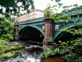
Kelvin Walkway: Milngavie to Partick
 Tourism professional
 10.58 mi
+10 ft
-151 ft
4h 50
10.58 mi
+10 ft
-151 ft
4h 50
 Average
Departure from East Dunbartonshire
Average
Departure from East Dunbartonshire
This 10 mile route along the River Kelvin feels surprisingly rural when walked from North to South, with the hustle and bustle of the city becoming more apparent the further along you go. Rather poorly way-marked for the first half, signage is then very easy to follow for the remainder of the route down to the Riverside Museum, where the Kelvin meets the Clyde.
From Milngavie to Drymen
 12.70 mi
+564 ft
-528 ft
6h 20
12.70 mi
+564 ft
-528 ft
6h 20
 Difficult
Departure from East Dunbartonshire
Difficult
Departure from East Dunbartonshire
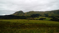
The first stage of the WHW, which presents no difficulty other than its distance, takes us through the Scottish countryside and introduces us to the first hills of the Highlands.
The West Highland Way
 96.87 mi
+9,957 ft
-10,026 ft
7 days
Difficult
Departure from East Dunbartonshire
96.87 mi
+9,957 ft
-10,026 ft
7 days
Difficult
Departure from East Dunbartonshire
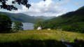
The West Highland Way (WHW) is a very popular circular route in Scotland. Covering over 150km with moderate elevation changes, it crosses the westernmost (as its name suggests) and southernmost (so to speak) parts of the Highlands.
A superb hike, characterised by the diversity of the landscapes, the ever-present water (lakes, rivers, torrents, waterfalls… and rain), and the rugged beauty of the terrain. Last but not least, you’re sure to meet some very friendly people along the way!
The West Highland Way - Stage One (Milngavie to Balmaha)
 Association / Club / Walk leader19.11 mi
+1,594 ft
-1,690 ft
10h 10
Average
Departure from East Dunbartonshire
Association / Club / Walk leader19.11 mi
+1,594 ft
-1,690 ft
10h 10
Average
Departure from East Dunbartonshire
The West Highland Way is the most established of Scotland’s long distance walking routes. This is the first of a five stage route, staying at prebooked accomodation along the way.
The West Highland Way in Five Days
93.09 mi
+9,695 ft
-9,810 ft
5 days
Difficult
Departure from East Dunbartonshire
The West Highland Way is the most established of Scotland’s long distance walking routes. Officially opened on 6th October 1980, it celebrated its 40th anniversary in 2020. The WHW stretches 96 miles (154 Km) from Milngavie to Fort William, taking in a huge variety of scenery along the way, from countryside parks to loch-shores and open moorlands to steep mountains. This is a five stage route, staying at prebooked accomodation along the way.
The Whangie, Kilpatrick Hills
 2.74 mi
+509 ft
-509 ft
1h 40
Average
Departure from Stirling
2.74 mi
+509 ft
-509 ft
1h 40
Average
Departure from Stirling
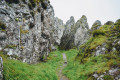
This massive and unique rocky outcrop seems to appear out of nowhere on an otherwise grassy hillside. Situated at an elevation of 300m (984 ft), the 10m high rocks have a narrow passageway through the middle, formed during the Ice Age.
Duncarnock Fort (The Craigie) from Neilston
 4.84 mi
+305 ft
-315 ft
2h 30
Easy
Departure from East Renfrewshire
4.84 mi
+305 ft
-315 ft
2h 30
Easy
Departure from East Renfrewshire
Duncarnock Fort (known locally as The Craigie) is a craggy hill (204 m / 669 ft) which stands invitingly on the banks of Glanderston Dam. Pausing on the summit of what was formerly an iron age fort, take a moment to wonder about it’s history and all that may have happened here many years ago! On a clear day, just as Mary Queen of Scots is rumoured to have done, you will enjoy panoramic views over greater Glasgow extending to the Campsies in the north.
For more walks, use our search engine .
The GPS track and description are the property of this route's author. Please do not copy them without permission.

