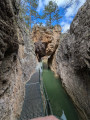
Source of the River Cuervo – Pico San Felipe

An easy hike from the source of the Rio Cuervo (beautiful waterfalls, very, very popular) to the highest point of the massif, San Felipe (1,838 m), via its northern slope. It is a dome-shaped peak from which you can enjoy a stunning 360° panorama on a clear day.
It can be done on foot in all seasons as there is often shade, and even on snowshoes in winter.
The hike takes place within the Serrania de Cuenca Natural Park.

Details

n°2502064
Creation:
Last update:
Last review:
  • Walking
    Activity: Walking
  • ↔
    Distance: 7.02 mi
  • ◔
    Average duration: 4h 20 
  • ▲
    Difficulty: Moderate

  • ⚐
    Back to start: Yes
  • ↗
    Ascent: + 1,273 ft
  • ↘
    Descent: - 1,270 ft

  • ▲
    Highest point: 5,991 ft
  • ▼
    Lowest point: 4,718 ft

Photos

Description of the walk

From the large car park and picnic area built for visitors to the Nasciemiento del Rio Cuervo, we’ll follow thePR® CU 79 marked trail (yellow and white markings) which will take us to Pico San Felipe.

(S/E) For a few minutes, head down towards the road, but very soon the well-marked path turns eastwards and climbs until it overlooks the Rio Cuervo cirque (with beautiful cliffs opposite). The path then bends southwards and you’ll come to a sign (alt. 1,621 m) indicating that you’ve covered 1.3 km and have 4.3 km to go!

(1) Continue along the path. A few minutes later, you’ll reach the first junction (alt. 1,625 m).

(2) Carry on south-east along the path, which remains fairly flat, and in 10 minutes you’ll reach asecond junction with several paths (alt. 1,624 m).

(3) Take the path heading south-east and continue through meadows and woodland for about twenty minutes until you see a series of cascading drinking troughs and a lovely fountain with fresh water (alt. 1,665 m).

(4) Carry on in the same direction, though through more woodland, for a few minutes. You’ll reach a clearing with an information board (alt. 1,718 m).

(5) A slight bend to the right takes you into the head of a small valley, which is dry at this time of year, then you continue through the forest on a very gentle incline. The path is very well marked and begins to climb with a few bends before reaching the foot of the San Felipe dome, which you round via a final bend where you come across another signposted path.

Head due west-north-west to reach the summit. There is a concrete platform, a boundary marker and a small wooden post. The 360° panorama is truly magnificent.

(6) We’ll take exactly the same route back to the car park (S/E).

Waypoints

  1. S/E : mi 0 - alt. 4,718 ft - Car park at the source of the Rio Cuervo
  2. 1 : mi 0.8 - alt. 5,328 ft - Sign
  3. 2 : mi 1.06 - alt. 5,361 ft - First junction
  4. 3 : mi 1.55 - alt. 5,371 ft - Junction of several paths
  5. 4 : mi 2.39 - alt. 5,495 ft - Fountain
  6. 5 : mi 2.7 - alt. 5,656 ft - Information board
  7. 6 : mi 3.51 - alt. 5,988 ft - Summit of San Felipe
  8. S/E : mi 7.02 - alt. 4,721 ft - Car park at the source of the Rio Cuervo

Notes

Water points at the start of the walk and around the halfway point.
When walking from north to south, the climb up to San Felipe presents no difficulty.
Complete tranquillity as soon as you leave the car park.

Worth a visit

(S/E) On the way back or upon arrival, a visit to the spring and waterfalls of the Rio Cuervo is a must (it’s very busy).
There are restaurants nearby, on the main road.

An alternative route for the return journey is possible towards the end, taking a path that heads north towards the waypoint (2), runs along the top of the Rio Cuervo cirque for quite some time before joining a track that winds its way down to the main road.

If you’ve arranged for a vehicle, you can head down from San Felipe towards San Blas, following the course of another major river, the Rio Júcar. At the end of the small road, there’s a small car park just before the narrows of the Rio Júcar (Fuente San Blas: 40.371068, -1.829523). This will add a few kilometres, but, judging by the photos I’ve seen, the landscape is completely different (and it’s certainly more common for Spaniards to do the hike from south to north).

Always be cautious and plan ahead when you're outdoors. Visorando and the author of this route cannot be held responsible for any accidents occurring on this route.

The GR® and PR® markings are the intellectual property of the Fédération Française de Randonnée Pédestre.

Reviews and comments

4.7 / 5
Based on 1 review

Reliability of the description
5 / 5
Ease of following the route
5 / 5
Route interest
4 / 5
bricoleur
bricoleur

Overall rating : 4.7 / 5

Date of your route : Sep 30, 2019
Reliability of the description : ★★★★★ Very good
Ease of following the route : ★★★★★ Very good
Route interest : ★★★★☆ Good

a brilliant walk

Machine-translated

For more walks, use our search engine .

The GPS track and description are the property of this route's author. Please do not copy them without permission.