Montsup via the Bois de Bazourge

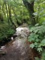
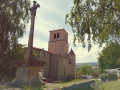
A pleasant walk through the woods leading to the Montsupt Chapel, offering a beautiful panoramic view of the Plaine du Forez.

Details

n°4912619
Creation:
Last update:
Last review:
  • Walking
    Activity: Walking
  • ↔
    Distance: 9.62 mi
  • ◔
    Average duration: 5h 20 
  • ▲
    Difficulty: Moderate

  • ⚐
    Back to start: Yes
  • ↗
    Ascent: + 1,040 ft
  • ↘
    Descent: - 1,040 ft

  • ▲
    Highest point: 2,018 ft
  • ▼
    Lowest point: 1,293 ft

Description of the walk

Park on Rue du 8 Mai 1945.

(S/E) Setting off from the centre of Saint-Romain-le-Puy, head towards Saint-Marcelin-en-Forez. Follow the railway line, turn right and cross the River Fumeuse. Continue for a further 200 m.

(1) Turn right onto Rue de l’Heurt to reach this hamlet, then turn left onto Rue des Marronniers to go round the woods before entering them.

(2) Head up into the Bois de Bazourges opposite, follow the main path, pass through Bel-Air and continue for about 200 metres.

(3) Turn right into the Bois de Mazenod, then right and twice left until you reach Pécharrat.

(4) Then turn right towards the hamlet of Les Varrats to join a road leading to Fontvial.

(5) At Fontvial, carry on, heading down the D109 towards Saint-Georges-Haute-Ville and pass the quarry on your left.

(6) Before the left-hand bend, at the 484-metre mark, turn left onto the path leading up through the woods, then turn right and then left to reach Les Peyrons at a crossroads with multiple directions.

(7) Follow the D5 to the right for a few metres, then leave it and take the path on the left which climbs up to Montsupt.

(8) At the junction, turn right then immediately left to reach the Montsupt Chapel. Walk round the Pic de Montsupt.

(9) Turn left at a place called l’Abreuvoir, then, 150 metres further on, at the cross, turn left, following theGR®765.

(10) At Les Genettes, continue along the small road down into the village of Saint-Georges-Haute-Ville.

(11) At the entrance to the village, at the junction, continue downhill to the Statue of the Pilgrim.

(12) At the statue, take the small road (Route des Loubatières) which runs alongside the castle and descends steeply to a four-way junction at a place called Les Loubatières.

(13) Continue along theGR® 765 East, following the path downwards.

(14) At the end of the path, turn right onto Rue du Huit Mai (S/E).

Waypoints

  1. S/E : mi 0 - alt. 1,309 ft - Rue du 8 Mai 1945. On the other side of the - Gare de St-Romain-le-Puy
  2. 1 : mi 0.9 - alt. 1,306 ft - Rue de l’Heurt
  3. 2 : mi 1.56 - alt. 1,398 ft - Bois de Bazourge
  4. 3 : mi 2.42 - alt. 1,611 ft - Mazenod Wood
  5. 4 : mi 3.41 - alt. 1,755 ft - Pécharrat
  6. 5 : mi 3.95 - alt. 1,693 ft - Fontvial
  7. 6 : mi 5.09 - alt. 1,591 ft - Terland
  8. 7 : mi 6.22 - alt. 1,837 ft - Les Peyrons
  9. 8 : mi 6.48 - alt. 1,926 ft - Montsupt – chapel
  10. 9 : mi 6.97 - alt. 1,903 ft - L’Abreuvoir
  11. 10 : mi 7.66 - alt. 1,647 ft - Les Genettes
  12. 11 : mi 8.43 - alt. 1,499 ft - Saint-Georges-Haute-Ville
  13. 12 : mi 8.55 - alt. 1,480 ft - The Castle
  14. 13 : mi 9.06 - alt. 1,378 ft - Les Loubatières
  15. 14 : mi 9.49 - alt. 1,309 ft - Rue du Huit Mai
  16. S/E : mi 9.62 - alt. 1,309 ft - Rue du 8 Mai 1945. On the other side of the - Gare de St-Romain-le-Puy

Always be cautious and plan ahead when you're outdoors. Visorando and the author of this route cannot be held responsible for any accidents occurring on this route.

The GR® and PR® markings are the intellectual property of the Fédération Française de Randonnée Pédestre.

Reviews and comments

5 / 5
Based on 1 review

Reliability of the description
5 / 5
Ease of following the route
5 / 5
Route interest
5 / 5
Aldebertus
Aldebertus

Thank you! I’m delighted you liked it.

Machine-translated

gilbonson
gilbonson

Overall rating : 5 / 5

Date of your route : Nov 25, 2024
Reliability of the description : ★★★★★ Very good
Ease of following the route : ★★★★★ Very good
Route interest : ★★★★★ Very good
Very busy route : Yes

A very pleasant walk.
Thanks to the person who created the route.

Machine-translated

Other walks in the area

For more walks, use our search engine .

The GPS track and description are the property of this route's author. Please do not copy them without permission.