


Malham 8/11/15 LUHC
Details
Creation:
Last update:
–
–
-
 Activity: Walking
 -
 Distance: 13.21 mi
 -
 Average duration: 7h 00
 -
 Difficulty: Not specified
 -
-
 Back to start: No
 -
 Ascent: + 1,017 ft
 -
 Descent: - 1,033 ft
 -
-
 Highest point: 1,322 ft
 -
 Lowest point: 574 ft
-
 Country:
United Kingdom
Country:
United Kingdom
-
 Area: Yorkshire Dales
 -
 City:
Malham
City:
Malham -
 Start: N 54.060131° / W 2.154779°
 -
 End: N 54.06188° / W 2.15213°
 -


 Hour-by-hour weather


Waypoints
- S : mi 0 - alt. 646 ft
- 1 : mi 0.05 - alt. 636 ft - Head east toward Chapel Gate
- 2 : mi 0.06 - alt. 633 ft - Turn left onto Chapel Gate
- 3 : mi 0.14 - alt. 633 ft - Turn left
- 4 : mi 0.14 - alt. 633 ft - Head north on Chapel Gate toward Cove Rd
- 5 : mi 0.18 - alt. 636 ft - Turn right
- 6 : mi 0.19 - alt. 636 ft - Head northeast
- 7 : mi 0.21 - alt. 636 ft - Turn left
- 8 : mi 0.26 - alt. 643 ft - Head north on Cove Rd toward Back Ln
- 9 : mi 0.46 - alt. 669 ft - Head west on Cove Rd toward Back Ln
- 10 : mi 0.62 - alt. 751 ft - Head southeast on Cove Rd
- 11 : mi 0.65 - alt. 732 ft - Sharp left
- 12 : mi 0.94 - alt. 722 ft - Head north toward Pennine Way
- 13 : mi 1.13 - alt. 751 ft - Head south
- 14 : mi 1.14 - alt. 748 ft - Slight right
- 15 : mi 1.18 - alt. 751 ft - Head west on Pennine Way toward Cove Rd
- 16 : mi 1.34 - alt. 1,014 ft - Head east on Pennine Way toward Cove Rd
- 17 : mi 1.46 - alt. 994 ft - Head east on Pennine Way toward Cove Rd
- 18 : mi 1.47 - alt. 994 ft - Turn left onto Cove Rd/Pennine Way
- 19 : mi 2.08 - alt. 1,191 ft - Head north on Cove Rd/Pennine Way
- 20 : mi 2.62 - alt. 1,214 ft - Head north on Cove Rd/Pennine Way
- 21 : mi 2.69 - alt. 1,217 ft - Turn left
- 22 : mi 2.7 - alt. 1,217 ft - Head northwest toward Cove Rd
- 23 : mi 3.22 - alt. 1,247 ft - Head northwest toward Cove Rd
- 24 : mi 3.63 - alt. 1,289 ft - Turn right at Cove Rd
- 25 : mi 3.63 - alt. 1,293 ft - Head north
- 26 : mi 4.18 - alt. 1,250 ft - Slight right
- 27 : mi 4.5 - alt. 1,247 ft - Head east toward Pennine Way
- 28 : mi 4.63 - alt. 1,247 ft - Continue straight onto Pennine Way
- 29 : mi 4.79 - alt. 1,240 ft - Head southeast on Pennine Way
- 30 : mi 5.07 - alt. 1,316 ft - Head southeast on Pennine Way
- 31 : mi 5.26 - alt. 1,240 ft - Head southeast on Pennine Way
- 32 : mi 5.9 - alt. 1,243 ft - Head south
- 33 : mi 6.38 - alt. 1,276 ft - Turn left
- 34 : mi 6.38 - alt. 1,276 ft - Head east
- 35 : mi 6.79 - alt. 1,181 ft - Head east
- 36 : mi 7.52 - alt. 1,306 ft - Continue onto Mastiles Ln
- 37 : mi 7.53 - alt. 1,306 ft - Head east on Mastiles Ln
- 38 : mi 8.5 - alt. 1,257 ft - Head southeast
- 39 : mi 8.73 - alt. 1,181 ft - Head southwest
- 40 : mi 8.75 - alt. 1,181 ft - Continue onto Smearbottoms Ln
- 41 : mi 9.15 - alt. 1,204 ft - Continue onto Hawthorns Ln
- 42 : mi 9.18 - alt. 1,207 ft - Turn left
- 43 : mi 9.18 - alt. 1,207 ft - Head west toward Hawthorns Ln
- 44 : mi 9.19 - alt. 1,207 ft - Turn left onto Hawthorns Ln
- 45 : mi 10.02 - alt. 741 ft - Head southwest on Hawthorns Ln toward Gordale Ln
- 46 : mi 10.04 - alt. 735 ft - Continue onto Gordale Ln
- 47 : mi 10.12 - alt. 745 ft - Turn left
- 48 : mi 10.13 - alt. 741 ft - Head south toward Pennine Way
- 49 : mi 10.58 - alt. 653 ft - Head southwest toward Pennine Way
- 50 : mi 11.11 - alt. 623 ft - Head south on Pennine Way
- 51 : mi 11.62 - alt. 728 ft - Head south on Pennine Way
- 52 : mi 11.78 - alt. 712 ft - Turn right to stay on Pennine Way
- 53 : mi 11.79 - alt. 709 ft - Head south on Pennine Way toward Green Gate
- 54 : mi 12.01 - alt. 574 ft - Turn left onto Green Gate
- 55 : mi 12.02 - alt. 574 ft - Head north on Green Gate
- 56 : mi 13.11 - alt. 633 ft - Head northwest toward Chapel Gate
- 57 : mi 13.12 - alt. 636 ft - Turn right onto Chapel Gate
- 58 : mi 13.14 - alt. 636 ft - Head north on Chapel Gate toward Cove Rd
- 59 : mi 13.15 - alt. 636 ft - Turn right
- E : mi 13.21 - alt. 643 ft
Other walks in the area
Malham, Kirkby Malham and Airton Circular
 Visorando Member
 6.06 mi
+594 ft
-607 ft
3h 20
6.06 mi
+594 ft
-607 ft
3h 20
 Moderate
Departure from Malham (North Yorkshire)
Moderate
Departure from Malham (North Yorkshire)
This is an easy circular walk from Malham, heading South to Kirkby Malham and then Airton. The walk up from Malham affords good views back to Malham Cove and the passes through varied farmland scenery. St Michael's Church at Kirkby Malham is worth a visit and the farm shop at Airton provides a good mid-walk stop for refreshments. The riverside path back provides further interest with views of Hanlith Hall, the old mill at Scalegill and Aire Head, which is the source of the River Aire.
Janet' Foss, Gordale Scar, Weets Top and Hanlith Moor.
 6.32 mi
+899 ft
-909 ft
3h 40
Moderate
Departure from Malham (North Yorkshire)
6.32 mi
+899 ft
-909 ft
3h 40
Moderate
Departure from Malham (North Yorkshire)
A circular route which can be done in either direction. As described it leaves Malham village on the good paths to the popular Janet's Foss waterfall, then it takes in the valley leading into Gordale Scar, returning to the road and up the hill until a track leads to the summit of Weets Top. The gentle descent of Halton Moor provides a different landscape and leads to Hanlith where you pick up the Pennine Way path back to Malham.
Janet's Foss, Weets Top, Calton Moor and River Aire
 8.02 mi
+748 ft
-771 ft
4h 20
Moderate
Departure from Malham (North Yorkshire)
8.02 mi
+748 ft
-771 ft
4h 20
Moderate
Departure from Malham (North Yorkshire)
A circular route which can be done in either direction. As described it leaves Malham village on the good paths to the popular Janet's Foss waterfall, then it takes the quiet road past the entrance to Gordale and up the hill until a track leads to the summit of Weets Top. The gentle descent of Calton Moor provides a different landscape and views over to Rystone Fell and Cracoe Fell. More quiet roads allow you to take in the pretty villages of Calton and Airton before following the riverside path back to Malham passing, Hanlith Hall and Aire Head, which is the source of the river Aire.
Malham Cove, Mastiles Roman Camp and the Bordley Beck valley from Malham
 10.99 mi
+1,444 ft
-1,444 ft
6h 20
Moderate
Departure from Malham (North Yorkshire)
10.99 mi
+1,444 ft
-1,444 ft
6h 20
Moderate
Departure from Malham (North Yorkshire)
This is a nice circular walk from Malham, which explores the popular viewpoints with the addition of some beautiful dales scenery to the East of the main valley. The ascent is not great and most of the walk is on good paths or tracks. On this walk you will visit: Malham Cove, Mastiles Roman Army Camp, The Bordley Farms and a beautiful dale, Gordale Scar and Janet's Foss.
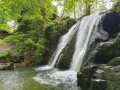
Malham Cove, Janet's Foss and Gordale Scar
 4.84 mi
+748 ft
-725 ft
2h 55
4.84 mi
+748 ft
-725 ft
2h 55
 Easy
Departure from Malham (North Yorkshire)
Easy
Departure from Malham (North Yorkshire)
Lovely circular walk to discover Janet's Foss waterfall, Gordale Scar and waterfall and Malham Cove. Dog friendly. Can be very busy during summer months.
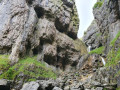
Gordale Scar, Malham Tarn and Malham Cove
 8.13 mi
+768 ft
-761 ft
4h 25
8.13 mi
+768 ft
-761 ft
4h 25
 Difficult
Departure from Malham (North Yorkshire)
Difficult
Departure from Malham (North Yorkshire)
A great circular walk from Malham village, taking in Janet's Cave / Foss, Gordale Scar, Malham Tarn, the limestone pavement at the top of Malham Cove and the cove itself before finishing back at the car. Consistently interesting and varied scenery.
⚠️Please note that there is a scramble up steep water worn rock in Goredale between waypoints (2) and (3). Some people might find this challenging and please do not attend to do this part when it is raining or icy! However an alternative is possible.
The Dales High Way and Settle from Malham
 11.15 mi
+1,706 ft
-1,680 ft
6h 35
Moderate
Departure from Malham (North Yorkshire)
11.15 mi
+1,706 ft
-1,680 ft
6h 35
Moderate
Departure from Malham (North Yorkshire)
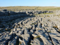
A nice circular walk from Malham in a westerly direction towards Settle and then curving north past Attermire Scar with a detour to explore Victoria Cave. The loop returns towards Malham via Malham Cove. Interesting and varied scenery throughout the walk and mostly on well maintained paths or tracks.
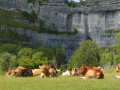
Malham Tarn and Cove via the bio-diverse pastures under Pikedaw Hill.
 7.50 mi
+1,227 ft
-1,204 ft
4h 30
Moderate
Departure from Malham (North Yorkshire)
7.50 mi
+1,227 ft
-1,204 ft
4h 30
Moderate
Departure from Malham (North Yorkshire)
An interesting circular walk from the delightful village of Malham. Up through the pasture below Pikedaw Hill to the well mark footpaths that lead across to Langscar Gate and then Malham Tarn, which is a great place to pic-nic. The return leg is via the dry valley of Watlowes to Malham Cove with its spectacular limestone pavement. Descend via the well made steps and then the less trodden footpath to the East of the village.
For more walks, use our search engine .
The GPS track and description are the property of this route's author. Please do not copy them without permission.

