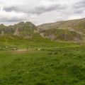
Start : Yorkshire Dales National Park Visitor Centre car park at the southern edge of Malham village. (BD23 4DA) Grid ref. SD 899 627.
(S/E) From the parking, walk through the car park to the road (Chapel Gate), turn left (North) and walk into the village until opposite the Blacksmiths. Cross over the road, walk behind the 'smithy'.
(1) Cross the beck using a footbridge. Turn right (South) and follow the good path to Janet's Foss. You will arrive at a gate with a barn on your left.
(2) Go through the gate and turn left (East) to pass the barn. Keep following the good footpath with gates to pass through until you enter some woodland. Go through the gate into the wood and continue along the path for 1.5 Km to Janet's Foss (B). This is a popular bathing spot.
(3) Now continue along the path up to the road (Gordale Lane). Turn right onto the road and walk (North-East then East) in single file to pass Gordale Bridge (refreshment van in the summer months) and the entrance to the campsite at Gordale. Keep following the road uphill (Hawthorns Lane) until the steep section starts to ease and there is a track on the right with a finger post.
(4) Turn right (South-East) and follow the stony track up as it bears South to the stump of a cross at Weets Gate. Go through a gate and turn left to walk 20 metres to the trig point and summit of Weets Top.
(5) From Weets Top walk back to the gate and finger post where two tracks split. Take the right-hand track signposted Calton. This descends gently (watch out of cyclists as this is a popular track for them) with a wall on the right until a point where the track and wall veer away from each other. You will be descending to Calton; look out for a valley on the left with trees in it, your grassy path keeps to the right of the trees. It then becomes a stony farm track as it descends (with a dog leg) and passes through a gate into the trees. Soon after, this the track joins the tarmac road in Calton Village.
(6) Walk through the village ignoring the road on the left. Stay in single file as you descend the road to a sharp bend right and then a steeper gradient down to the bridge at Airton (C). (If you have time you can cross the bridge and explore the quiet and delightful village)
(7) At the bridge turn right (North) onto a path (Pennine Way) which is on the East side of the river. Follow the path (gates) until you arrive at a stone step stile leading up to another bridge below Hanlith Hall.
(8) Climb the steps, turn left and cross the bridge and take the road on the right to Scalegill Mill. The tarmac track is quiet as it leads to the mill which has been converted into apartments. At the mill go through a gate on the left and take a path to the left of the buildings.
Continue following the path with the old mill leat on the right. At one point the path crosses and re-crosses the leat; it also passes through gates. Once you have left the leat behind, look out for a spring on the right, next to a gate that you pass through. (A)
(9) Continue along the path into a field, walk through this and cross a small footbridge into the next field which is used as an overflow car park, pass through into the next field and after this go through a gate onto the road at the start of the village.
(10) Turn left, cross over and walk back past the visitor centre to the parking. (S/E)
(or explore Malham village, plenty of places for refreshments)


