Mailh Massibé

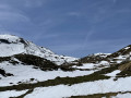
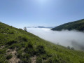
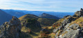
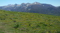
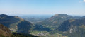
Mailh Massibé is a magnificent vantage point offering views stretching from the Pic du Midi de Bigorre to the Atlantic, taking in all the peaks of Béarn and the Basque Country.
Although the approach to this summit is a little long, it is easy to reach and presents no particular difficulties in the absence of snow or fog.

Details

2995320
Creation:
Last update:
Last review:
  • Walking
    Activity: Walking
  • ↔
    Distance: 9.06 mi
  • ◔
    Average duration: 7h 15 
  • ▲
    Difficulty: Difficult

  • ⚐
    Back to start: Yes
  • ↗
    Ascent: + 3,579 ft
  • ↘
    Descent: - 3,579 ft

  • ▲
    Highest point: 6,427 ft
  • ▼
    Lowest point: 2,848 ft

Description of the walk

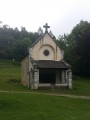
From Oloron-Sainte-Marie or Pau, take the N134. Then head towards Laruns. Once past Arudy, take the D294 to the Chapelle de Houndas. Take a small road on the left and follow it for 850 m. Park in the small car park at an altitude of 865.

(S/E) Continue along this small road heading due south, which leads to the Cabane des Bordes, until you reach the first hairpin bend.

(1) Leave the track as it turns right and take a path that continues straight ahead. Shortly afterwards, turn right. Further on, rejoin the track.

(2) Follow the track to the left for about 500 metres.

(3) Take a path on the left. Head uphill, cutting across the track’s hairpin bends several times. Head generally westwards to the Cabane des Bordes.

(4) Walk 80 m to the right of the hut and continue along the track for 300 m. Pass in front of a sheep pen.

(5) Leave the track and take a path on the right (cairn). Follow the cairned path which climbs up the hillside heading west. This will take you to the Col d’Aran.

(6) Look for the start of a track that heads south-west and follows the ridge to reach a small plateau marked ‘Esturou’ on the map (elevation 1832).

(7) Continue climbing straight ahead towards the south. A little further on, pass a tempting path on your left and reach the Col de Lanssatté.

(8) Continue climbing, keeping the summit in your sights. Wind your way through the rocks to reach Mailh Massibé.

(9) After taking in the extraordinary panoramic views, return along the same route to (S/E).

Waypoints

  1. S/E : mi 0 - alt. 2,848 ft - Small car park
  2. 1 : mi 0.52 - alt. 3,068 ft - Start of the path – Cairn
  3. 2 : mi 1.07 - alt. 3,540 ft - Back on the track
  4. 3 : mi 1.39 - alt. 3,661 ft - Leave the track
  5. 4 : mi 2.05 - alt. 4,213 ft - Cabane des Bordes
  6. 5 : mi 2.24 - alt. 4,308 ft - Aran Pass Trail
  7. 6 : mi 3.12 - alt. 5,404 ft - Col d'Aran (1654m)
  8. 7 : mi 3.74 - alt. 5,965 ft - Esturou Plateau
  9. 8 : mi 4.32 - alt. 6,109 ft - Col de Lansatté (1861m)
  10. 9 : mi 4.53 - alt. 6,427 ft - Mailh Massibé
  11. S/E : mi 9.06 - alt. 2,848 ft - Small car park

Reviews and comments

4.3 / 5
Based on 3 reviews

Reliability of the description
4 / 5
Ease of following the route
4.3 / 5
Route interest
4.7 / 5
User 29939960

Overall rating : 4.7 / 5

Date of your route : Aug 03, 2026
Reliability of the description : ★★★★★ Very good
Ease of following the route : ★★★★★ Very good
Route interest : ★★★★☆ Good
Very busy route : No

The descent along the eastern ridge of Mail Massibé to the Col de Losque makes it easy to carry on to the Pic Montagnon.
The path up the peak is clearly visible from the Massibé.

Machine-translated

mirouchi
mirouchi

Overall rating : 3.7 / 5

Date of your route : Oct 26, 2021
Reliability of the description : ★★☆☆☆ Disappointing
Ease of following the route : ★★★★☆ Good
Route interest : ★★★★★ Very good
Very busy route : Yes

There isn’t enough additional information about this walk. Generally speaking, though, the 2:3 point on the route is easy to find.
However, the route is poorly signposted in the description once you reach the Col de Lanssatté. To climb up to Le Mailh, be sure to take the track opposite as you arrive; do not head towards the pass between Le Mailh and Le Montagnon.On the way back, after descending from Le Mailh Massibé, it’s not easy to find the path you took on the way up – they all look the same – which is why it’s important to take note of your bearings whilst ascending.Don’t hesitate to head well to the left, heading north; the 4x4 track is misleading, so don’t rely on it – make sure you lose sight of it completely as you set off towards L’Escoumère and L’Estourou.

Machine-translated

xiberotarra
xiberotarra

Overall rating : 4.7 / 5

Date of your route : Jul 18, 2020
Reliability of the description : ★★★★★ Very good
Ease of following the route : ★★★★☆ Good
Route interest : ★★★★★ Very good
Very busy route : No

"After taking in an extraordinary panorama..." the author is quite right to be enthusiastic. The view from the summit is breathtaking and well worth all the effort required to reach it. The lovely weather on this Saturday allowed us to make the most of this hike, which is rightly classified as difficult but accessible to hikers. The ascent to the Col d’Aran initially involves criss-crossing between the track and the paths until you reach the cairn clearly marked at point 5. After that, it’s simply a matter of climbing. The path along the ridge from the Col d’Aran towards the Col de Lansatte isn’t very visible, but the GPX track guided us. The final climb to the summit of Mailh Massibé is quite gruelling, but it’s well worth the effort, as we’ve already mentioned.

Machine-translated

Other walks in the area

For more walks, use our search engine .

The GPS track and description are the property of this route's author. Please do not copy them without permission.