Maidenhead to Marlow

This is the eighth stage of the multi-day route "Railways and Waterways, between Oxford and London".

A scenic walk to Boulter's Lock and tranquil Ray Island, through the dappled shade of Clivedon Reach, passing a cottage of ill repute to the home town of Stanley Spencer, then with good views of Winter Hill on the approach to the Georgian market town of Marlow.

This walk is part of a multi-day hike: Railways and Waterways, between Oxford and London

Details

100342991
Creation:
Last update:
Last review:
  • Walking
    Activity: Walking
  • ↔
    Distance: 8.54 mi
  • ◔
    Average duration: 3h 55 
  • ▲
    Difficulty: Moderate

  • ⚐
    Back to start: No
  • ↗
    Ascent: + 26 ft
  • ↘
    Descent: - 26 ft

  • ▲
    Highest point: 112 ft
  • ▼
    Lowest point: 75 ft

Photos

Description of the walk

Start: Maidenhead Station (SU 887 807)

(S) From the station entrance, follow the line of trees and cross three roads at the traffic lights, turn left and at the next junction turn right towards the Green Way.

(1) Cross the road at the traffic lights and continue on the Green Way to a road.

(2) Turn right and keep ahead at the crossroads. Join the main road and continue across Oldfield Road.

(3) At the roundabout just before the bridge, carefully cross the main road to the Thames Path sign. Keep ahead along the road to reach the bridge to Ray Island at Boulter’s Lock.

(4) Continue along the road past the lock, then take the river path to the right, at the Thames Path sign.
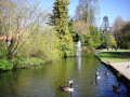
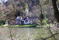
Just past the weir, the Jubilee River diverges from the Thames. The steep slopes of the Clivedon estate are across the river, and further on is Spring Cottage, where John Profumo and Christine Keeler held their rendezvous.

(5) The path leaves the riverside and, after half a mile, joins a lane leading into Cookham. Turn right at the main road, soon coming to a road junction, with the Stephen Spencer Gallery on the left.

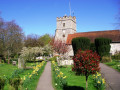
(6) Keep ahead but soon bear left along an alleyway, turn right through the churchyard of Holy Trinity Church and pass Stanley Spencer’s grave.

(7) Turn left along the riverbank through the water meadows. Cross the river via the railway bridge.

(8) Turn left and follow the River past the marina.

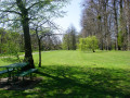
(9) Continue through several meadows with the hills above Cock Marsh across the river and further on, Winter Hill. The ‘Marlow Donkey’ railway line between Bourne End and Marlow runs parallel on the right. Pass through a wooded picnic area, then under the noisy A404.

(10) Follow the Thames Path when it leaves the river to reach a road. Here, leave the Thames Path and turn right, then left into Lock Road. At the end, opposite the Marlow Donkey, turn right to the station.(E)

Waypoints

  1. S : mi 0 - alt. 102 ft - Maidenhead Station
  2. 1 : mi 0.32 - alt. 92 ft - Green Way - Cross the road
  3. 2 : mi 0.46 - alt. 82 ft - High Street - Turn right
  4. 3 : mi 1.02 - alt. 89 ft - Roundabout - Cross to Thames Path sign
  5. 4 : mi 1.68 - alt. 75 ft - Ray Island
  6. 5 : mi 3.32 - alt. 102 ft - Turn left to leave the River
  7. 6 : mi 4.17 - alt. 92 ft - Stanley Spencer Gallery
  8. 7 : mi 4.37 - alt. 95 ft - Turn left to follow the riverbank
  9. 8 : mi 5.42 - alt. 95 ft - Railway bridge
  10. 9 : mi 6.03 - alt. 82 ft - Spade Oak Lake
  11. 10 : mi 8.06 - alt. 89 ft - Follow the Thames Path - leave the river
  12. E : mi 8.54 - alt. 102 ft - Marlow Station

Notes

Travel Information:

  • Start - Maidenhead Station is on the main line between Reading and Paddington with Elizabeth Line trains extending through London to Abbey Wood.
  • Finish - Marlow has an hourly train service to Maidenhead with connections to Reading and London.

OS Explorer Map

172

Grid References

  • Start SU 887 807
  • Finish SU 855 865

Refreshments and facilities

(4) There is the Boathouse gastropub, picnic tables and public amenities.

(9) At the start of the water meadows, the Spade Oak may be reached by carefully crossing the railway and going along the lane.

Information to shorten the walk

(8) For Bourne End Station, turn right, then left up the steps on the footpath.

Worth a visit

Other walks in the area

For more walks, use our search engine .

The GPS track and description are the property of this route's author. Please do not copy them without permission.