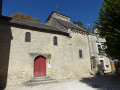
The Loire, the village, the forest, the vineyards, the chapel and the abbey at Rochecorbon

A walk during which you’ll discover the magnificent village of Rochecorbon, a mix of tuffeau stone houses and troglodyte cellars, perched on the banks of the Loire. Discover the Chapel of Saint-Georges, an 11th-century Romanesque cave chapel, with its murals and timber framework, as well as the marvellous Marmoutier Abbey towards the end of the route. It’s a very easy walk; if you’re concerned about the duration, there are plenty of ways to shorten it.

Details

37994142
Creation:
Last update:
Last review:
  • Walking
    Activity: Walking
  • ↔
    Distance: 6.98 mi
  • ◔
    Average duration: 3h 25 
  • ▲
    Difficulty: Moderate

  • ⚐
    Back to start: Yes
  • ↗
    Ascent: + 259 ft
  • ↘
    Descent: - 259 ft

  • ▲
    Highest point: 331 ft
  • ▼
    Lowest point: 157 ft
  • ⚐ Country: France
  • ⚐ City: Rochecorbon (37210)
  • ⚑
    Start/End: N 47.404815° / E 0.734165°
  • ❏
    IGN map(s): Ref. 1822SB, 1922SB
  • Hour-by-hour weather

Photos

Description of the walk

The walk starts at the Saint-Georges car park on the banks of the Loire. You can get there by bus on routes 53 and 54, getting off at the Saint-Georges stop.

(S/E) From the car park, take the path along the banks of the Loire to the left, heading upstream. Walk alongside the Rabouilleuse.

(1) When you reach the Guinguette de Rochecorbon, carry on past the gardens until you come to a small bridge.

(2) Cross the bridge, then leave the riverside path to head back up towards the road; cross the road and take Rue des Clouets opposite, continuing until you reach a three-way junction

(3) Turn right up Rue du Peu Boulin. Then take the second left, Rue des Hautes Gatinières, and follow it to the end, then continue along Rue de Bellevue until you reach the end.

(4) At the junction, take the Sentier des Pélus straight ahead; go down the small flight of steps (or continue along the path to the end) to reach Rue des Bourdaisières. Walk up this street to Chemin de la Chicane, which you take straight ahead. At the end of the path, head up to your right until you reach the next path, then turn left between the gardens and head into the forest.

(5) Follow the forest path straight ahead to the end.

(6) Head down to your left to reach the hamlet known as La Planche.

(7) Take the road to the left, passing through the hamlet, and follow the path that runs alongside the Bédoire to Les Monteaux.

(8) Cross the river at the bridge and continue along the opposite bank.

(9) Carry on straight ahead at the junction, then straight on until you reach the roundabout. Take the first right at the roundabout, then follow the path on the left before the bus stop.

(10) Take this path, which runs alongside the River Bédoire, and head towards the church at Rochecorbon.

(11) Walk up to Rue du Dr. Lebled, and follow it to the left for 400 m until you reach the crossroads.

(12) Take Rue de la Bourdonnerie, which climbs up to your right, and follow it for about 1 km. At the crossroads amongst the vineyards, do not take the roads but follow the path straight ahead alongside the vineyards. The path branches off to the right, descends through the trees and joins Rue Saint-Georges.

(13) Walk down the street, keeping to the left, until you reach thesecond street on the right. Immediately on your right, you’ll be able to admire the Saint-Georges Chapel.

(14) Take Rue de Beauregard on your right and continue to the end, where you’ll pass under the bridge. You’ll arrive at Marmoutier Abbey.

(15) Head back up to the left towards the road, cross the roundabout and follow the path along the banks of the Loire to the left until you reach the Saint-Georges car park (S/E).

Waypoints

  1. S/E : mi 0 - alt. 167 ft - Saint-Georges car park - La Loire
  2. 1 : mi 0.43 - alt. 164 ft - La Guinguette de Rochecorbon
  3. 2 : mi 1.25 - alt. 161 ft - Bédoire Bridge
  4. 3 : mi 1.51 - alt. 187 ft - Rue du Peu Boulin
  5. 4 : mi 2.03 - alt. 253 ft - The Pélus Trail
  6. 5 : mi 2.43 - alt. 292 ft - Entrance to the forest
  7. 6 : mi 2.84 - alt. 305 ft - Descent
  8. 7 : mi 3.01 - alt. 210 ft - La Planche
  9. 8 : mi 3.36 - alt. 200 ft - Bédoire Bridge
  10. 9 : mi 3.47 - alt. 194 ft - Crossroads
  11. 10 : mi 3.9 - alt. 190 ft - Bus stop and the Bédoire footpath
  12. 11 : mi 4.11 - alt. 184 ft - Église Notre-Dame de Vosnes (Rochecorbon)
  13. 12 : mi 4.41 - alt. 213 ft - Rue de la Bourdonnerie
  14. 13 : mi 5.51 - alt. 249 ft - Rue St Georges
  15. 14 : mi 5.76 - alt. 177 ft - Rue de Beauregard
  16. 15 : mi 6.34 - alt. 167 ft - Abbaye de Marmoutier
  17. S/E : mi 6.98 - alt. 167 ft - Saint-Georges car park

Notes

Nothing in particular – just the essentials for a walk lasting between 3 and 4 hours.

(5) Shorter alternative: you can turn left to return to the village without going through the forest and head for (9).
(14) Shorter alternative: you can reach the Saint-Georges car park (S/E) by continuing straight on and crossing the road.

Remember that, if you’re with children, you can easily shorten the walk or find places to take a break ((1), (11), (12)).

Worth a visit

Heritage sites

  • St George’s Chapel is usually closed, but the winegrower below (Le Capitaine) sometimes has the keys – you can ask him politely if you’d like to see it. Orthodox services have recently resumed, so it is now open more and more regularly.
  • Marmoutier Abbey (15), meanwhile, is a Catholic educational institution, but it does occasionally hold open days. The tower and the street behind it are very pretty, and behind them lies the old abbey, which is open during Heritage Days.

Eating out

  • La Guiguette (1): a large open-air café on the banks of the Loire, with a pleasant setting and food that lives up to the number of diners.
  • La Part Belle: near the church (11), serving quality food and drinks.
  • Café Corbon: past Le Point (12), continuing down Rue Lebled past the bakery, for a drink on a small, shaded terrace.

Activities

  • La Rabouilleuse (S/E) (1), for a trip along the Loire in traditional boats – book in advance.
  • Lulu Parc (1), next to the open-air café, for your children who don’t fancy a walk!

Reviews and comments

5 / 5
Based on 2 reviews

Reliability of the description
5 / 5
Ease of following the route
5 / 5
Route interest
5 / 5
Jay Ryan
Jay Ryan

Overall rating : 5 / 5

Date of your route : Jul 21, 2025
Reliability of the description : ★★★★★ Very good
Ease of following the route : ★★★★★ Very good
Route interest : ★★★★★ Very good
Very busy route : Yes

A good description of the trail, and easy to follow. A lovely walk too... Thank you.

Machine-translated

GTania
GTania

Overall rating : 5 / 5

Date of your route : Feb 26, 2025
Reliability of the description : ★★★★★ Very good
Ease of following the route : ★★★★★ Very good
Route interest : ★★★★★ Very good
Very busy route : No

We used the GPX track to complete this walk and stopped off to visit the cave-dwelling village of Rochecorbon along the route, which is well worth a visit. Don’t hesitate to give this walk a go – the scenery is varied.

Machine-translated

Other walks in the area

For more walks, use our search engine .

The GPS track and description are the property of this route's author. Please do not copy them without permission.