


Lizard To Porthleven
Details
Creation:
Last update:
–
–
-
 Activity: Walking
 -
 Distance: 13.40 mi
 -
 Average duration: 7h 30
 -
 Difficulty: Not specified
 -
-
 Back to start: No
 -
 Ascent: + 1,512 ft
 -
 Descent: - 1,480 ft
 -
-
 Highest point: 246 ft
 -
 Lowest point: 16 ft
-
 Country:
United Kingdom
Country:
United Kingdom
-
 City:
Landewednack
City:
Landewednack -
 Start: N 49.95968° / W 5.20665°
 -
 End: N 50.08251° / W 5.31208°
 -


 Hour-by-hour weather


Waypoints
- S : mi 0 - alt. 108 ft - Start near S W Coast Path, Helston TR12 7NU, UK
- 1 : mi 0 - alt. 108 ft - Walk south towards S W Coast Path
- 2 : mi 0 - alt. 102 ft - Sharp right onto S W Coast Path
- 3 : mi 0.59 - alt. 128 ft - Walk north on S W Coast Path
- 4 : mi 1.08 - alt. 72 ft - Walk north on S W Coast Path
- 5 : mi 1.34 - alt. 194 ft - Walk north-west on S W Coast Path
- 6 : mi 2.04 - alt. 20 ft - Walk south-west on S W Coast Path
- 7 : mi 2.53 - alt. 217 ft - Walk west on S W Coast Path
- 8 : mi 3.84 - alt. 236 ft - Walk north-west on S W Coast Path
- 9 : mi 5.71 - alt. 200 ft - Walk north on S W Coast Path
- 10 : mi 6.41 - alt. 46 ft - Turn left towards Nansmellyon Rd
- 11 : mi 6.42 - alt. 49 ft - Turn left onto Nansmellyon Rd
- 12 : mi 6.45 - alt. 36 ft - Turn right onto S W Coast Path
- 13 : mi 6.48 - alt. 66 ft - Walk west on S W Coast Path towards Mullion Cove
- 14 : mi 6.58 - alt. 167 ft - Turn left onto Mullion Cove
- 15 : mi 6.62 - alt. 177 ft - Slight left to stay on Mullion Cove
- 16 : mi 6.63 - alt. 184 ft - Turn left onto S W Coast Path
- 17 : mi 6.79 - alt. 161 ft - Walk north-east on S W Coast Path towards S W Coast Path
- 18 : mi 7.04 - alt. 187 ft - Turn left to stay on S W Coast Path
- 19 : mi 7.2 - alt. 72 ft - Walk north on S W Coast Path
- 20 : mi 7.68 - alt. 125 ft - Walk north-west on S W Coast Path
- 21 : mi 8.09 - alt. 95 ft - Turn left towards Poldhu Rd
- 22 : mi 8.31 - alt. 20 ft - Turn left onto Poldhu Rd
- 23 : mi 8.49 - alt. 52 ft - Slight left onto S W Coast Path
- 24 : mi 8.6 - alt. 59 ft - Walk west on S W Coast Path
- 25 : mi 8.73 - alt. 125 ft - Turn left towards S W Coast Path
- 26 : mi 8.76 - alt. 128 ft - Continue onto S W Coast Path
- 27 : mi 8.83 - alt. 95 ft - Walk north on S W Coast Path
- 28 : mi 9.07 - alt. 16 ft - Turn right towards S W Coast Path
- 29 : mi 9.17 - alt. 23 ft - Turn left onto S W Coast Path
- 30 : mi 9.52 - alt. 148 ft - Walk north-west on S W Coast Path
- 31 : mi 10.02 - alt. 167 ft - Walk north-east on S W Coast Path
- 32 : mi 10.69 - alt. 62 ft - Sharp left towards S W Coast Path
- 33 : mi 10.72 - alt. 33 ft - Turn right onto S W Coast Path
- 34 : mi 10.91 - alt. 85 ft - Walk north-west on S W Coast Path
- 35 : mi 11.97 - alt. 30 ft - Walk north-west on S W Coast Path
- 36 : mi 12.77 - alt. 79 ft - Turn right towards Loe Bar Rd
- 37 : mi 12.92 - alt. 118 ft - Continue onto Loe Bar Rd
- 38 : mi 12.98 - alt. 95 ft - Walk north-west on Loe Bar Rd towards S W Coast Path
- 39 : mi 13.26 - alt. 52 ft - Walk north-west on Loe Bar Rd
- 40 : mi 13.27 - alt. 56 ft - Turn right towards Cliff Rd
- 41 : mi 13.3 - alt. 79 ft - Turn right onto Cliff Rd
- 42 : mi 13.36 - alt. 115 ft - Continue onto Shrubberies Hill
- E : mi 13.4 - alt. 148 ft
Other walks in the area
Circular walk around Lizard Point
 Visorando Member6.08 mi
+719 ft
-722 ft
3h 25
Visorando Member6.08 mi
+719 ft
-722 ft
3h 25
 Easy
Departure from Landewednack (Cornwall)
Easy
Departure from Landewednack (Cornwall)
A gorgeous circular coastal walk to visit the famous Lizard Point.
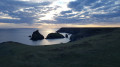
Pen Olver, Lizard Point and Kynance Cove from Lizard village
 5.84 mi
+627 ft
-627 ft
3h 15
5.84 mi
+627 ft
-627 ft
3h 15
 Moderate
Departure from Landewednack (Cornwall)
Moderate
Departure from Landewednack (Cornwall)
This circular walk mainly using The Lizard Coastal Walk is a good way to explore the most southerly point on mainland Great Britain including beautiful coves, turquoise seas and impressive cliffs
Lizard Point from Lizard village
3.78 mi
+312 ft
-305 ft
2h 00
Easy
Departure from Landewednack (Cornwall)
Walk (dogs on a lead) along the coast between Church Cove and Kynance, passing Lizard Lighthouse (Lizard Point) with access to the beach along the way (dogs not allowed on the beach). From Kynance Campsite, there is a path leading to the car park in the village of Lizard. It is also possible to set off directly from the village car park.
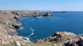
Vellan Head and Kynance Cove from Predannack Wollas
 4.93 mi
+364 ft
-384 ft
2h 35
Easy
Departure from Mullion (Cornwall)
4.93 mi
+364 ft
-384 ft
2h 35
Easy
Departure from Mullion (Cornwall)
This pretty flat circular walk allows discovering impressive cliffs walking along Vellan Head until you reach the lovely Kynance Cove. Then, the return route goes straight across The Predannack Downs.
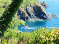
Lizard Point
 8.79 mi
+1,184 ft
-1,362 ft
5h 05
8.79 mi
+1,184 ft
-1,362 ft
5h 05
 Difficult
Departure from Mullion (Cornwall)
Difficult
Departure from Mullion (Cornwall)
It can sometimes be tricky to complete a circular walk in this region, firstly because there aren’t enough paths or tracks to avoid stretches of tarmac – some longer, some shorter – and traffic on very narrow roads, and secondly because the most attractive scenery is mainly found along the coast rather than inland.So here is a hike that isn’t circular. As is always the case with such routes, you’ll either need to arrange for two cars or return by taxi. There are no buses serving the starting point, so you’ll either have to walk there and back – in which case you’ll need to cover 28.5 km and set aside a whole day for it – or, of course, you could tackle this route as a stage of a multi-day hike.
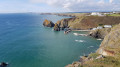
Porth Mellin from Predannack Wollas
 3.60 mi
+436 ft
-433 ft
2h 00
Easy
Departure from Mullion (Cornwall)
3.60 mi
+436 ft
-433 ft
2h 00
Easy
Departure from Mullion (Cornwall)
This pleasant circular walk explores a beautiful section of the South West Coast path leading to Mullion Cove. You can visit Porth Mellin as well before you go back using paths and tracks inland.
Mullion, Polurrian Cove, and the Chocolate Factory
 2.59 mi
+194 ft
-174 ft
1h 20
Easy
Departure from Mullion (Cornwall)
2.59 mi
+194 ft
-174 ft
1h 20
Easy
Departure from Mullion (Cornwall)
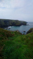
From the small village of Mullion on the south Cornish coast, the walk leads down through the valley to Polurrian Cove. As the South West Coast path winds its way back along the coastline to Mullion Cove, before heading back past the Chocolate factory, and back through the old village.
Mullion, the Poldhu Marconi Centre, and the Monument
 2.49 mi
+151 ft
-151 ft
1h 15
Easy
Departure from Mullion (Cornwall)
2.49 mi
+151 ft
-151 ft
1h 15
Easy
Departure from Mullion (Cornwall)
Walking from the small Cornish village of Mullion to the coast, and following the South West Coast path, along with the coastal views, passing the historic monument and museum of Marconi, where the first trans-Atlantic radio transmission was made from.
For more walks, use our search engine .
The GPS track and description are the property of this route's author. Please do not copy them without permission.

